SymGEO is proud to announce a new project with the Virginia Department of Transportation (VDOT), designed to explore the use of remote sensing techniques in the identification of wetlands. Traditional wetland delineation requires expert field work, which includes many hours of travel, sampling, and precise survey measurement to delineate what can actually be quite a variable environmental boundary. The best indicators of wetlands tend to be the vegetative species, ground elevation, and hydrology connectivity. Soil sampling and other methods are used to further validate findings, but in today’s data-rich environment, a pretty good indication of wetlands can be gathered through remote sensing.
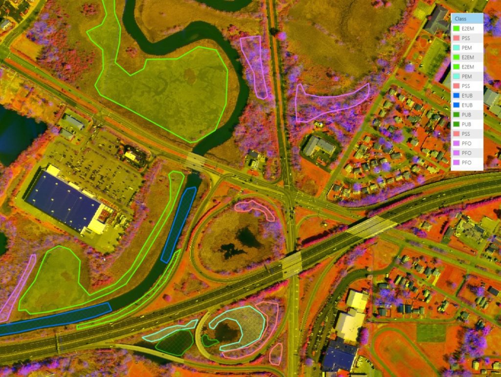
For this project, LiDAR elevation information was combined with multi-spectral imagery to produce a 6-band composite image using ArcGIS Pro. This composite image was then used in conjunction with National Wetland Inventory (NWI) data to establish training sites for a supervised classification algorithm.
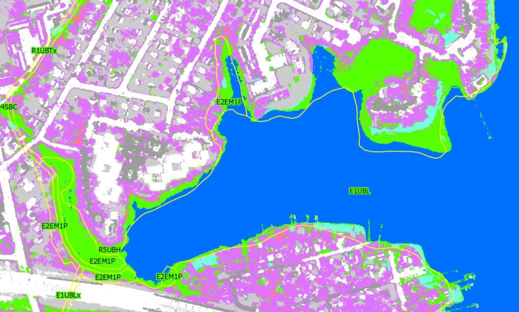
Once a suitable number of training sites were established, the supervised classification algorithm was run on the pilot study area. The results were compared with the National Wetland Inventory data, and a substantial improvement in boundary alignment was noted. This is critical in the accurate measurement of potential impacts to wetlands during road construction or property development, so that an equivalent, mitigating wetland area can be created elsewhere.
It was noted that upland forested areas were sometimes identified as wetland forested areas, indicating that elevation relative to nearest water needs to be included in the classification algorithm. The classification results are currently used as a guide for semi-automated wetland area delineation, but we believe the model could mature to include all required factors and accurately, automatically delineate the wetlands.
If you have supporting data and a need for efficient wetland delineation, SymGEO would love to talk!

