Urban Forest Health

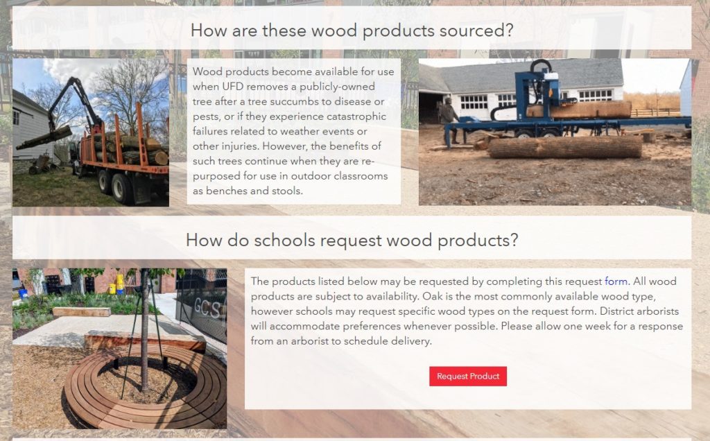
SymGEO is pleased to announce the launch of a Forest Health website for DDOT’s Urban Forest Division (UFD), designed to educate the community on how DDOT (and DC residents!) help keep the urban canopy vibrant, healthy, and productive. In a natural ecosystem, there are many checks and balances to keep a forest healthy. Urban environments present many challenges to trees, which include the urban heat island effect, degraded soil, limited growing space, and the introduction of exotic pests. This can lead to pest infestations and canopy damage if not caught quickly and mitigated efficiently. Fortunately, at the DDOT Urban Forestry Division, dedicated specialists prevent and respond to urban forest health issues on a daily basis.

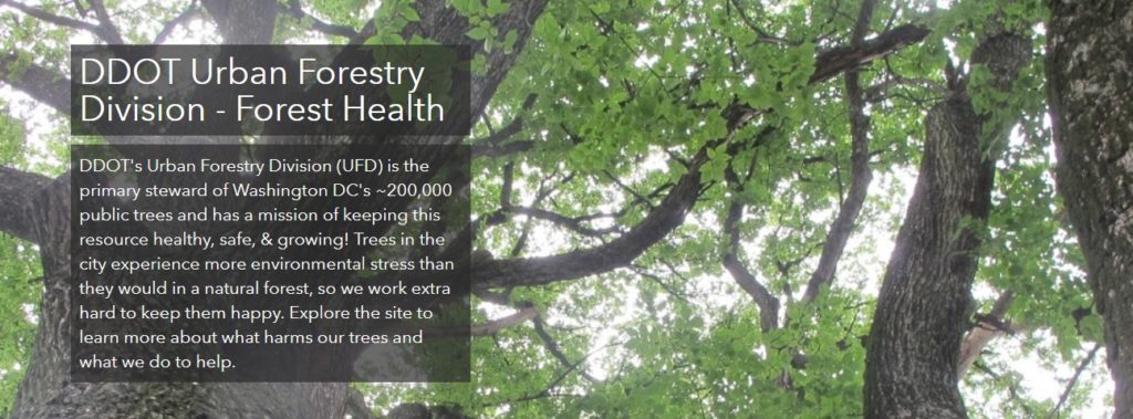
“We are excited to share our forest health programs with the public in this new format. The new forest health website is dynamic and easy to use, it allows users to learn about pests and pathogens to look out for, while also giving them the opportunity to report their observations.”

– DDOT Urban Forestry Division

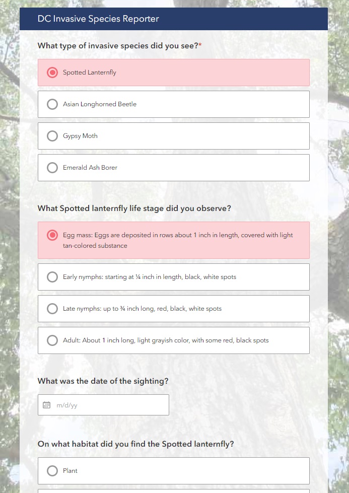
The new Forest Health site discusses a range of preventative measures the UFD takes against pests, including the Early Detection Rapid Response (EDRR) and the Cryptic Wood-Borer Insect (CWBI) programs, as well as how DC residents can identify and report invasive species.

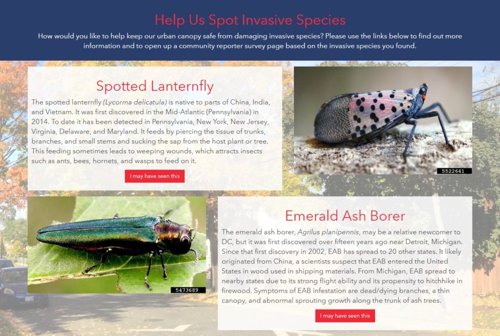
The site leverages Esri’s ArcGIS Hub framework for design and mobile responsiveness and Esri’s Survey123 for ArcGIS for pest reporting. Information is gathered through the website, including pest species, life stage, or signs/symptoms, and is passed to the survey to help the reporting process along.

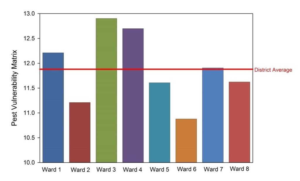
A Pest Vulnerability Matrix (PVM) is also presented which enables urban foresters to evaluate the overall vulnerability of the urban forest and evaluate the potential impacts of emerging pests and diseases.

Talk to our industry experts today if your agency or organization is interested in community engagement with the power of Esri’s ArcGIS Hub – SymGEO is here to help!

School Recycling: Urban Wood Reuse

Teaching kids the importance of nature, recycling, history, and culture is a lofty goal. Perhaps it’s a lesson that could be taught from the comfort of a bench constructed from recycled urban wood sourced from a local DC neighborhood rich in cultural history? This is now possible thanks to the District Department of Transportation (DDOT) Urban Forestry Division (UFD)’s new initiative called “Urban Wood Reuse: for Schools“. This partnership with the Office of the State Superintendent of Education (OSSE) will provide DC Public Schools and public charter schools with wood products to improve school grounds at no cost.

SymGEO was excited to help the Urban Forestry Division (UFD) develop this initiative by using Esri’s ArcGIS Hub technology to establish two-way communication between the UFD and DC schools interested in “sitting on a piece of DC History”. The site shares knowledge and products from the UFD while gathering the school’s product ideas and requirements.

The site discusses the benefits of wood reuse, where the wood comes from, and the variety of products available including benches, stumps, or woodchips. It also provides a link to an order form as a convenient and easy way to request wood products.

The order form itself is powered by Esri’s Survey 123 for ArcGIS technology and is designed with step-logic where pertinent questions appear based on previous answers.

One of the exciting new aspects of an initiative is the ability for an audience member to sign into a community account and “follow” the initiative. This will grant them access to broadcasts about new events, updates, new product launches, and other useful information. Now, being able to show which schools are as excited as we are about this new initiative has never been easier!

Talk to our digital platform experts today if your agency or organization is interested in community engagement with the power of Esri ArcGIS Hub Initiatives – SymGEO is here to help!

DDOT Urban Forestry Division Hub

SymGEO is pleased to announce the launch of the DDOT Urban Forestry Division Hub! This new digital platform is designed to engage and interact with the DC community and provide information about the many services and resources offered by the Urban Forestry Division (UFD) of the District Department of Transportation (DDOT). This digital platform was built using Esri’s ArcGIS Hub technology, in coordination with OCTO and Open Data DC.

With a long history of caring for the extensive forest canopy in DC, the Urban Forestry Division has meticulously assembled data sets and applications to help in their forest management mission and to communicate with a variety of audiences. With the introduction of Esri’s ArcGIS Hub technology, there is finally a digital platform perfectly designed to tie all the pieces together into a cohesive story. SymGEO was honored to be approached by the Urban Forestry group to help them design, configure, and deploy this comprehensive digital solution.

“SymGEO is a remarkably flexible and responsive company. They listen carefully to requirements and deftly blend customer vision with technological capabilities.”

DDOT Associate Director / State Forester, Urban Forestry Division

The urban forest story begins with a look to the past and introduces the audience to the long history and important role of trees in DC.

history

The story then turns to the impressive variety of trees available for public enjoyment and leverages several applications and digital stories that the urban forestry group has already developed.

canopy

The flagship data set of the Urban Forest group is the Public Tree Map which elegantly displays a tremendous amount of current information about the urban tree canopy. Links are provided to both the map and the underlying data for the community to use and explore.

public tree map

Work orders, permits, inspections, plantings, removals… there’s a lot going on in Urban Forestry! Fortunately, many data sets and reporting mechanisms have been developed to keep track of it all. These have now been shared with the public under one digital roof for a better understanding of agency scope and status.

urban forestry maps

Of course, what fun are statistics if they can’t be updated on the fly as new information is entered into databases behind the scenes?

stats

Finally, links to tools and resources are provided for partners and stakeholders to begin making their own applications and discoveries with DC government data.

tools

Talk to our industry experts if your agency or organization is interested in leveraging the power of Esri’s ArcGIS Hub – SymGEO is here to help!