One Tree Planted wants to make it simple for anyone to help the environment by planting trees. By partnering with 680+ organizations across 80+ countries, they have restored forests, created habitats for biodiversity, and made a positive social impact around the world by planting over 100 Million trees! Learn more about the critical importance of their nonprofit mission in the following educational video.
Keeping track of the positive impact of 680+ partners can be a daunting task. Fortunately, through a collaborative effort with SymGEO, One Tree Planted built an interactive Donor Portal prototype that helps communicate project-specific information to funding partners. The portal was designed so that each partner will have their own specific page, featuring just the projects that their funding helped to support. The donor portal was built using ArcGIS Experience Builder, and leverages Dashboards, StoryMaps, and embedded content to provide data transparency and inspiration.
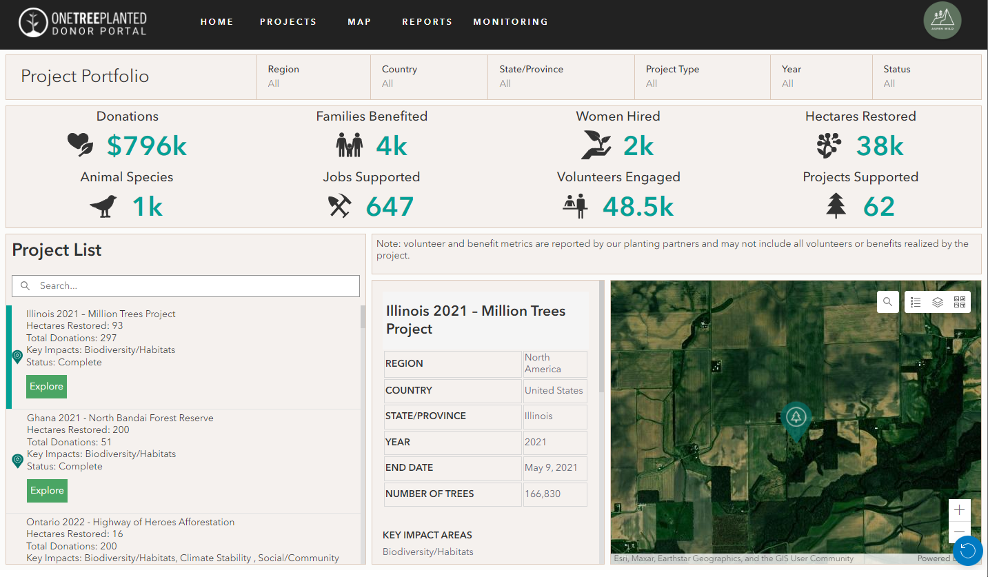
Projects are geo-located to show the global breadth of a partner’s funding impact.
Project-specific information is presented upon selection with links to the detailed project report.
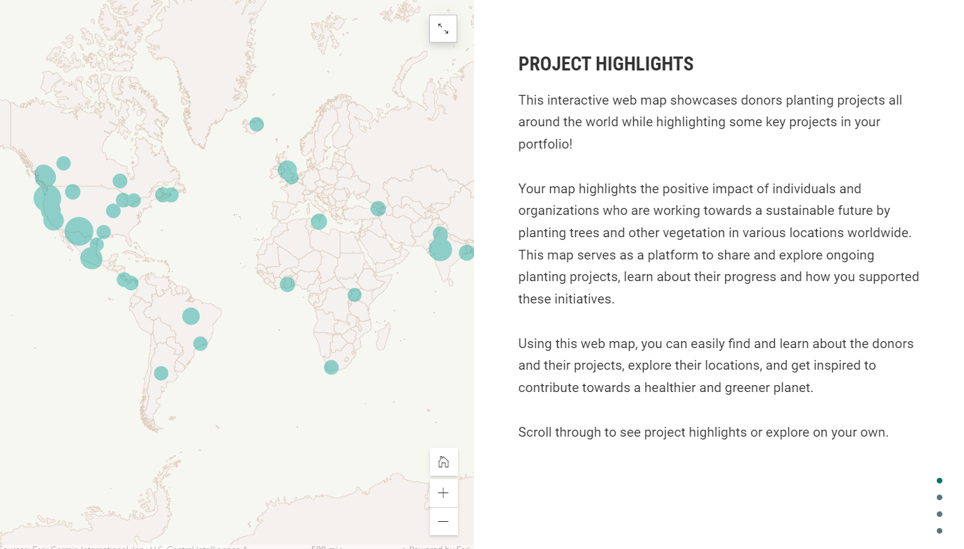
Projects are also displayed on a dedicated mapping page and can be searched by name or geography.
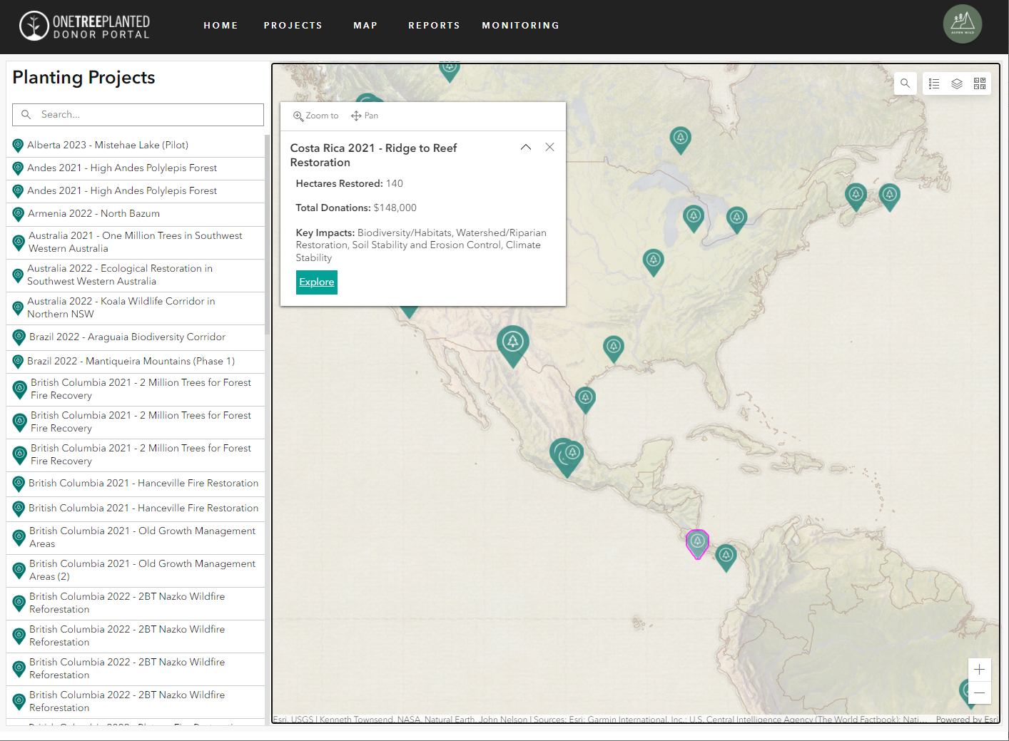
The map links to a detailed project dashboard with key information and a virtual fly-through of each planting site. 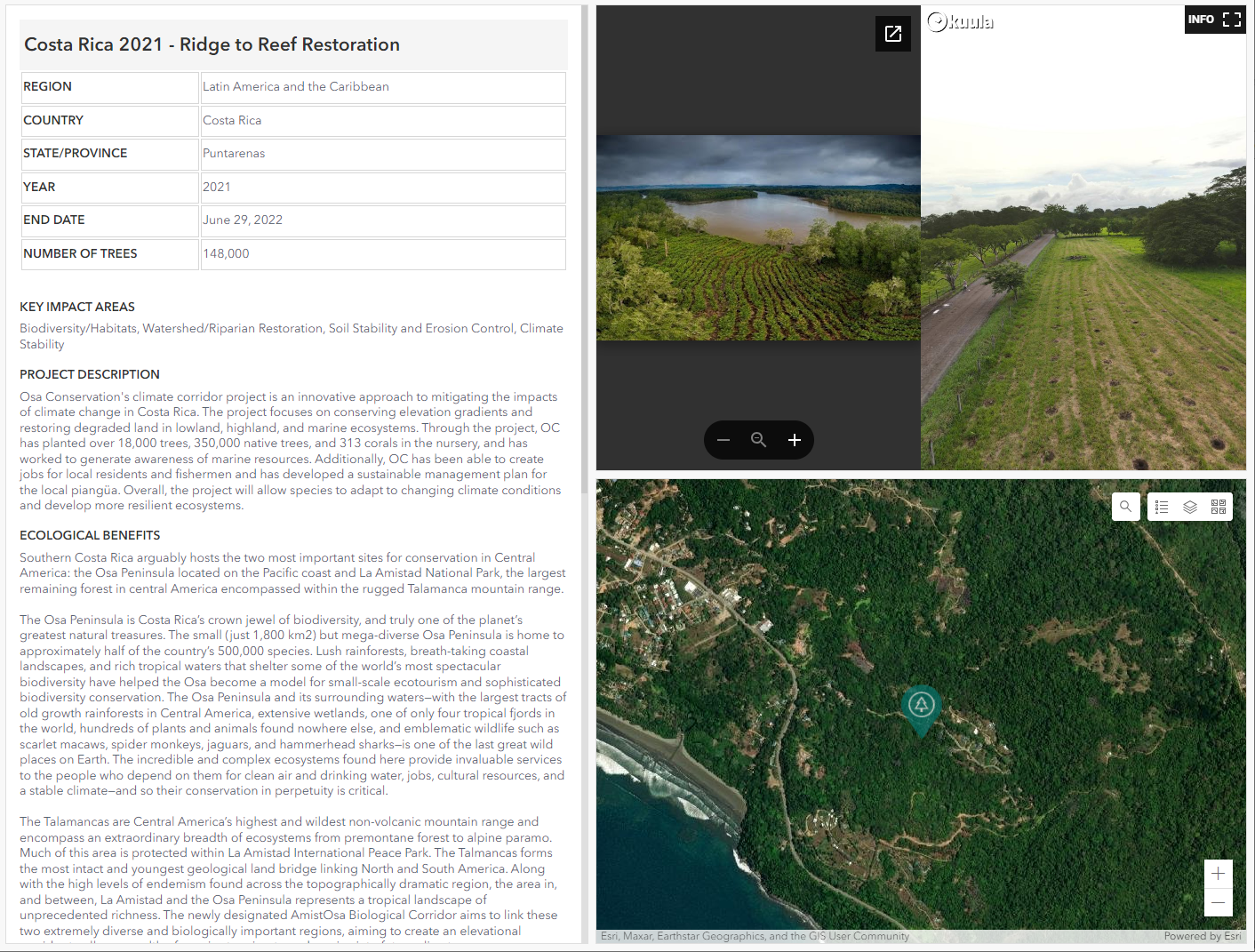
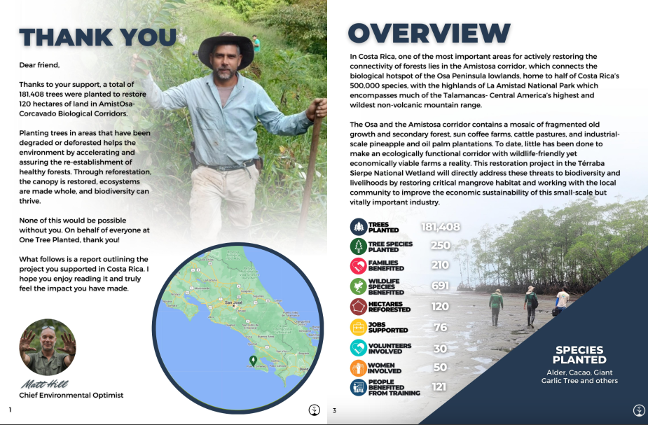
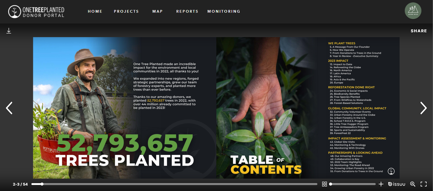
The report section of the portal links to the most recent planting report, highlighting key achievements of the year.
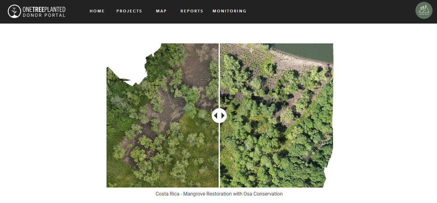
The monitoring section uses before and after imagery to convey the landscape scale impact of the planting projects and details the methods used to monitor and ensure planting success.
“The impact of the prototype on our donors was nothing short of astounding. Collaborating with SymGEO to craft a functional prototype during the feedback-gathering phase proved instrumental in cultivating a comprehensive catalog of requisites across all donors.”
– Geospatial Systems Manager, One Tree Planted
Talk to SymGEO today if your organization would like to feature projects or impacts using the power of Esri’s ArcGIS Online platform – we are certified experts and here to help.