Trail Rangers are a consistent and helpful presence on DC’s mixed-use, paved trails, charged with assisting trail users, improving trail conditions, and working with local agencies to keep the trails clean, bright, and clear of obstacles. This amazing nonprofit program, run by the Washington Area Bicyclist Association (WABA), is made possible through a grant from the District Department of Transportation’s Urban Forestry Division, and was featured in the Esri case study “GIS-Driven Initiatives Promote Active Transportation in Washington, DC“.

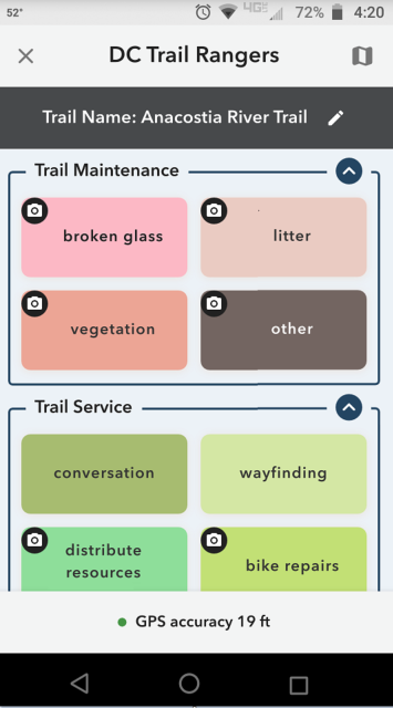
To help facilitate the data collection process and quantify work efforts, SymGEO was pleased to configure and deploy an ArcGIS QuickCapture application for the DC Trail Ranger team. Every trail service, maintenance task, work order request, or trail-side event is now captured by location with optional notes or photographs and tagged to the appropriate trail.
To assist with task management, the collected data was used to populate an internal ArcGIS Dashboard that lists all tasks and events by Trail Ranger and the date of the event. A public-facing version of the dashboard allows great visibility into all the activities undertaken by the Trail Rangers to better DC’s collective trail experience.
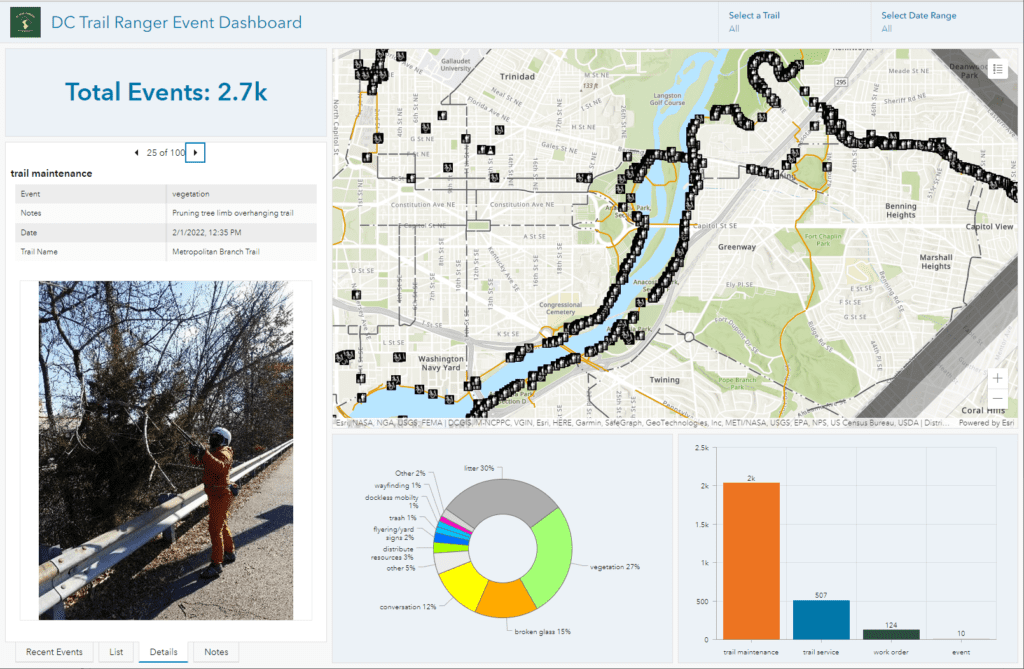
“As a field team that does a wide variety of outreach and maintenance tasks, ArcGIS QuickCapture has been great for record-keeping and storytelling of program impact. I can confidently say that staff stopped to sweep up broken glass in February 97 times!”
– Trail Ranger and Outreach Director, Washington Area Bicyclist Association
Talk to SymGEO industry experts today if your agency or organization is interested in data collection with the power of Esri’s ArcGIS QuickCapture technology – we are an award-winning, certified Esri business partner and are here to help.