Founded in 1741, Historic Bethlehem invites exploration through its museums, cultural attractions, historic sites, and walkable streets. To make planning visits easier and to share the area’s rich architectural and cultural heritage, the new Bethlehem Historic District Explorer offers an interactive online experience for both locals and visitors. SymGEO was honored to collaborate with the Bethlehem Historic District Association (BHDA) on this project, building the web infrastructure and training local staff to contribute to this growing digital library.
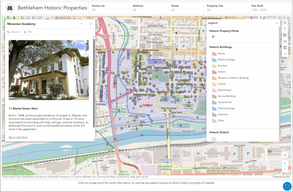
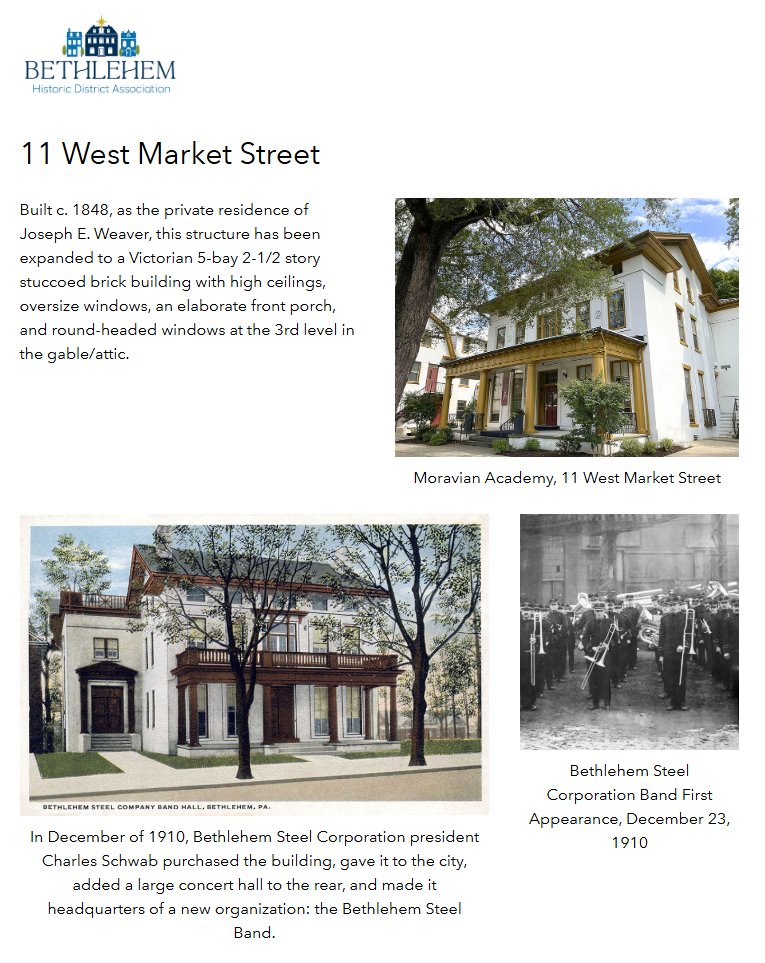
The project began with a high-resolution wall map of historic properties, an Excel database of property attributes, and a large collection of detailed property descriptions with accompanying digital photos. By georeferencing the map, extracting and geocoding address information, and batch-converting documentation into web-ready formats, the team created an inclusive, immersive spatial database. Originally built with ArcGIS Dashboards, the project soon expanded to include detailed property information hosted on dedicated ArcGIS Hub pages.
SymGEO also provided training and configured web-editing applications to enable BHDA staff to maintain and grow the digital resources. As a new member of the Esri Non-Profit Program partner, BHDA is quickly gaining proficiency with Esri technology and expanding its use of the interactive platform.
“SymGEO was an absolute pleasure to work with and provided timely solutions to complex challenges. The sophistication of the ArcGIS platform allowed us to achieve a product that exceeded our expectations and will enhance the user experience. We anticipate that the Bethlehem Historic District Explorer will allow residents and visitors alike to fully appreciate the history and architecture of our unique community.”
– Bethlehem Historic District Association
Talk to SymGEO today if your organization would like to feature projects or sites using the power of Esri’s ArcGIS Online platform – we are certified experts and here to help.