Esri’s Special Event Operations is a configurable solution that helps organize special events, create event site maps, develop health and safety plans, manage event incidents and assignments, monitor public health and safety operations, and create after-action reports. The District Department of Transportation (DDOT) recognized the value of having comprehensive information about an event in one authoritative, collaborative place, and asked SymGEO to help configure and deploy Special Event Operations for their internal use.

“The Special Events solution has sparked a new level of excitement in preparing for special events in the city. With SymGEO’s technical help, DDOT now has improved internal communication and decision-making abilities. The training provided by SymGEO has been super beneficial – they are a treasure!”
– DDOT Program Manager, Traffic Management Center
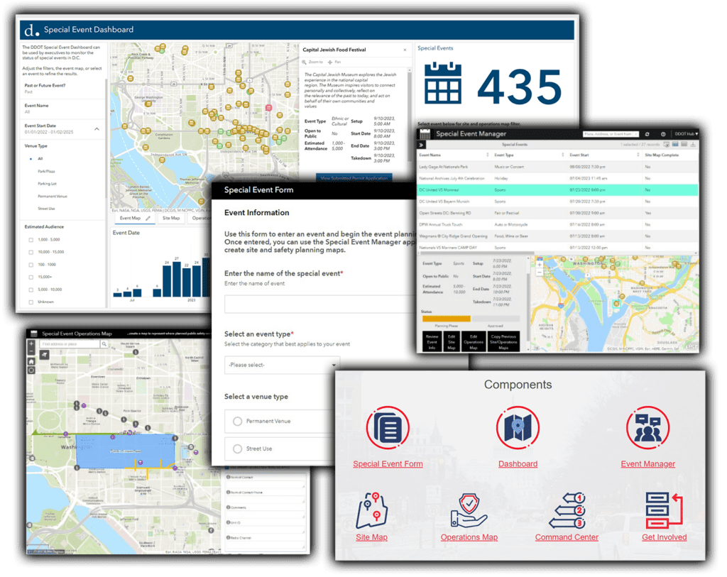
ArcGIS Hub was used to host the solution as it facilitated the understanding and workflow of how each individual component fits into the comprehensive picture.
The solution is built around a core data set of special events. Individual events are initially “registered” with the solution using an ArcGIS Survey123 intake form.
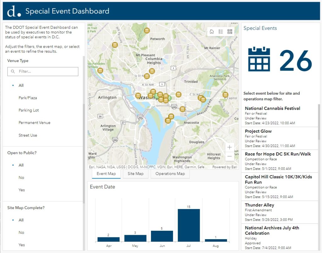
An ArcGIS Dashboard uses the event information to give managers an overview of upcoming (or past) events that can be filtered by venue type, expected crowd size, approval status, or other event characteristics.
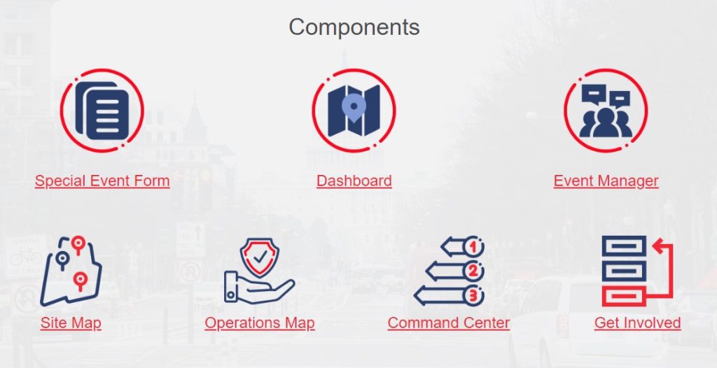
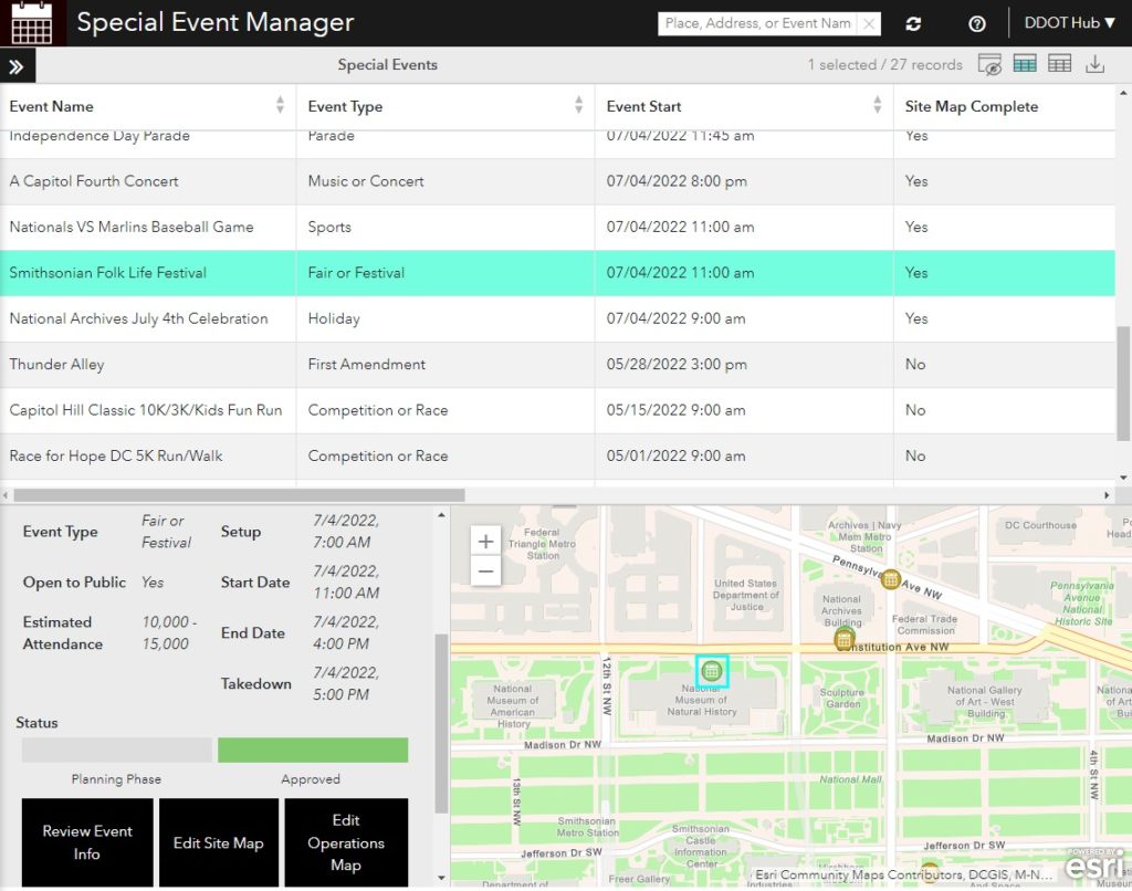
The Special Event Manager is used to dive deep into specific events. From this interface, site maps or operation maps can be created, copied from past events, reviewed, and eventually approved.
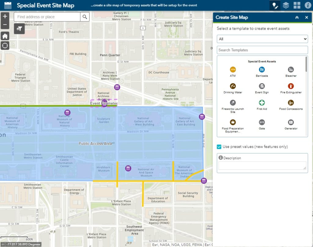
The Special Event Site Map interface facilitates the creation of site maps linked to individual events. Site maps include the point, line, or area representation of event physical features. This may include signs, fire lanes, event perimeters, or other stationary event components.
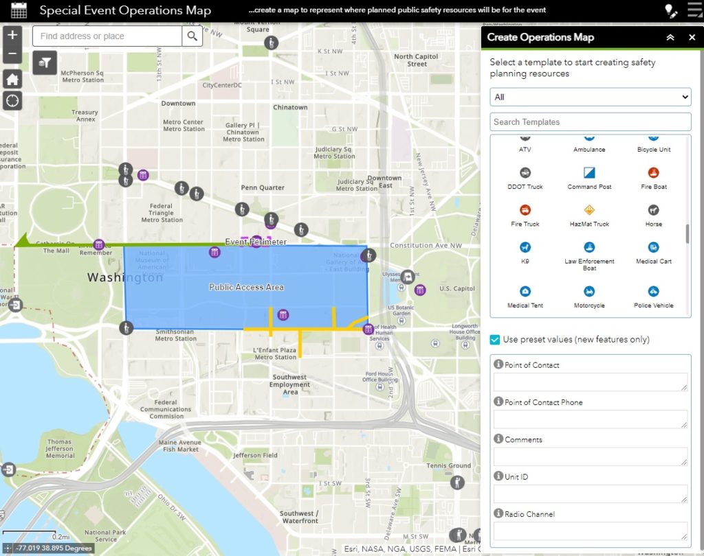
The operations map includes mobile or distributed resources that will be actively deployed during the event. This may include trucks, traffic control officers, resource assignment paths, staging areas, or security perimeters.
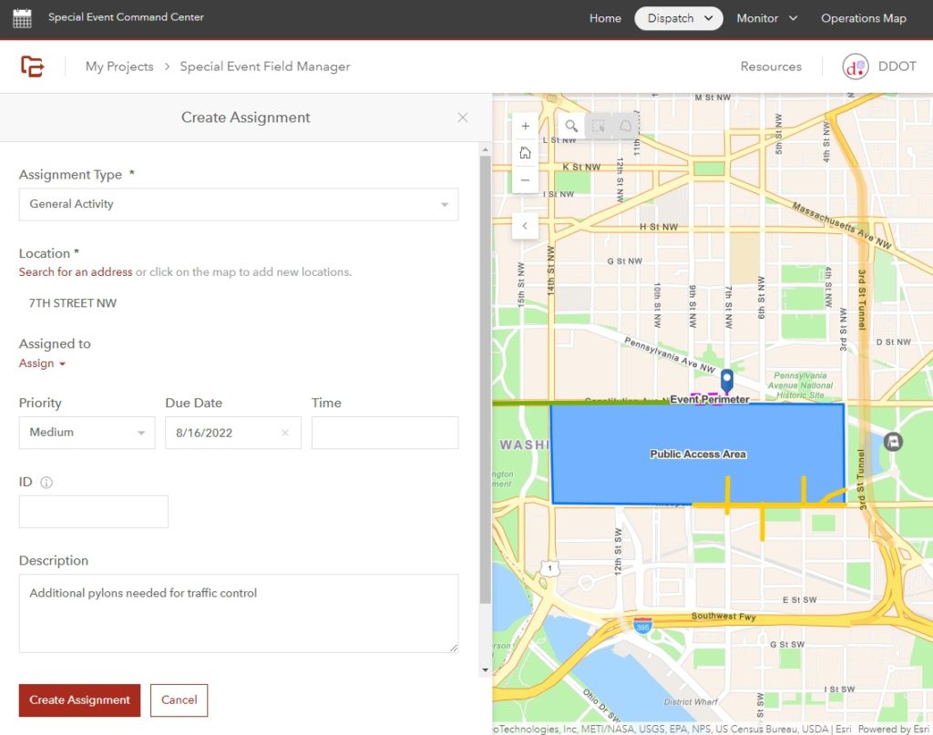
During an event, assignments can be created and assigned from the Special Event Command Center. Assignment deployment, tracking, and in-the-field responses are managed using ArcGIS Workforce behind the scenes.
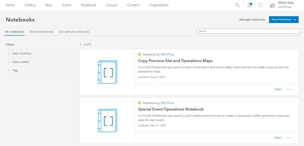
ArcGIS Notebooks are used to copy site plans and operations maps from previous events. This saves time, money, and the duplication of effort for annual or repeating events.
Talk to SymGEO today if your agency or organization is interested in managing special events using the power of Esri’s Special Event Operations solution – we are certified experts and here to help.