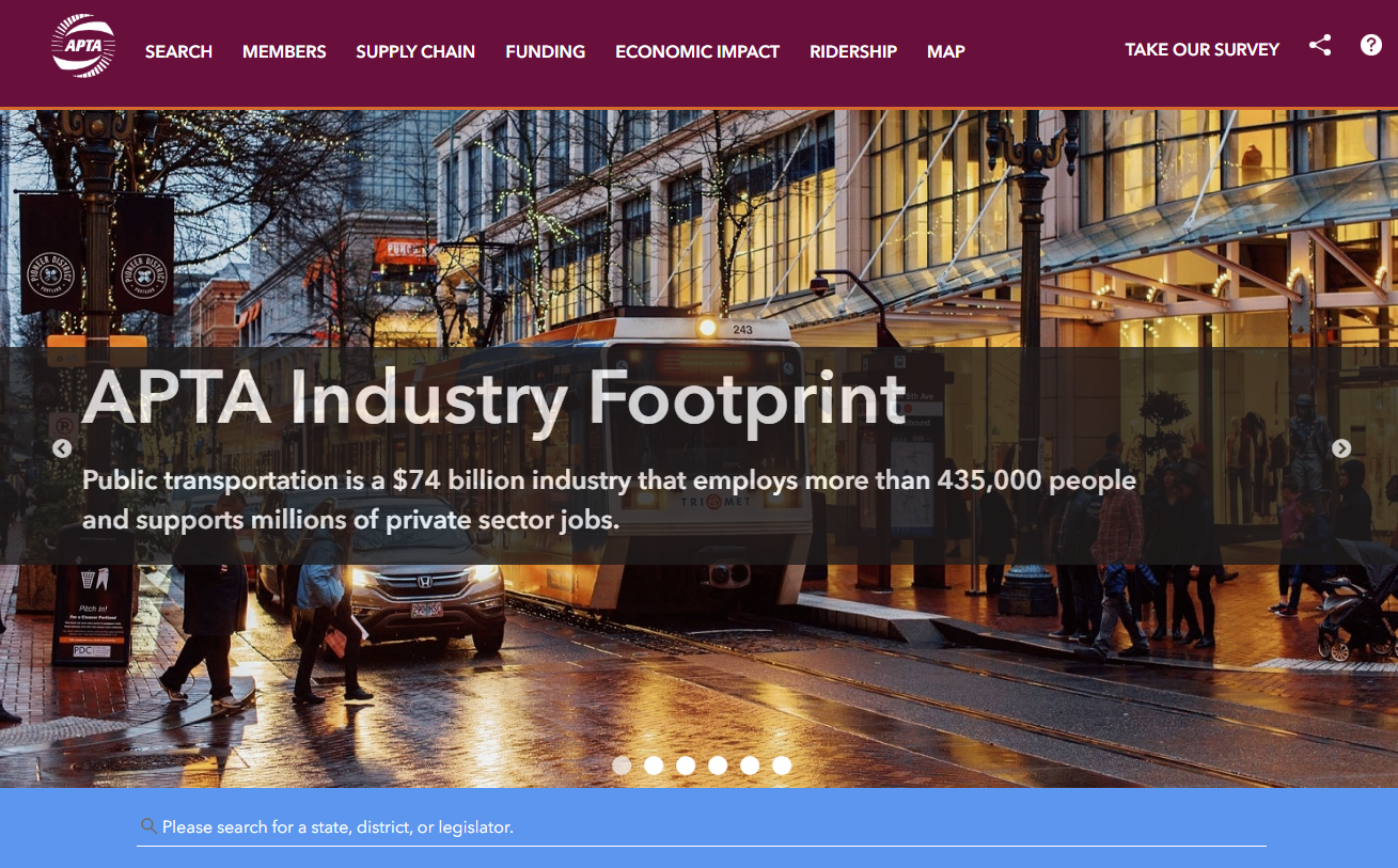
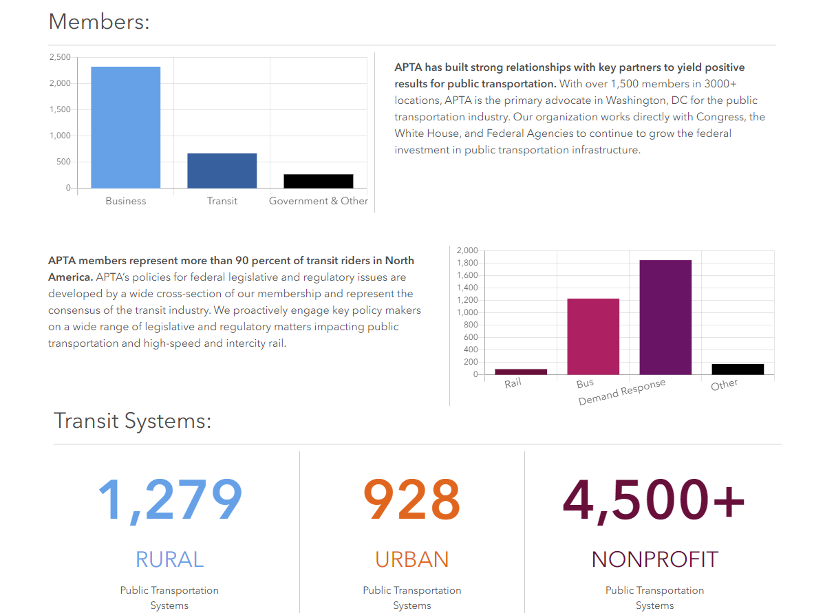
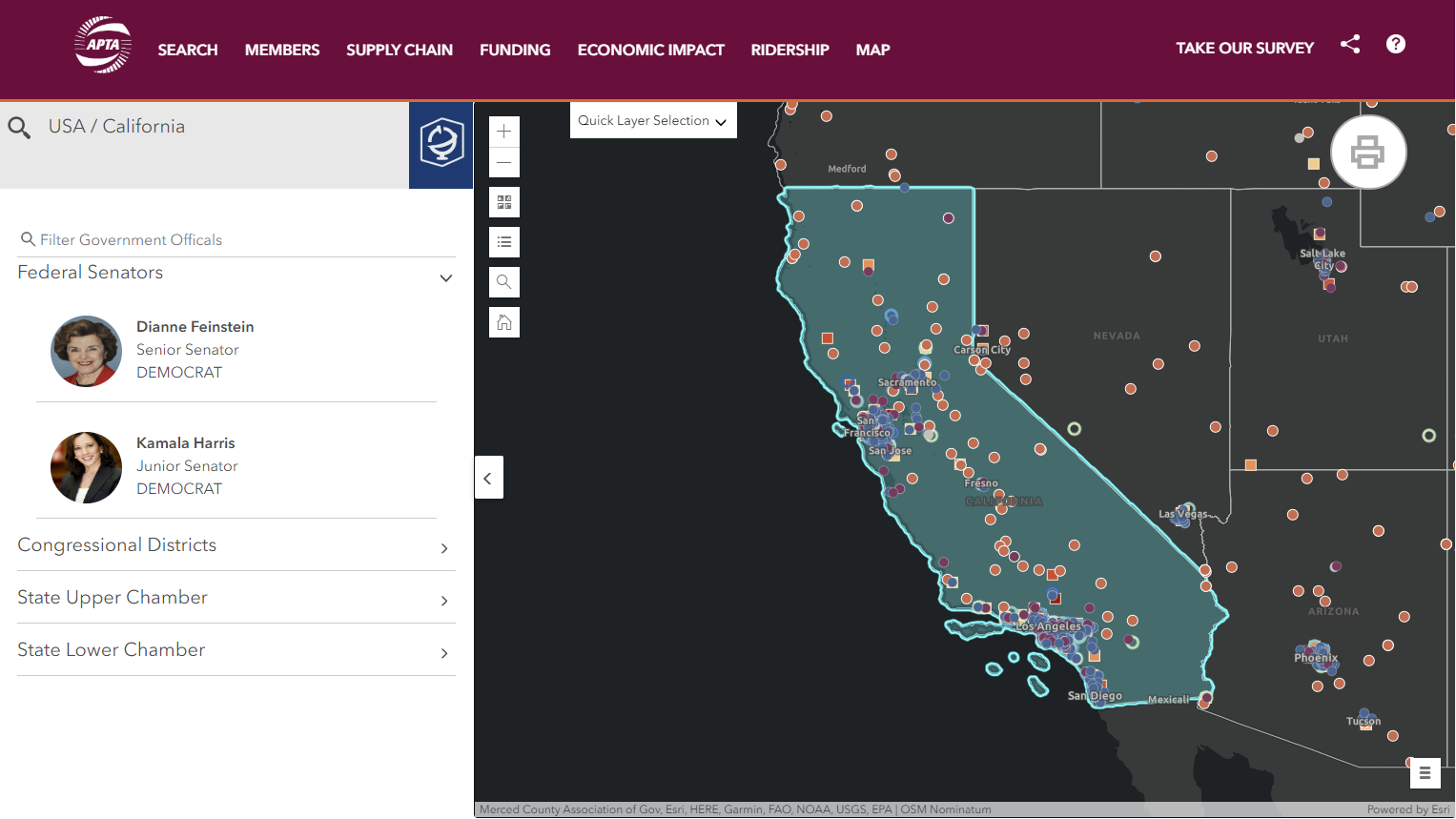
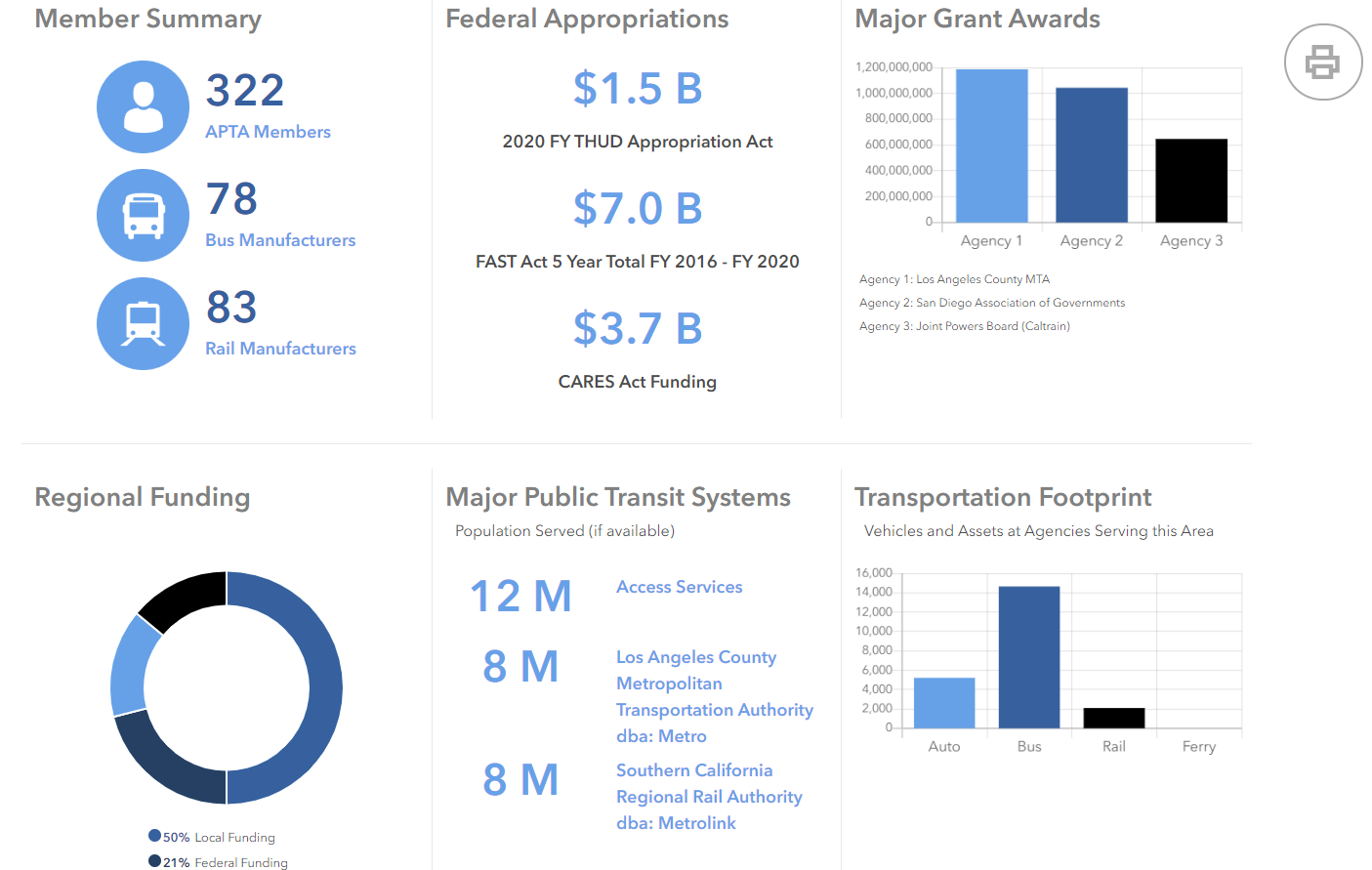
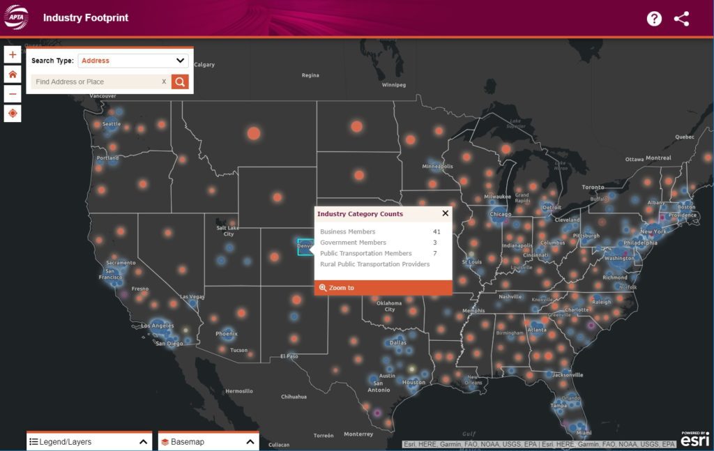
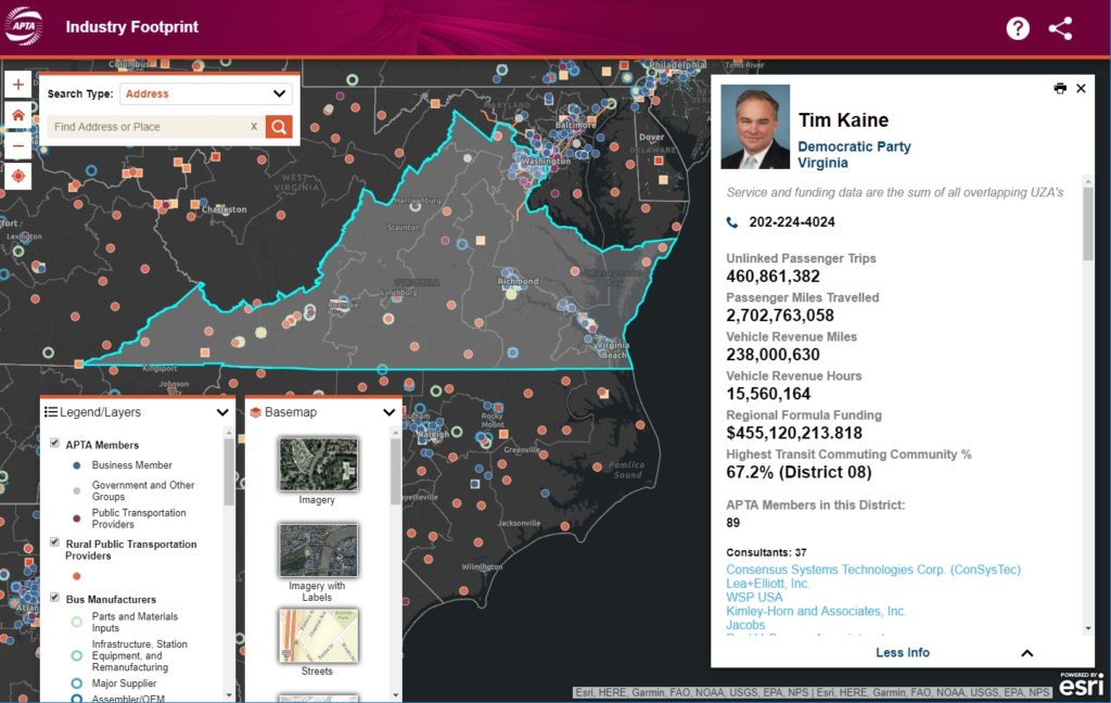
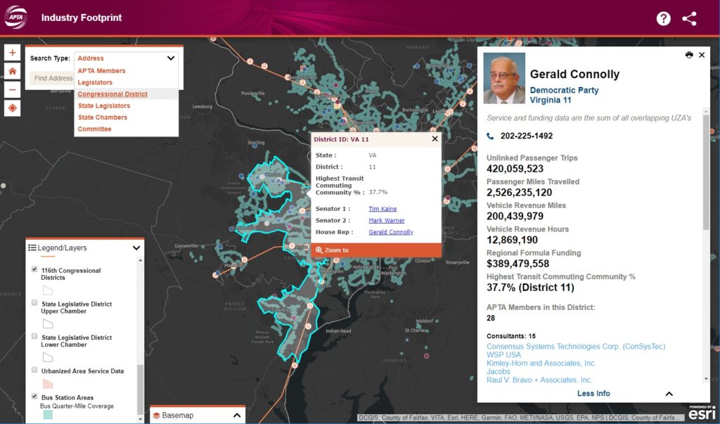
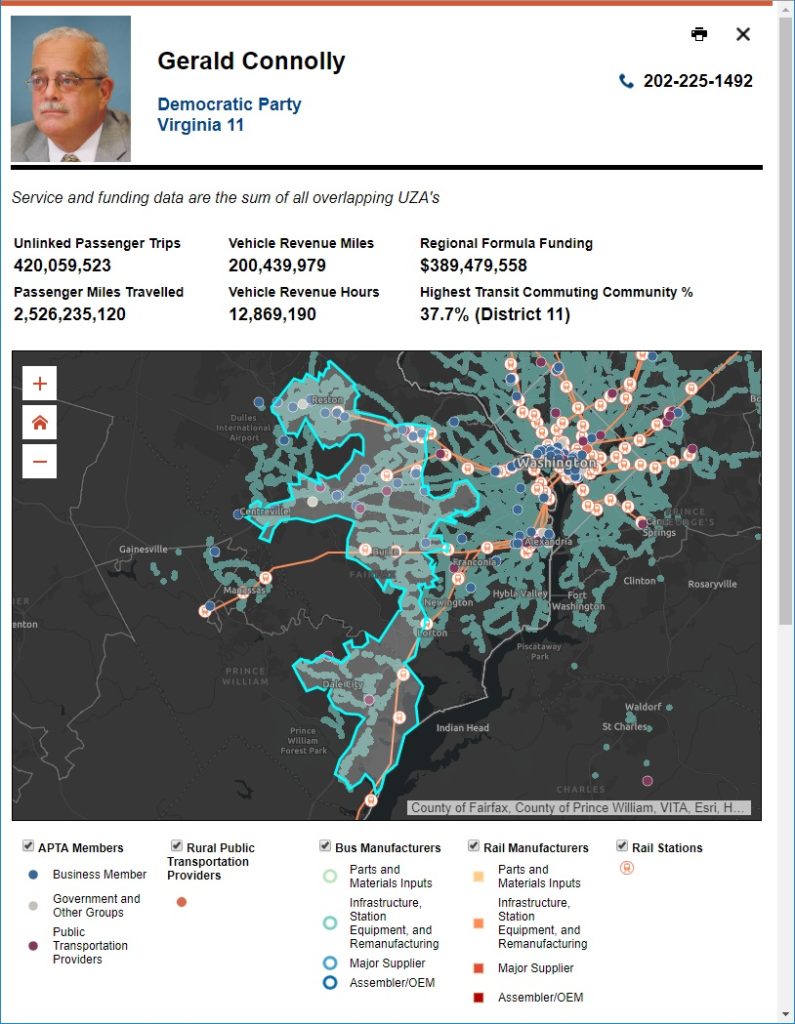
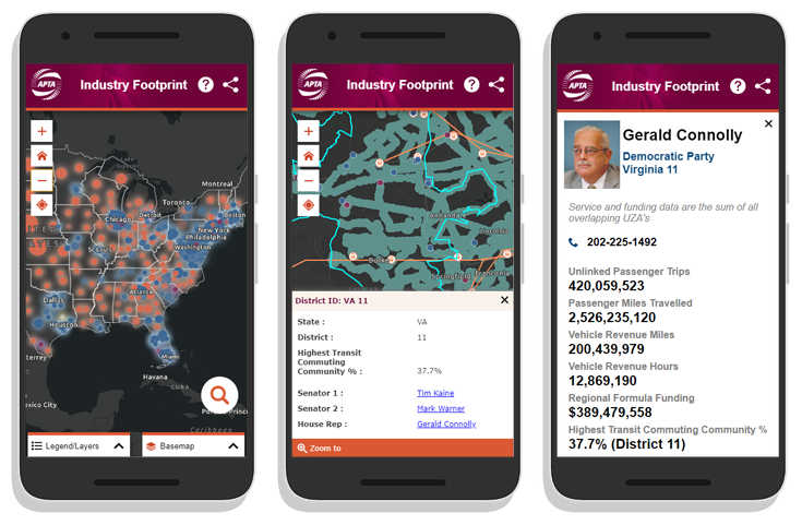
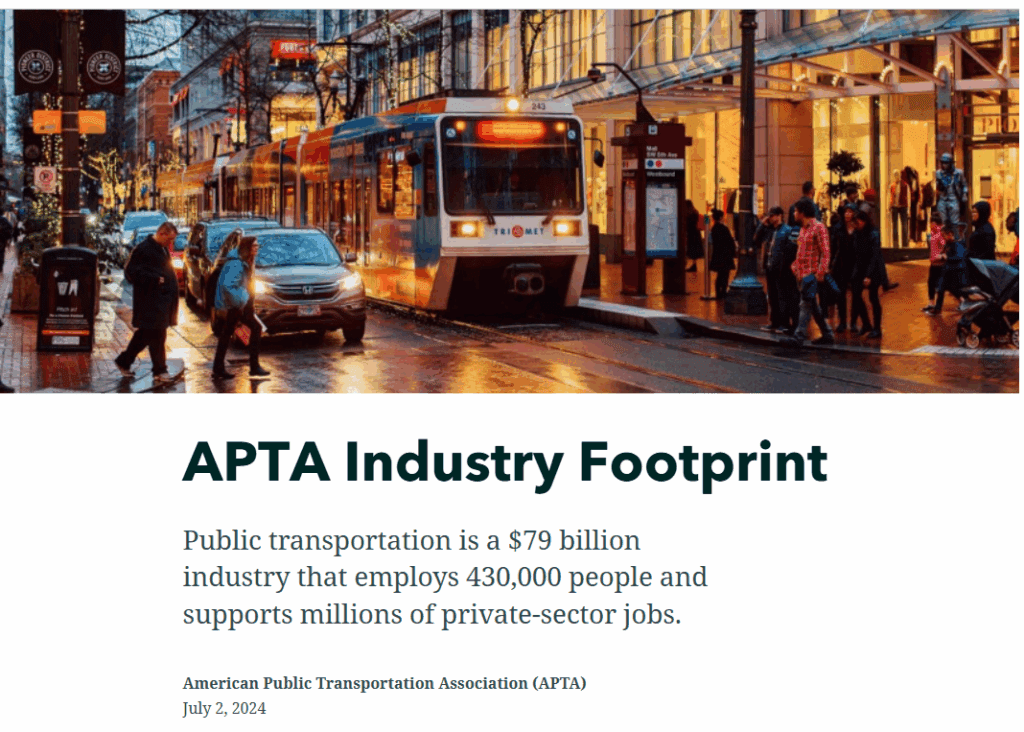
Public transportation is a $79 billion industry that employs 430,000 people and supports millions of private-sector jobs. As the public transportation industry advocacy leader, the American Public Transportation Association (APTA) is dependent on accurate, current data to help inform critical decisions. The newly updated Industry Footprint is designed to collect, analyze, and present key statistics at national, state, and local levels. This application, produced in collaboration with our development partners at GeoMarvel, provides insight into APTA membership, public transportation providers, transit service, manufacturing and supply chain, and congressional/legislative contact information. Learn more about all the innovative platform enhancements in the APTA Industry Footprint Storymap.
“We are happy with the results of our partnership with SymGEO. They produced a website that equals our ambition and stature as an association.”
– APTA Director of Policy Research and Development
Would a custom mapping application like this be useful to your organization? Talk to our solution experts today about your unique GIS needs, the SymGEO team is here to help!
Public transportation is a $74 billion industry that employs 435,000 people and supports millions of private-sector jobs. As the public transportation industry advocacy leader, the American Public Transportation Association (APTA) is dependent on accurate, current data to help inform critical decisions. The all-new Industry Footprint is designed to collect, analyze, and present key statistics at national, state, and local levels. This application, produced in collaboration with our development partners at GeoMarvel, provides insight into APTA membership, public transportation providers, transit service, manufacturing and supply chain, and congressional/legislative contact information.
“We are happy with the results of our partnership with SymGEO. They produced a website that equals our ambition and stature as an association.”
– APTA Director of Policy Research and Development
National-level statistics and APTA membership overview are provided on the homepage of the Footprint platform. Navigation links in the header help direct the audience to the section of interest. The top-level summary narrative for each section explains the importance of that component. Search functionality enables the audience to find a person, state, or legislative district of interest. Upon search, the local infographic “map” section is opened to explore in greater detail.
Search functional is enabled for legislators, states, APTA members, and committees in the upper-left corner. Selecting a search result will update the map with the associated geographic area and associated statistics. Map controls include the ability to turn on or off layers of interest, search for a location, switch the basemap, and zoom controls. Quick layer selection is provided to switch between state, congressional, or legislative geographies.
If a state is selected or the map is clicked upon, legislative information opens in the left-hand panel. This searchable section provides easy access to contact information for policymakers throughout the nation.
Upon selection of a search result or clicking on a map area, statistics and summary infographics are generated to help characterize the geographic selection. This information is compiled in a print-ready format, designed to help inform and energize a policy discussion for that geographic area.
Would a custom mapping application like this be useful to your organization? Talk to our solution experts today about your unique GIS needs, the SymGEO team is here to help!
We are excited and honored to announce that our World Bank asset management work in Croatia has been published in ArcNews Spring 2020 edition! We had lots of fun crunching data, solving international geospatial mysteries, and leveraging ArcGIS Dashboard and ArcGIS Pro capabilities. It’s not every day that our work is featured in front of an audience of 900,000 GIS professionals, so come see what all the excitement is about!
Check out the article to learn all about this project and let us know if SymGEO can help you leverage your spatial data with an ArcGIS Dashboard.
SymGEO is honored to have our World Bank asset management work in Croatia featured as a successful case study by Esri! We had lots of fun crunching data, solving geospatial mysteries, and leveraging ArcGIS Dashboard and ArcGIS Pro capabilities.
This solution was also featured on the ArcGIS Dashboard product page as a good example of what can be done with this flexible and powerful technology.
The SymGEO team was honored to redesign the flagship custom mapping application for the American Public Transportation Association (APTA) called the Industry Footprint. This application is designed to explore APTA membership, public transportation providers, transit service, manufacturing and supply chain, and congressional / legislative information. There is a wealth of information packed into one application!
The newly modernized Industry Footprint first begins with a look at APTA membership and transportation provider data at the national scale. It’s not easy making intuitive sense of thousands of data points, but fortunately, there are visualization tools designed to help. SymGEO uses a novel cartographic predominance approach that shows the relative number of members and dominant industry category in each congressional district with a firefly symbology effect to give it a pleasing glow.
“The SymGEO team worked on a tight schedule to deliver a series of impressive updates and fixes to our existing application, including a whole visual re-imagining. We are excited to work on even more innovations to the tool going forward together.”
– Matthew Dickens, Senior Policy Analyst, APTA
State-wide information is provided upon zoom-in and includes details about the many APTA members, providers, bus and rail service areas, manufacturing supply chain, and legislative representative information. Most of these data sets required updates as part of this project, and several had broken over time as congressional data APIs had changed since the first version of this tool. This required extensive code logic updates and re-writes by our fantastic development partner and included many stylistic and responsive updates to match the new modern design comps from our design partner.
There are several search options available to help users find the information they are looking for and create the perfect map for their report or policy advocacy. For the detailed legislative information, users can locate their area of interest and select a congressional district or an upper / lower house state legislative district. Contact information is provided for the appropriate representative as well as a snap-shot of transit facts and membership data pertinent to that area.
Print-ready interactive reports are also offered for the convenience of researchers who need to share their findings with others, either as digital pdfs or hard-copy prints.
Finally, the application was redesigned for a fluid and responsive mobile experience. This allows data access on the go, in a meeting, or wherever needed.
Talk to our mapping application experts today if you have an aging custom application that needs some modern TLC – the SymGEO team is here to help!
This project started from humble beginnings, with a series of excel files that detailed rail segment speed, passenger numbers, freight volumes, age of the track, and other characteristics.
SymGEO then used a schematic diagram of the network to build and calibrate a spatially accurate network based on OpenStreetMap rail data and linear referencing of station locations.
This newly created spatial data was then hosted in ArcGIS Online and used to configure an ArcGIS Dashboard application. This application was specifically designed to filter and query the data interactively on demand and present summary statistics based on complex queries. This combination of attribute queries, summary statistics, and visual representation now enables report graphics and key decision data to be created on-the-fly by the client.
“This is superb and exactly what the client needed and what I was imagining.”
– World Bank client
If you have complex transportation network data that you’d like to leverage with an intuitive, user-friendly, configurable application, then SymGEO would love to hear from you!