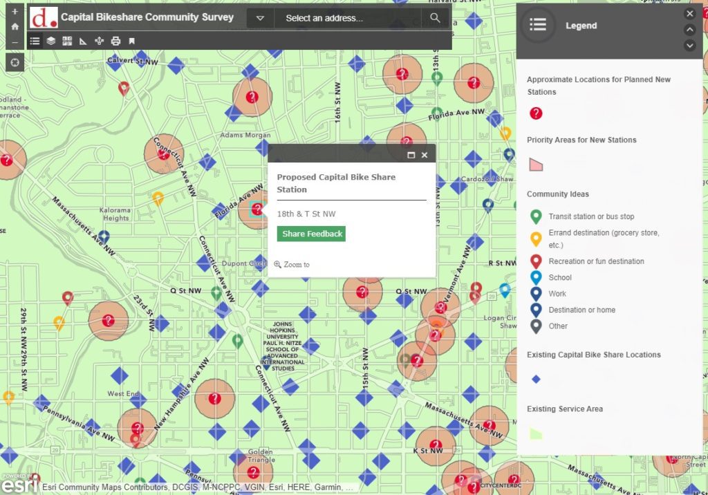
With 6000+ bikes covering 180+ square miles of the region, Capital Bikeshare is a great way to explore Metro DC and travel to and from various destination points. The network of 600+ bike stations is constantly expanding, and community feedback is an important part of deciding where to locate new stations. To facilitate the presentation of proposed locations to the general public and gather community feedback, SymGEO was honored to help build the Capital Bikeshare Station Request Tool using Esri’s ArcGIS Online technology. This work was featured in the Esri case study “GIS-Driven Initiatives Promote Active Transportation in Washington, DC“.
“The SymGEO team helped DDOT quickly implement a complex, public facing tool with a simple user interface to help us gather a high volume of public input data, which is extremely useful for Capital Bikeshare planning purposes. Their knowledge of GIS and ESRI products helped make a challenging project with many stakeholders simple and quick to turn around.”
– DDOT Project Manager
The tool leverages an ArcGIS web map and ArcGIS Web AppBuilder for the application as well as Survey123 for the gathering of comments on proposed bike stations, and it is hosted on ArcGIS Hub. Sharing feedback for a selected station opens a survey page for that station using URL parameters so that the comment is connected to the appropriate station.

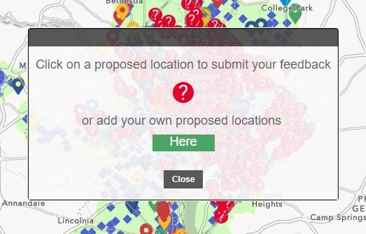
If a resident would like to suggest a location for a new site, an alternative survey is launched with additional data capture fields.
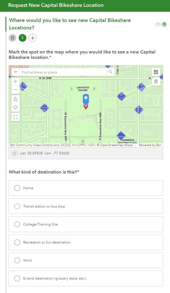
The Request New Capital Bikeshare Location survey was constructed using Survey123 Connect and offers the ability for a user to suggest multiple sites in the same submission.
“This is great stuff. Thanks again for pulling this together so quickly!”
– DDOT GIS and Applications Manager
Talk to SymGEO today if your agency or organization is interested in community engagement with the power of Esri’s ArcGIS Online platform – we are certified experts and here to help.