Academic Hub Site Case Study

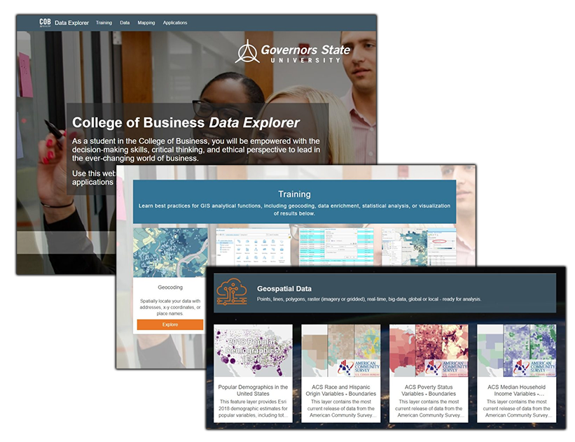
Client: Governors State University College of Business

Challenge: Collaboration and using the best available data are keys to success at academic institutions, however, finding authoritative data and relevant training classes can be difficult without guidance.

Solution: SymGEO built the pilot GSU COB Data Explorer Hub site, available for students and faculty to explore and engage with Esri geospatial technology and the larger GIS community.

Client Feedback: “For students in the College of Business at GSU, this website will help them find, visualize, and analyze geospatial data and applications relevant to the business world around us.” – Associate Professor, Governors State University

Read the full story here.


Ward7 Outreach Case Study

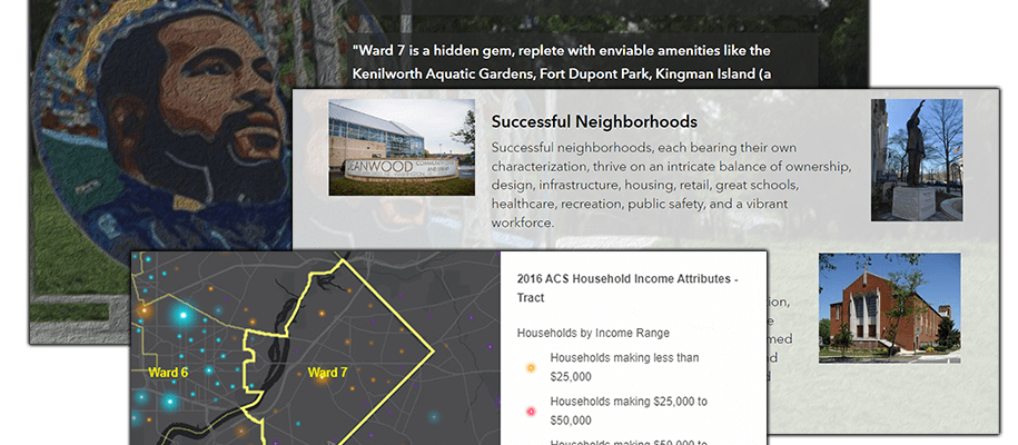
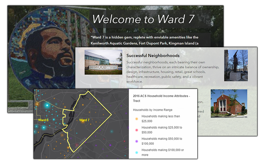
Client: Ward7 Outreach Committee

Challenge: Development within Washington DC is guided by a Comprehensive plan developed by the Office of Planning. Over the years, Ward7 has achieved its own distinct success, however, historic challenges have caused a rather sharp divide between Ward7 and some of its surrounding neighborhoods. Community outreach regarding what factors are considered by the plan and some of the challenges faced by Ward7 during the development process was required.

Solution: SymGEO built a community outreach site using ArcGIS Hub, designed to present a brief history of the area, a flavor of the neighborhood, the challenges faced due to a changing development landscape, and a call to action for the residents.

Client Feedback: “The genius of SymGEO was exactly what I needed to help jump-start a discussion on the DC Comprehensive Plan/Element Framework, transforming it from a boring review of data sets into an energizing discussion where people can clearly identify themselves in the data and endeavor to become change agents! SymGEO has taken community engagement and data collection to another level! #OneHappyCustomer” – Ward7 Outreach Committee Chair

Read the full story here.


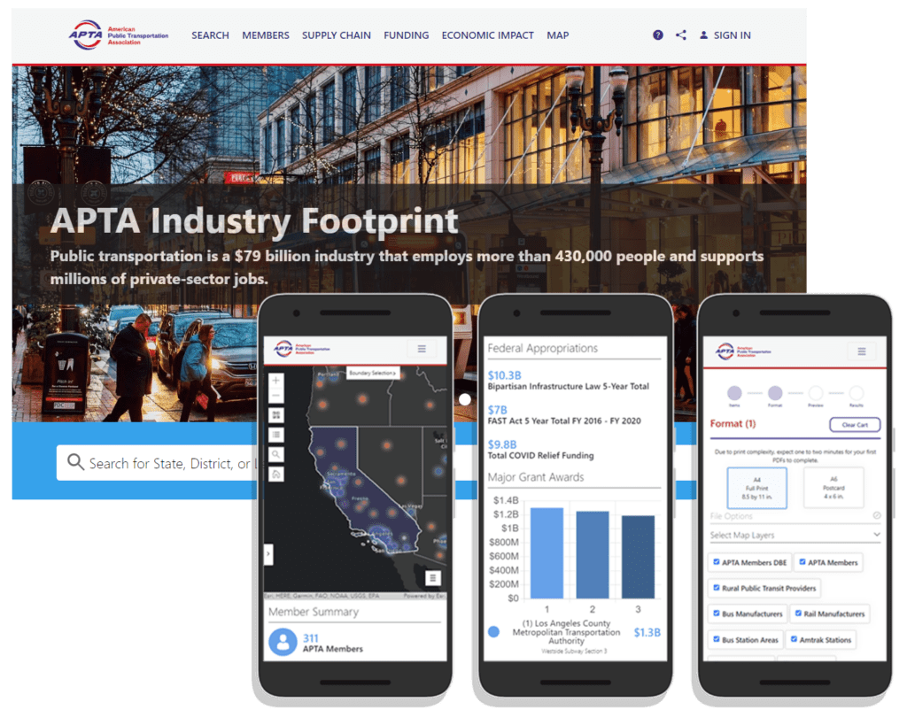
APTA Industry Footprint Case Study

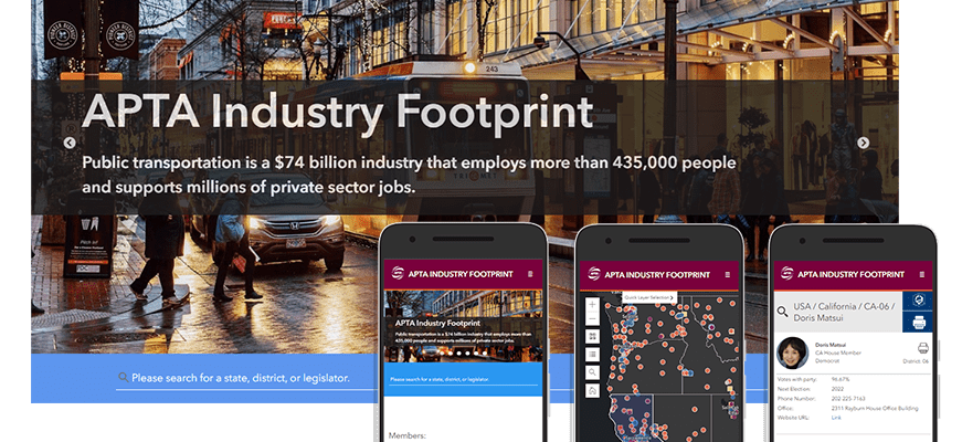
Client: American Public Transportation Association

Challenge: Public transportation is a $79 billion industry that employs 430,000 people and supports millions of private-sector jobs. As the public transportation industry advocacy leader, the American Public Transportation Association (APTA) is dependent on accurate, current data to help inform critical decisions. APTA needed a platform to collect, analyze, and present key statistics at national, state, and local levels for their nonprofit work.

Solution: SymGEO worked with our partners at GeoMarvel to develop the APTA Industry Footprint, providing insight into APTA membership, public transportation providers, transit service, manufacturing supply chains, and congressional/legislative contact information.

Client Feedback: “We are happy with the results of our partnership with SymGEO. They produced a website that equals our ambition and stature as an association.” – APTA Director of Policy Research and Development

Read the full story here.


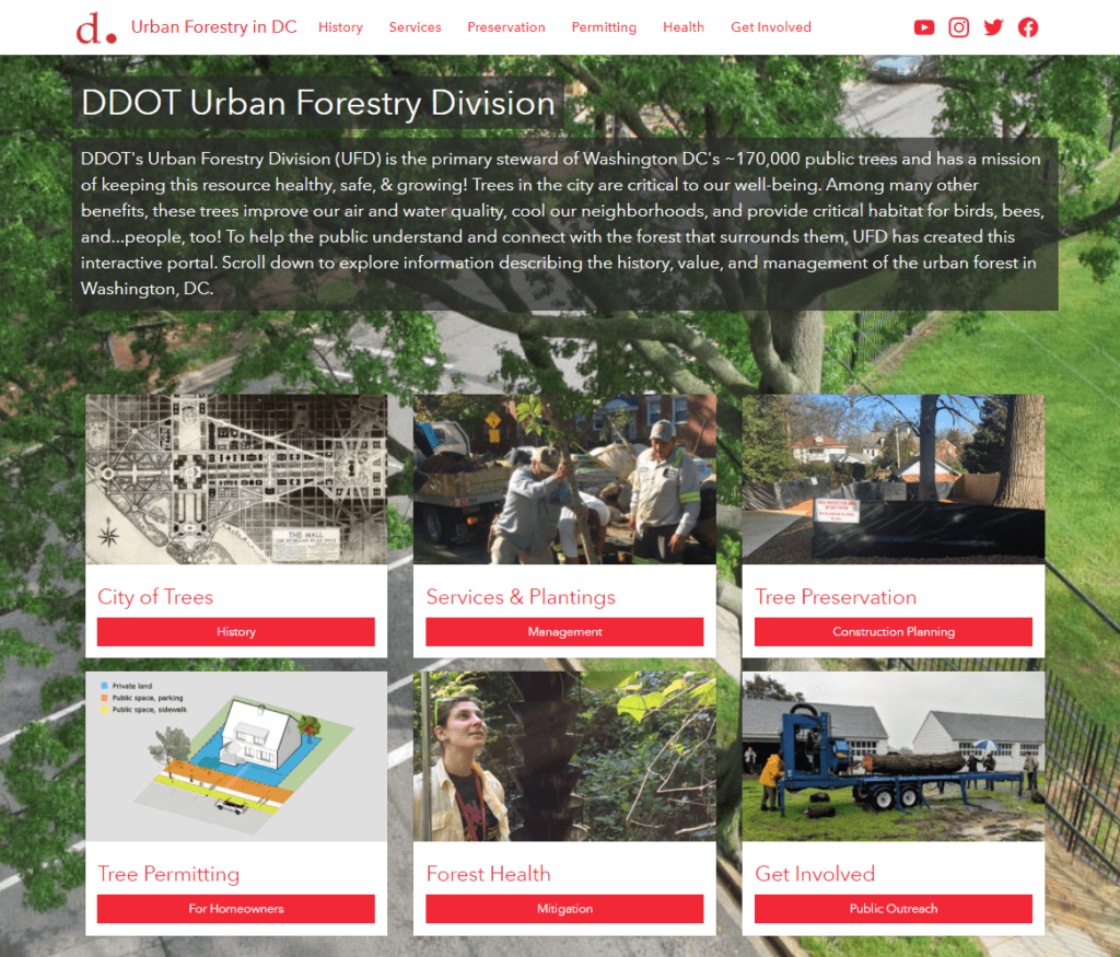
Urban Forestry Hub Case Study

Client: DDOT Urban Forestry Division

Challenge: With a long history of caring for the extensive forest canopy in DC, the Urban Forestry Division (UFD) has meticulously assembled data sets and applications to help in their forest management mission and to communicate with a variety of audiences. The UFD needed a way to effectively communicate the depth and breadth of service and resource offerings.

Solution: SymGEO built a digital platform designed to engage and interact with the DC community and provide information about the many services and resources offered by the Urban Forestry Division (UFD) using ArcGIS Hub technology. This platform was also featured in Esri’s State and Local government solutions newsletter.

Client Feedback: “SymGEO is a remarkably flexible and responsive company. They listen carefully to requirements and deftly blend customer vision with technological capabilities.” – DDOT Associate Director / State Forester

Read the full story here.


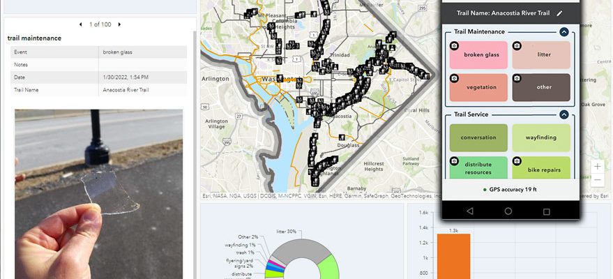
DC Trail Rangers Case Study

Client: DC Trail Rangers

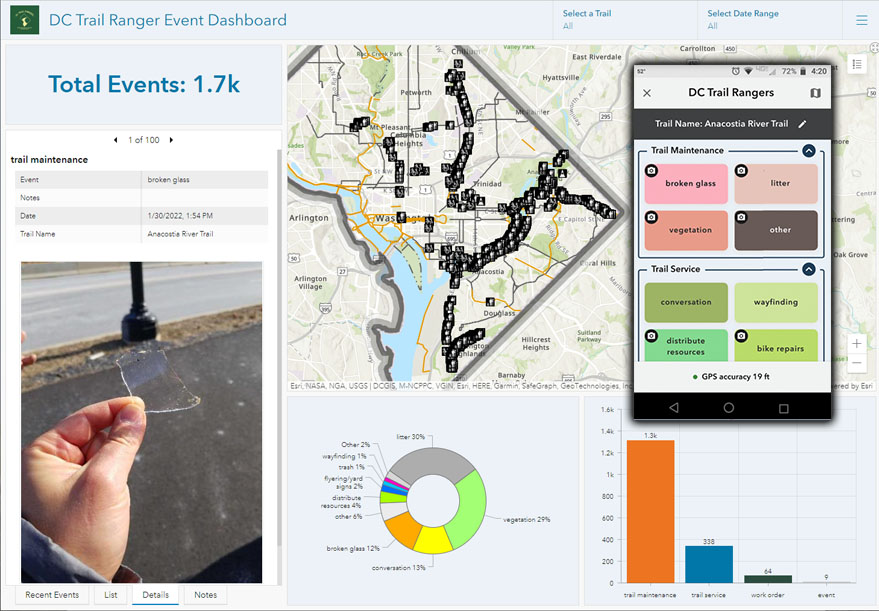
Challenge: Trail Rangers are a consistent and helpful presence on DC’s mixed-use, paved trails, charged with assisting trail users, improving trail conditions, and working with local agencies to keep the trails clean, bright, and clear of obstacles. To record their daily helpful activities, every trail service, maintenance task, work order request, or trail-side event needed to be captured by location with optional notes or photographs and tagged to the appropriate trail.

Solution: SymGEO configured and deploy an ArcGIS QuickCapture application for the DC Trail Ranger nonprofit team to facilitate the data collection process and quantify work efforts, and then used the collected data to populate a public-facing dashboard. This work was featured in the Esri case study “GIS-Driven Initiatives Promote Active Transportation in Washington, DC“.

Client Feedback: “As a field team that does a wide variety of outreach and maintenance tasks, ArcGIS QuickCapture has been great for record-keeping and storytelling of program impact. I can confidently say that staff stopped to sweep up broken glass in February 97 times!” – Trail Ranger and Outreach Director, Washington Area Bicyclist Association

Read the full story here.


Capital Projects Case Study

Client: DDOT Performance Office

Challenge: The District Department of Transportation’s (DDOT‘s) mission is to enhance the quality of life for District residents and visitors by ensuring that people, goods, and information move efficiently and safely with minimal adverse impact on residents and the environment. To accomplish this goal, many transportation capital projects are being funded, designed, and constructed throughout the city.

Solution: To help organize and communicate capital project status and information, SymGEO collaboratively built an interactive engagement portal called DDOT Capital Projects using ArcGIS Hub technology.

Client Feedback: “The SymGEO team has helped DDOT transform our digital presence into a highly engaging, well-organized platform. They leverage GIS best-practices and Esri technology to produce visually informative and actionable solutions.” -DDOT Chief Performance Officer

Read the full story here.


Capital Bikeshare Case Study

Client: DDOT Capital Bikeshare

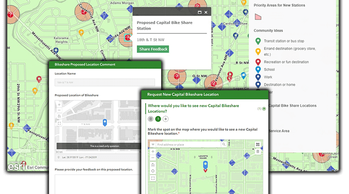
Challenge: With 6000+ bikes covering 180+ square miles of the region, Capital Bikeshare is a great way to explore Metro DC and travel to and from various destination points. The network of 600+ bike stations is constantly expanding, and community feedback is an important part of deciding where to locate new stations.

Solution: To facilitate the presentation of proposed locations to the general public and gather community feedback, SymGEO built the Capital Bikeshare Station Request Tool using Esri’s ArcGIS Online technology. This work was featured in the Esri case study “GIS-Driven Initiatives Promote Active Transportation in Washington, DC“.

Client Feedback: “The SymGEO team helped DDOT quickly implement a complex, public-facing tool with a simple user interface to help us gather a high volume of public input data, which is extremely useful for Capital Bikeshare planning purposes.  Their knowledge of GIS and ESRI products helped make a challenging project with many stakeholders simple and quick to turn around.” – DDOT Project Manager

Read the full story here.


Croatia Railway Dashboard Case Study

Client: The World Bank

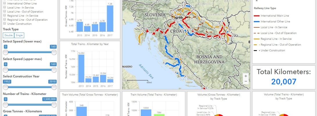
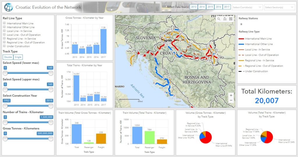
Challenge: The World Bank partnered with a group in Croatia to gain insight into the country’s rail network, an effort that would lead to improved safety and the more efficient transport of goods. As part of this effort, the two teams inventoried Croatia’s railways to better identify sections that were at risk of deterioration and in need of maintenance or that could become commerce choke points. In the inventory, however, some of the data were shown in different systems of measurement, and a lot of the schematic diagrams were rudimentary, which made it difficult to view and manage the data.

Solution: To enhance and streamline the railway’s existing data management system, the World Bank and the local teams in Croatia joined forces with Esri partner SymGEO. Over the course of two months, SymGEO worked with staff from the World Bank to develop a high-resolution, unified dataset and create a dashboard solution that improved data management and analysis. This solution was featured in ArcNews as a success story entitled “World Bank Deploys GIS Dashboard to Improve Railway Safety in Croatia” highlighting how to effectively develop and deploy a dashboard solution.

Client Feedback: “This is superb and exactly what the client needed and what I was imagining.” – World Bank client

Read the full story here.

Downtown: Energize Kentlands Case Study

Client: Kentlands Downtown Working Group

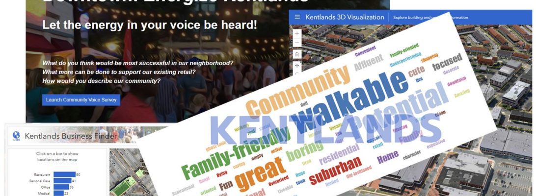
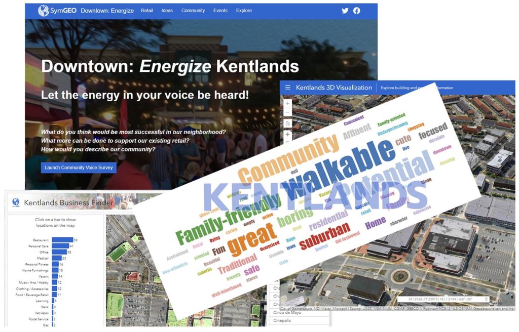
Challenge: The Kentlands development in Gaithersburg, Maryland, located north of Washington, DC, offers residents a high density of services, restaurants, and entertainment. From a residential perspective, Kentlands has been a success, with more than 8,000 inhabitants living in the development and its sister community, Lakelands. But the town has had challenges on the retail side, including assembling an ideal group of businesses that will have long-term success.

Solution: To help amplify a local initiative to energize Kentlands’ retail businesses and boost economic development, SymGEO developed Downtown: Energize Kentlands. The web-based community engagement platform, built on ArcGIS Hub, is designed to inform the public about future plans for Kentlands and provide a feedback mechanism for residents to express what kinds of retail offerings they would like to see. Featured by Esri in an ArcNews publication entitled “ArcGIS Hub Gets Mixed-Use Community Involved in Retail Decision-Making“, the solution is now available for configuration in the ArcGIS Marketplace.

Client Feedback: “Downtown Energize! is an innovative digital tool that provides mapping of business locations to potential and existing customers in a format that is fun, easy to use, and flexible enough to accept updates and even track current events. It’s a win-win for our community by empowering residents to engage with our local businesses and to energize our downtown!” – Local Business Owner, Kentlands

Read the full story here.

Capital Bikeshare Community Survey

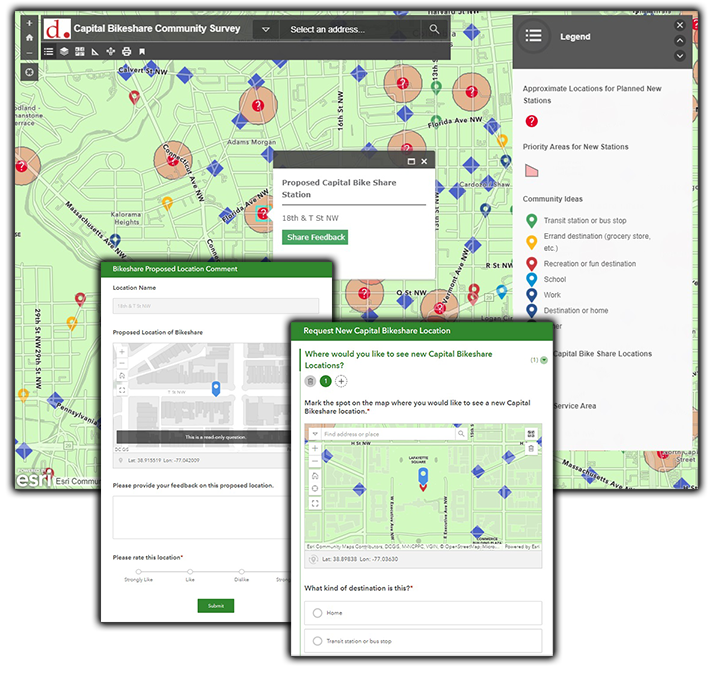
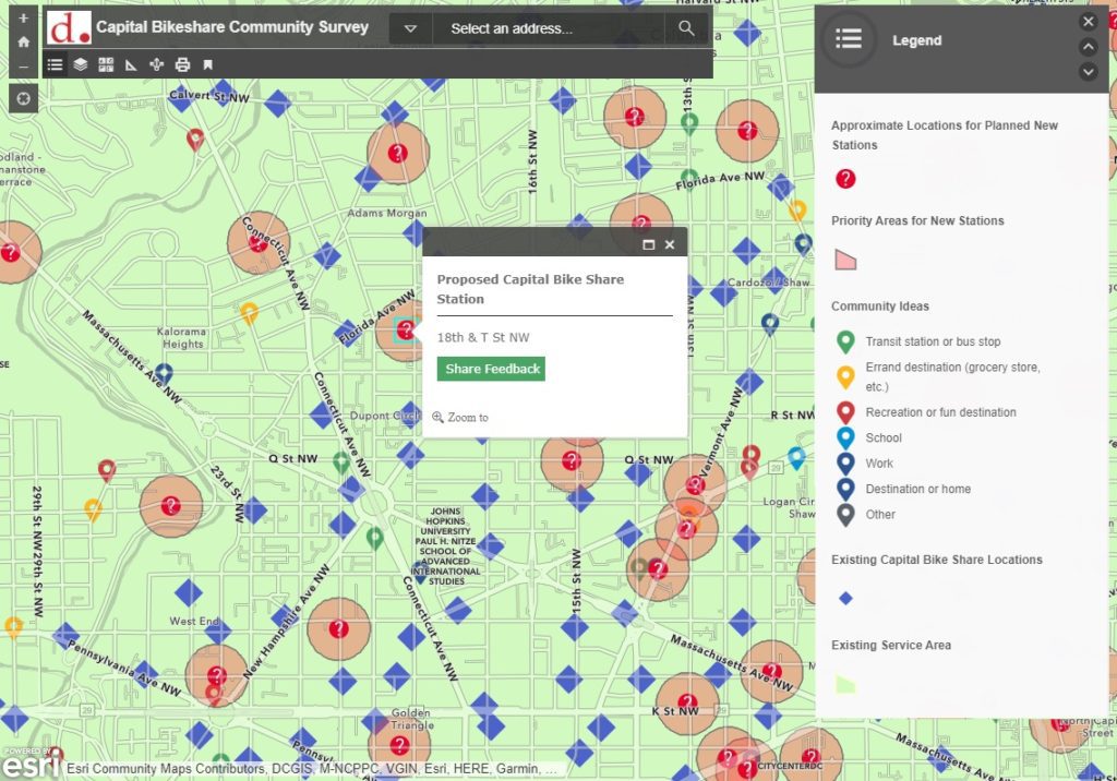
With 6000+ bikes covering 180+ square miles of the region, Capital Bikeshare is a great way to explore Metro DC and travel to and from various destination points. The network of 600+ bike stations is constantly expanding, and community feedback is an important part of deciding where to locate new stations. To facilitate the presentation of proposed locations to the general public and gather community feedback, SymGEO was honored to help build the Capital Bikeshare Station Request Tool using Esri’s ArcGIS Online technology. This work was featured in the Esri case study “GIS-Driven Initiatives Promote Active Transportation in Washington, DC“.

“The SymGEO team helped DDOT quickly implement a complex, public facing tool with a simple user interface to help us gather a high volume of public input data, which is extremely useful for Capital Bikeshare planning purposes.  Their knowledge of GIS and ESRI products helped make a challenging project with many stakeholders simple and quick to turn around.” 

– DDOT Project Manager

The tool leverages an ArcGIS web map and ArcGIS Web AppBuilder for the application as well as Survey123 for the gathering of comments on proposed bike stations, and it is hosted on ArcGIS Hub. Sharing feedback for a selected station opens a survey page for that station using URL parameters so that the comment is connected to the appropriate station.

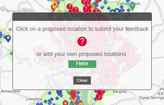
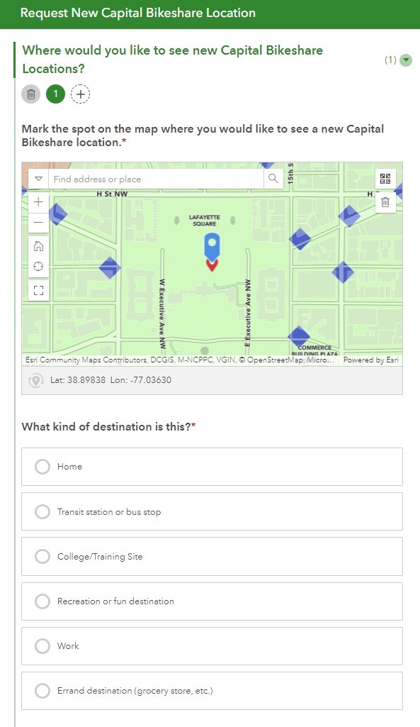
If a resident would like to suggest a location for a new site, an alternative survey is launched with additional data capture fields.

The Request New Capital Bikeshare Location survey was constructed using Survey123 Connect and offers the ability for a user to suggest multiple sites in the same submission.

“This is great stuff. Thanks again for pulling this together so quickly!”

– DDOT GIS and Applications Manager

Talk to SymGEO today if your agency or organization is interested in community engagement with the power of Esri’s ArcGIS Online platform – we are certified experts and here to help.