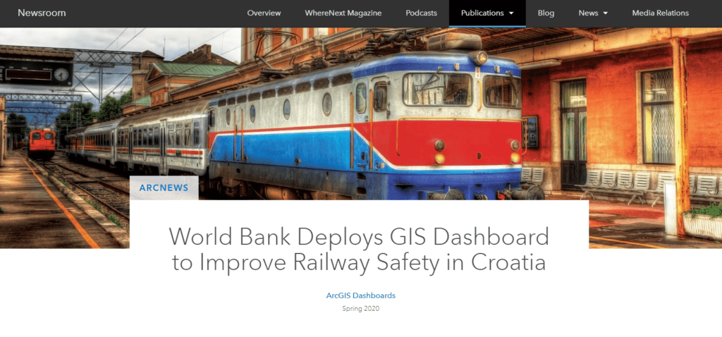
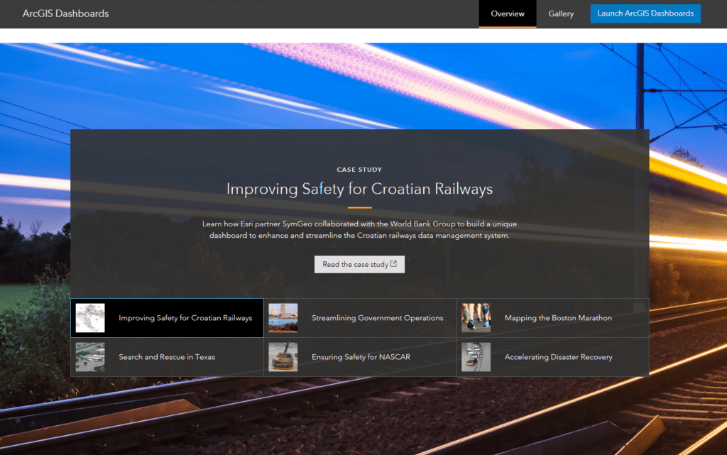
We are excited and honored to announce that our World Bank asset management work in Croatia has been published in ArcNews Spring 2020 edition! We had lots of fun crunching data, solving international geospatial mysteries, and leveraging ArcGIS Dashboard and ArcGIS Pro capabilities. It’s not every day that our work is featured in front of an audience of 900,000 GIS professionals, so come see what all the excitement is about!
Check out the article to learn all about this project and let us know if SymGEO can help you leverage your spatial data with an ArcGIS Dashboard.
SymGEO is thrilled to have our services and solutions listed in the ArcGIS Marketplace, the top destination for users to search, discover, and acquire apps, content, solutions, and professional services from Esri’s ecosystem of providers for use within their organization.
“ArcGIS Marketplace makes it easy to connect with users, provide free trials, generate leads, and sell your products and services with e-commerce.” – Esri
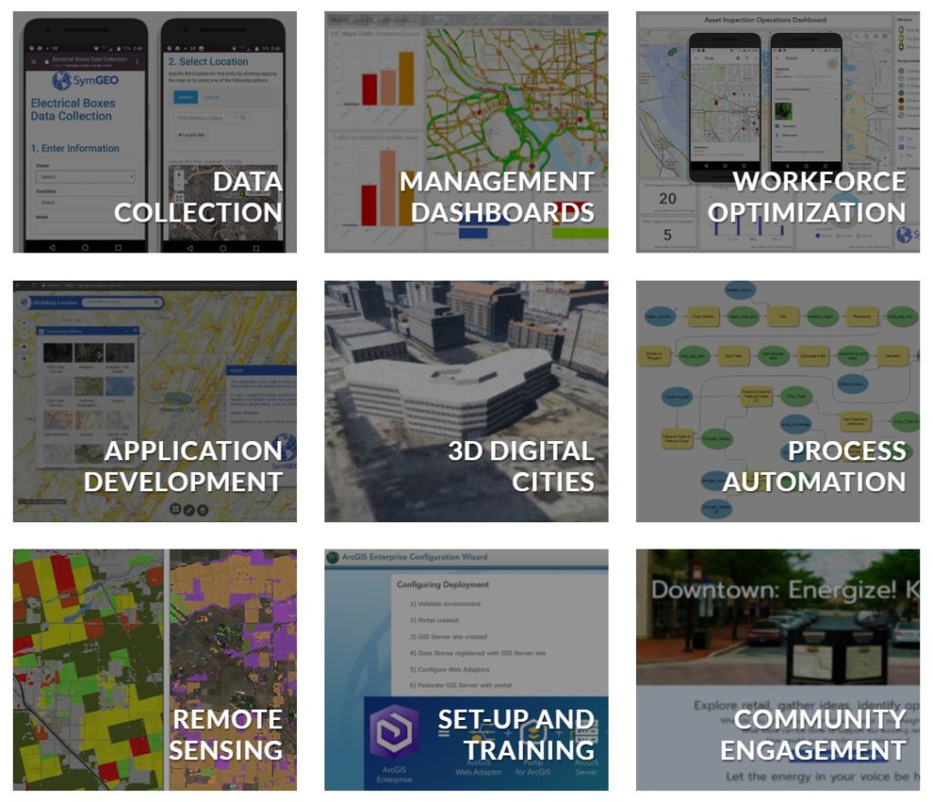
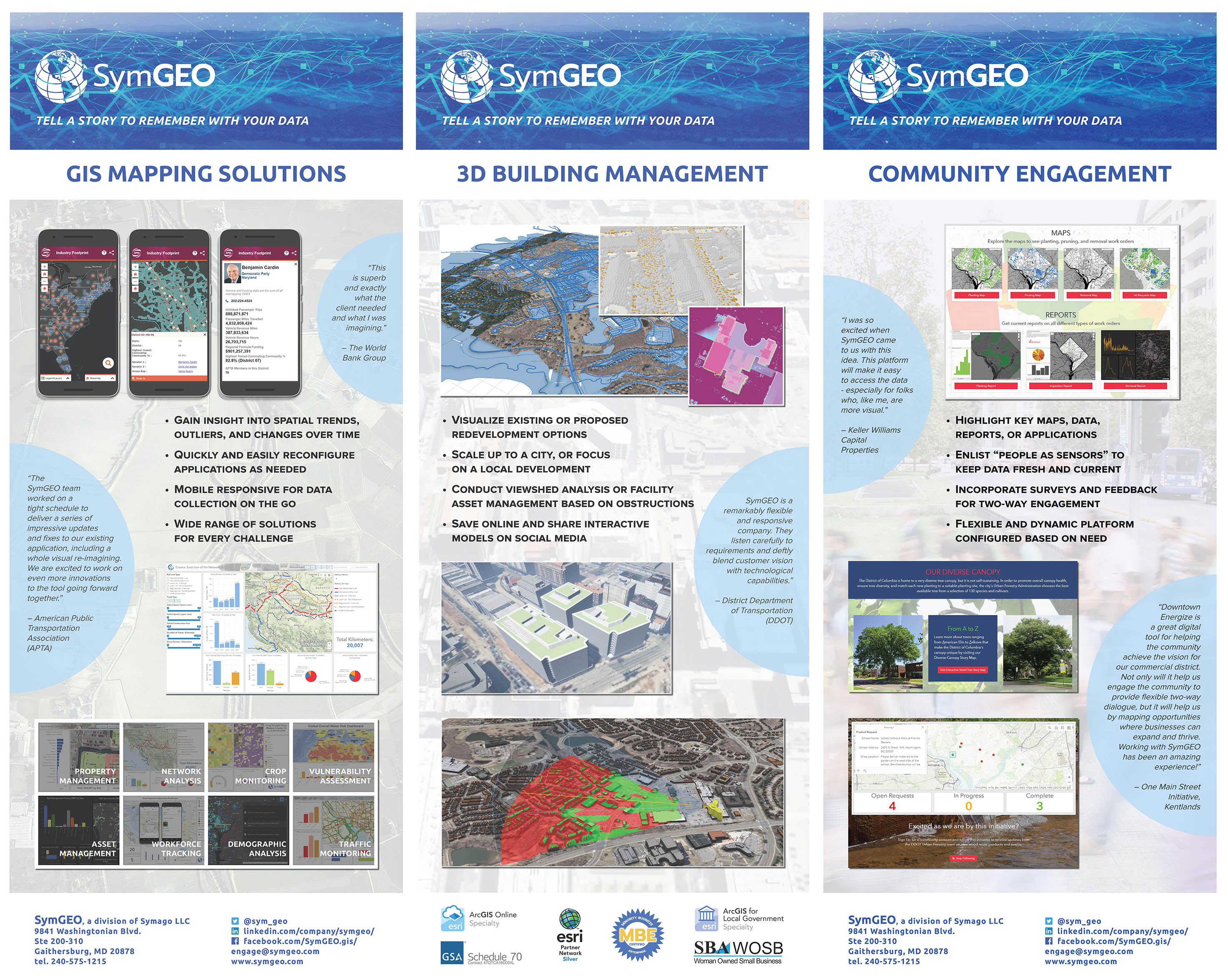
We were fortunate to have three of our listings accepted into the marketplace. The first is our ArcGIS Online and ArcGIS Hub solutions configuration and implementation services. These services focus on our expertise with the ArcGIS Online environment, data analytics and visualization, application configuration and deployment, and community engagement using ArcGIS Hub.
Our second listing is a partner solution focused on an ArcGIS Hub configuration called Downtown: Energize!. This solution is configurable for cities or communities looking to energize their downtown core with retail that fits the needs of the local population. This solution empowers the local community to explore retail in their area and to voice their opinions on what types of new commercial development they feel would do well.
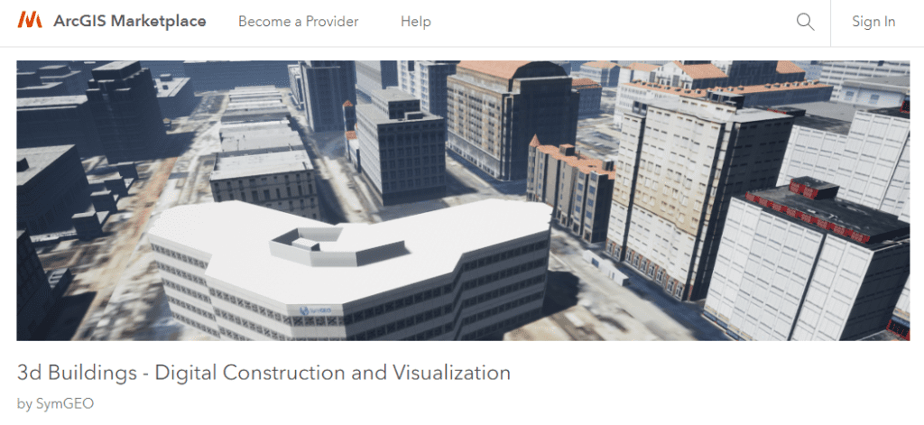
Our third listing provides information about our 3d building modeling capabilities. This solution leverages ArcGIS Pro for 3d model production, ArcGIS CityEngine for model texturing, analysis, and landscape refinement, and Unreal Engine by Epic Games for rendering and visualizations. Whether the goal is a digital twin or proposed development scenarios, the end result is a virtual environment that can’t wait to be explored!
To learn more about our marketplace listings or any of our services, contact us to set up a time to talk – SymGEO is a certified Esri specialist and is here to help!
SymGEO is pleased to announce we have been awarded Esri’s ArcGIS System Ready Specialty designation! This honor is for partners that are highly focused on delivering services, content or solutions leveraging the latest versions of ArcGIS technology.
“ArcGIS is a platform for organizations to create, manage, share, and analyze spatial data. It consists of server components, mobile and desktop applications, and developer tools. This platform can be deployed on-premises or in the cloud (Amazon, Azure) with ArcGIS Enterprise, or used via ArcGIS Online which is hosted and managed by Esri.” – Esri
Only a few hundred Esri Partners have been awarded this specialty (out of almost 3500 partners), so we are grateful to be among the top 10 percent! SymGEO has been fortunate to work with great clients on projects that have now appeared at Esri plenary presentations around the country. We are really thankful for the opportunity and trust that Esri has placed in our skills and services with the Release Ready Specialty designation, and we look forward to continuing to develop as GIS professionals over the coming years!
To learn more about these projects or any of our services, contact us to set up a time to talk – SymGEO is a certified Esri specialist and is here to help!
SymGEO is honored to have our World Bank asset management work in Croatia featured as a successful case study by Esri! We had lots of fun crunching data, solving geospatial mysteries, and leveraging ArcGIS Dashboard and ArcGIS Pro capabilities.
This solution was also featured on the ArcGIS Dashboard product page as a good example of what can be done with this flexible and powerful technology.
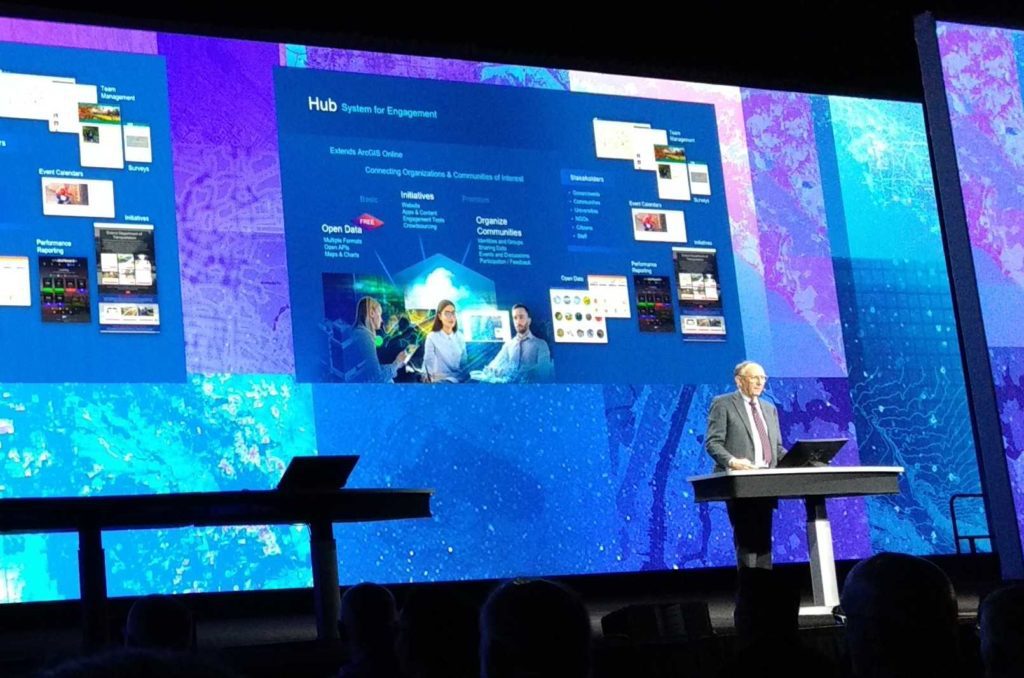
SymGEO is pleased to announce we have been awarded the ArcGIS Hub Specialty designation from Esri! This prestigious honor is bestowed upon partners to recognize their expertise and delivery of solutions and services that help customers build a bridge between government departments and communities using ArcGIS Hub technology.
“ArcGIS Hub is an easy-to-configure cloud platform that organizes people, data, and tools to accomplish Initiatives and goals.” – Esri
SymGEO has been fortunate to work on community engagement projects for municipal and local government clients and has enhanced our partnership with Esri to gain valuable insight into best practices and emerging Hub technologies. We work diligently with our clients to identify their core messaging, digital assets, targeted audience, and corporate branding. We then typically implement a Hub site comprised of pages and initiatives that feature a range of ArcGIS Online solutions, including Survey123, Web AppBuilder, ArcGIS Dashboard, Collector, and 3D WebScenes.
To show a sampling of our ArcGIS Hub work, we offer the following examples:
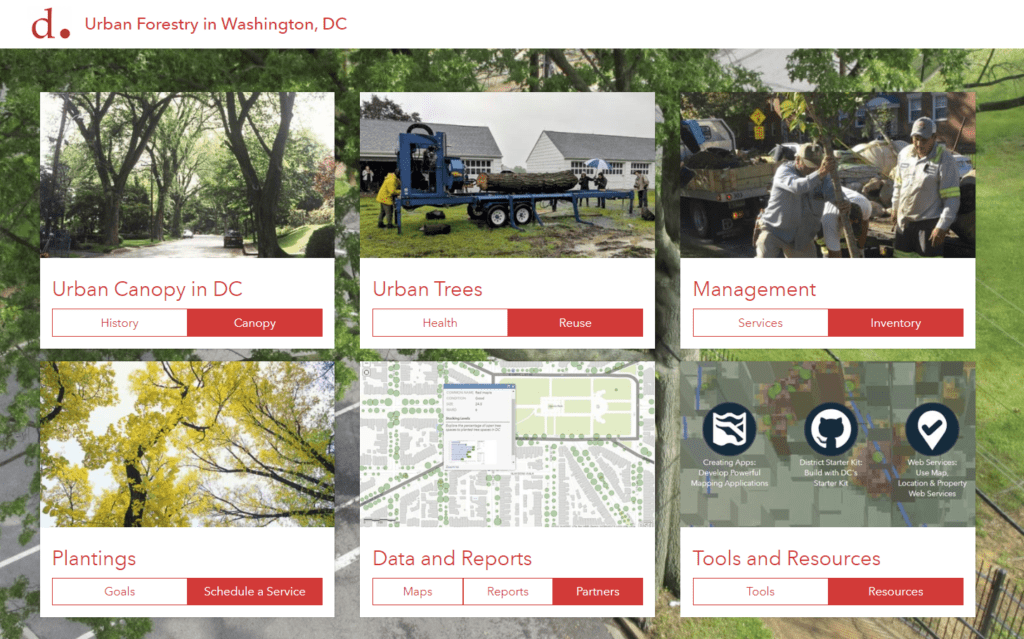
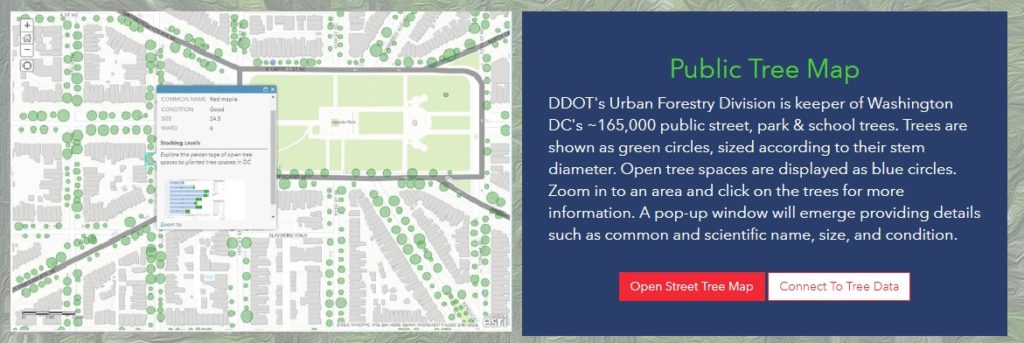
SymGEO partnered with the District Department of Transportation (DDOT) Urban Forestry Division (UFD) to build an ArcGIS Hub site that showcases their work, data, and configurable applications. Upon completion, we then developed an initiative for their group that features Urban Wood Reuse in Washington, DC. The site is designed for schools that are interested in ordering products from DDOT made from urban trees so that school children can appreciate the continued benefits of the urban forest. The site uses Survey123 to capture order information, and ArcGIS Dashboard (on the backend) to track request status as the orders are being processed. Most recently, we have made a page for their group that explores Urban Forest Health issues.
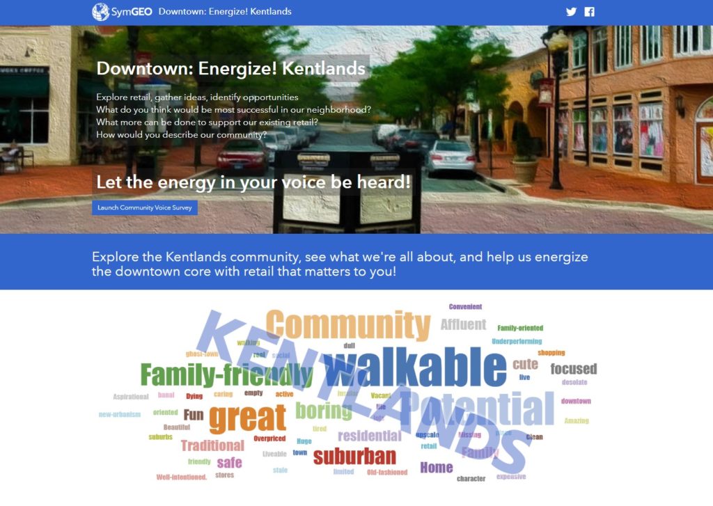
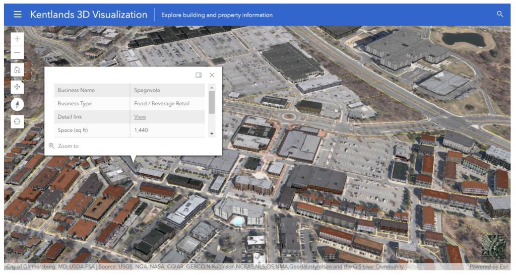
SymGEO worked with guidance from the Kentlands Downtown Working Group to develop Kentlands Downtown: Energize!, an ArcGIS Hub-powered site that aims to connect the community with the economic development team to voice their opinions on what would do well or is needed in the Kentlands. The site leverages Survey123, ArcGIS Dashboard, and a number of unique design elements, including a 3D “virtual” fly-through. The realistic textured 3D environment was developed using a Local Government solution (Local Government 3D Basemaps) that used building footprints, LiDAR data, and CityEngine.
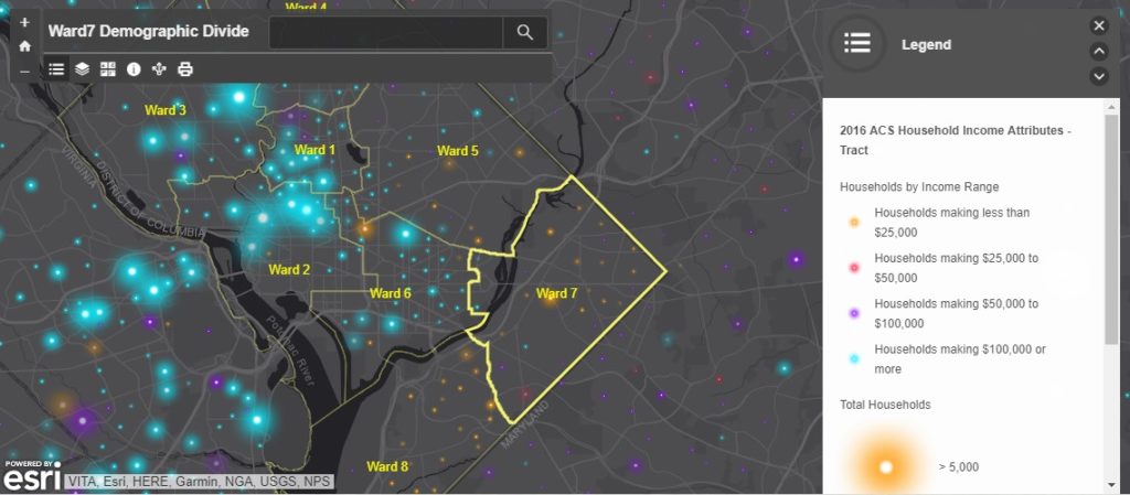
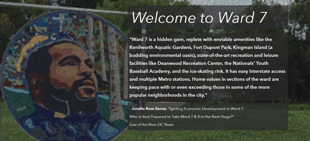
SymGEO was honored to partner with DC’s Ward7 to design and launch a community outreach site designed to present a brief history of the area, a flavor of the neighborhood, the challenges faced due to a changing development landscape, and a call to action for the residents. The site features a history of the development and a map showing the rather sharp economic divide between Ward7 and some of its surrounding neighborhoods.
SymGEO is focused on empowering state and local governments to better use their data and digital assets and to facilitate 2-way engagement with their constituents and communities. We leverage configurable Esri applications to deliver cost-effective solutions to our clients and pride ourselves on delivering a tailored, successful experience during each engagement. Talk to our industry experts today if your neighborhood, department, or organization is interested in community engagement with the power of Esri’s ArcGIS Hub technology – SymGEO is a certified specialist and is here to help!
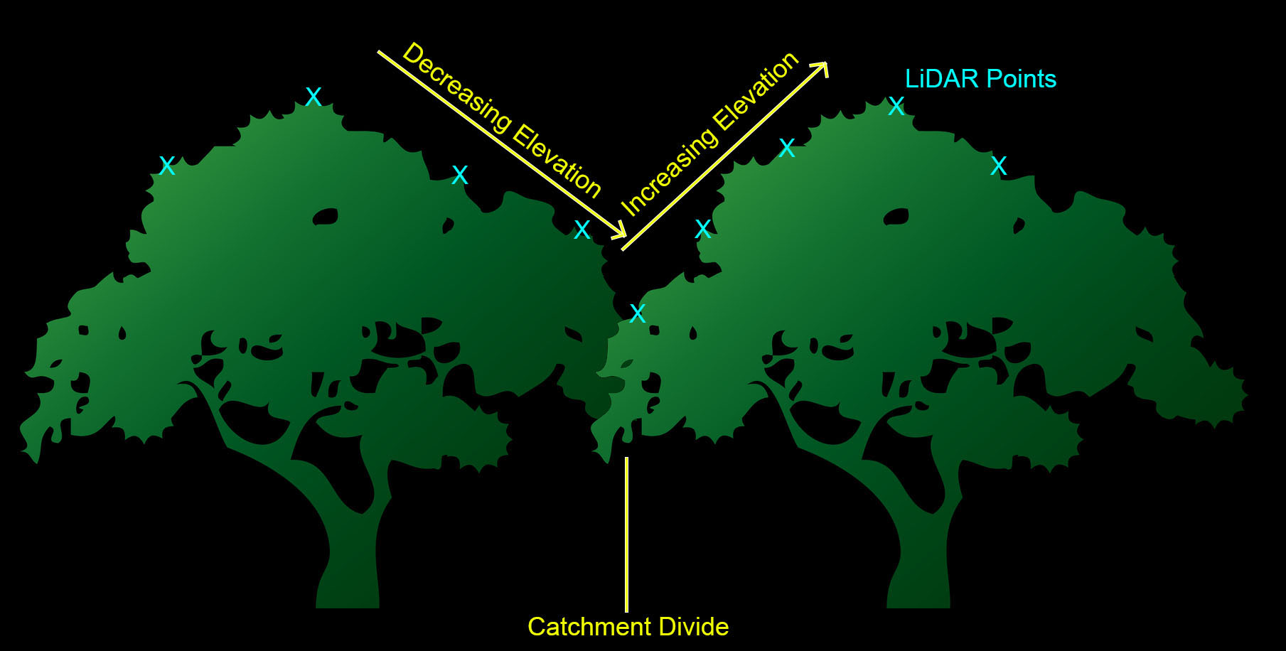
SymGEO is pleased to announce the development of two new D.C. forest structure datasets created in partnership with DDOT Urban Forest Division, using LiDAR data managed by OCTO and the DC GIS program. The final version of this dataset will help Urban Foresters manage the canopy by providing important attributes including tree height, canopy width, and forest structure information.
A little background: LiDAR data is a digital cloud of millions of elevation points typically gathered by a low-flying airplane or ground-level vehicle. The elevation is recorded at every surface the measuring laser beams hit, so in the case of a forest, it will capture the top of the trees, some branches, as well as under-story vegetation and ground elevation. The LiDAR used for this project was also classified by the provider into a number of useful categories, including buildings, ground, and high / medium / low vegetation.
Using an innovative method, SymGEO used the ArcHydro toolset to create “catchment” areas for each tree, with tree locations being determined by the UFA Street Trees dataset. Each tree point was given an artificially high elevation value, and then all surrounding vegetation points around the tree point were examined. If the model determined that the vegetation points were connected to the tree, then it was included in the catchment. If an adjacent tree was found (indicated by adjacent vegetation elevation points increasing in height), then the catchment was divided into the two tree areas. Kind of technical, but maybe the graphic below will help 🙂
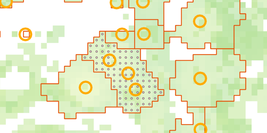
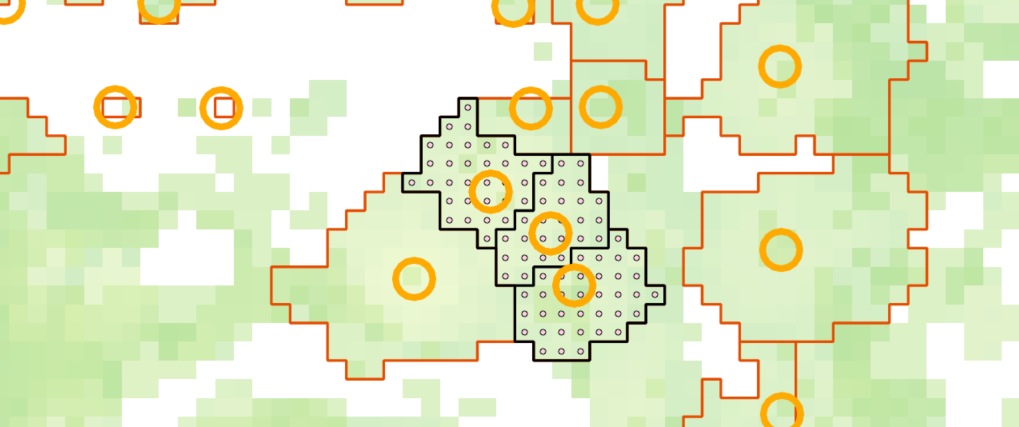
This catchment method worked quite well; however, it did suffer from capturing multiple trees in the same catchment. Fortunately, these cases were isolated quite easily be doing a spatial join between the catchment areas and street tree points, and identifying many-to-one joins.
For these cases, the catchment areas were converted into a grid of points, and the points were joined to the nearest tree. They were then back into areas (with the new tree ID as an attribute), effectively splitting up the area into smaller areas that had a one-to-one join with the tree points.
Once the tree area was established and cleaned up through manual inspection of outliers, attributes including tree height and average canopy width are assigned to each tree. These attributes will help the Urban Forestry Division manage the tree canopy even more effectively.
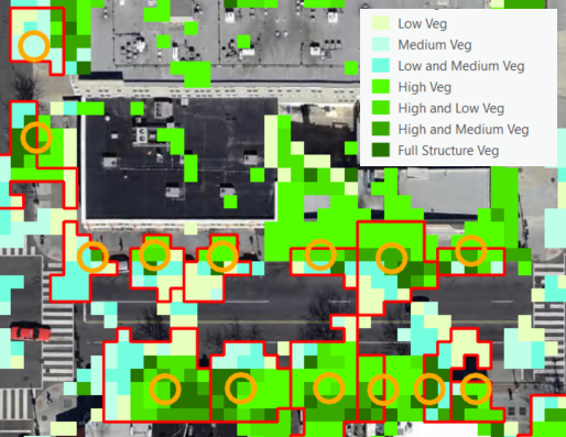
A secondary dataset was also produced using the LiDAR data that categorized areas into high, medium, or low vegetation, so some combination thereof. This helps the Urban Forestry Division prioritize areas for under-story plantings or the establishment of new urban canopies. This data set suffered a little from miscategorized LiDAR points, but it is a good starting point for an urban canopy structure dataset.
If you have access to a LiDAR dataset, and are interested in learning more about derivative products, contact us today – SymGEO is here to help!
SymGEO is pleased to announce that we have graduated the Esri Startup Program a year and a half early and have joined the Esri Partner Network as a Silver Tier partner. This elevated partnership status is a direct result of our focus to integrate best-in-class ArcGIS technology into our products and our determination to benefit our clients with a long-term Esri partnership.
“The Esri Partner Network is a rich ecosystem of organizations that work together to amplify The Science of Where. Partners deliver solutions, content, and services using the Esri Geospatial Cloud. Alliances are industry leaders aligned with Esri’s high level goals, joining forces to advance shared initiatives.”
– Esri
We have also been included in the Esri ArcGIS Online Specialty program in recognition of our proven set of value-added services and solutions that help users implement and optimize ArcGIS Online within their organizations.
Finally (for now!), SymGEO is honored to be part of the Esri ArcGIS for Local Government Specialty program. This designation is for promoting and implementing ArcGIS apps, maps and solutions for local government.
“As a proud Esri business partner, we are so grateful for all the support, encouragement, and technical resources that Esri has generously shared with SymGEO. We have benefited tremendously from Esri’s business guidance, shared best practices, and professional friendship!”
– Kevin McMaster, Principal, SymGEO
Talk to our industry experts today to hear more about our innovative, cost-effective, mapping solutions that leverage Esri technology – SymGEO is here to help!
SymGEO was honored to partner with DC’s Ward7 to design and launch a community outreach site designed to present a brief history of the area, a flavor of the neighborhood, the challenges faced due to a changing development landscape, and a call to action for the residents.
“The genius of SymGEO was exactly what I needed to help jump-start a discussion on the DC Comprehensive Plan/Element Framework, transforming it from a boring review of data sets into an energizing discussion where people can clearly identify themselves in the data and endeavor to become change agents! SymGEO has taken community engagement and data collection to another level! #OneHappyCustomer”
– Ward7 Outreach Committee Chair
The Ward7 Community Outreach site is built on Esri’s ArcGIS Hub framework which offers exceptional design flexibility and mobile responsiveness. The site begins by presenting what makes a successful neighborhood and how Ward7 has achieved its own distinct success.
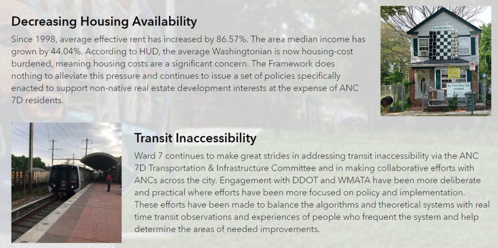
Historic challenges have caused a rather sharp divide between Ward7 and some of its surrounding neighborhoods. This divide was best illustrated with demographic data showing income and education. This mobile-responsive data exploring application was built using Web AppBuilder.
The site discusses how long-term planning and development within Washington DC is guided by the Comprehensive plan, what factors are considered by the plan, and some of the challenges faced by Ward7 during the development process.
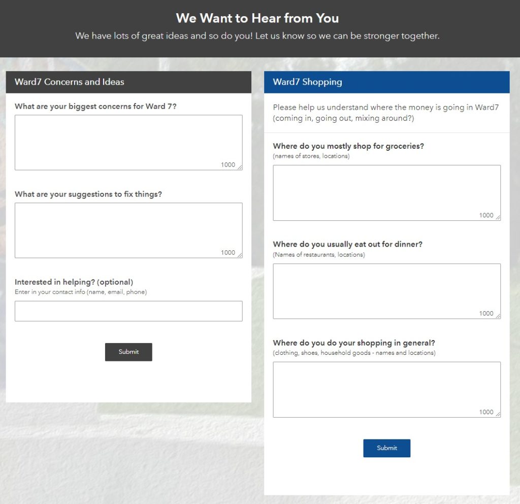
Suggestions on how to improve the plan are offered, and community input is solicited using Esri’s Survey123 for ArcGIS,
Finally, social media is embedded into the site so that the community can stay up to date with the many events happening in and around Ward7.
Talk to SymGEO today if your agency or organization is interested in community engagement with the power of Esri’s ArcGIS Online platform – we are certified experts and here to help.
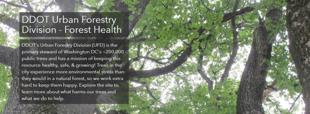
SymGEO is pleased to announce the launch of a Forest Health website for DDOT’s Urban Forest Division (UFD), designed to educate the community on how DDOT (and DC residents!) help keep the urban canopy vibrant, healthy, and productive. In a natural ecosystem, there are many checks and balances to keep a forest healthy. Urban environments present many challenges to trees, which include the urban heat island effect, degraded soil, limited growing space, and the introduction of exotic pests. This can lead to pest infestations and canopy damage if not caught quickly and mitigated efficiently. Fortunately, at the DDOT Urban Forestry Division, dedicated specialists prevent and respond to urban forest health issues on a daily basis.
“We are excited to share our forest health programs with the public in this new format. The new forest health website is dynamic and easy to use, it allows users to learn about pests and pathogens to look out for, while also giving them the opportunity to report their observations.”
– DDOT Urban Forestry Division
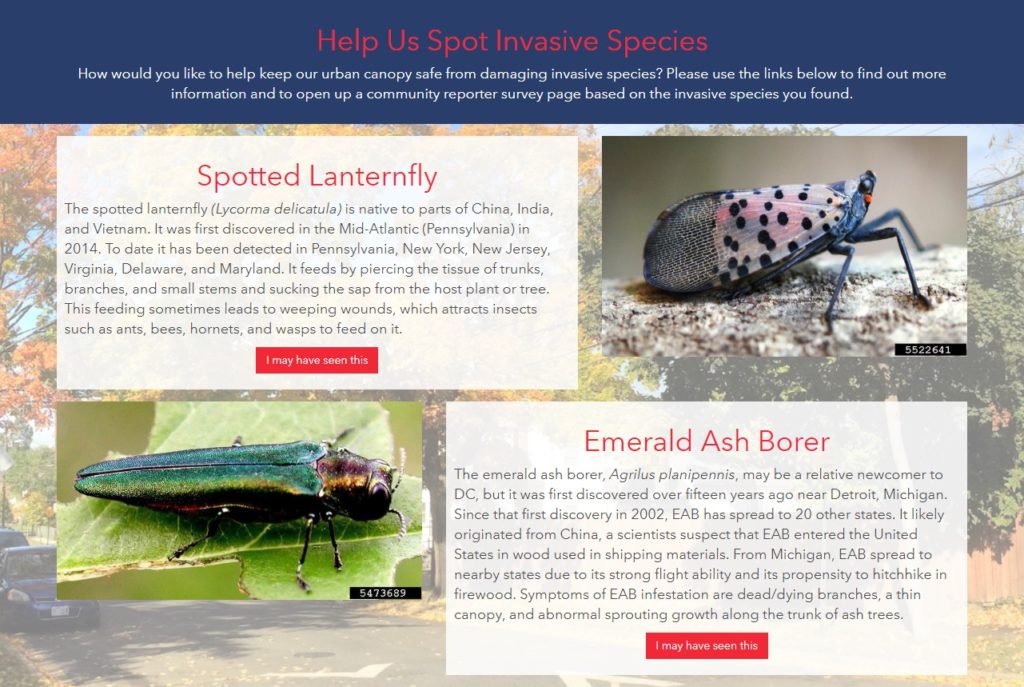
The new Forest Health site discusses a range of preventative measures the UFD takes against pests, including the Early Detection Rapid Response (EDRR) and the Cryptic Wood-Borer Insect (CWBI) programs, as well as how DC residents can identify and report invasive species.
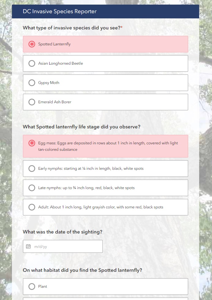
The site leverages Esri’s ArcGIS Hub framework for design and mobile responsiveness and Esri’s Survey123 for ArcGIS for pest reporting. Information is gathered through the website, including pest species, life stage, or signs/symptoms, and is passed to the survey to help the reporting process along.
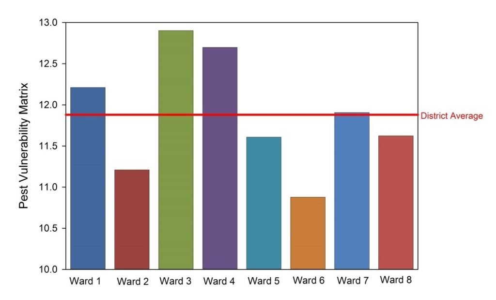
A Pest Vulnerability Matrix (PVM) is also presented which enables urban foresters to evaluate the overall vulnerability of the urban forest and evaluate the potential impacts of emerging pests and diseases.
Talk to our industry experts today if your agency or organization is interested in community engagement with the power of Esri’s ArcGIS Hub – SymGEO is here to help!
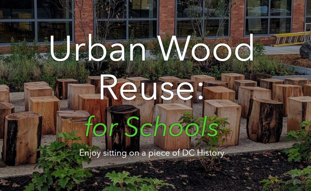
Teaching kids the importance of nature, recycling, history, and culture is a lofty goal. Perhaps it’s a lesson that could be taught from the comfort of a bench constructed from recycled urban wood sourced from a local DC neighborhood rich in cultural history? This is now possible thanks to the District Department of Transportation (DDOT) Urban Forestry Division (UFD)’s new initiative called “Urban Wood Reuse: for Schools“. This partnership with the Office of the State Superintendent of Education (OSSE) will provide DC Public Schools and public charter schools with wood products to improve school grounds at no cost.
SymGEO was excited to help the Urban Forestry Division (UFD) develop this initiative by using Esri’s ArcGIS Hub technology to establish two-way communication between the UFD and DC schools interested in “sitting on a piece of DC History”. The site shares knowledge and products from the UFD while gathering the school’s product ideas and requirements.
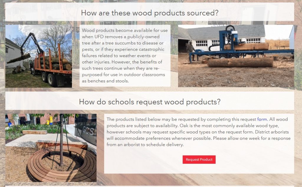
The site discusses the benefits of wood reuse, where the wood comes from, and the variety of products available including benches, stumps, or woodchips. It also provides a link to an order form as a convenient and easy way to request wood products.
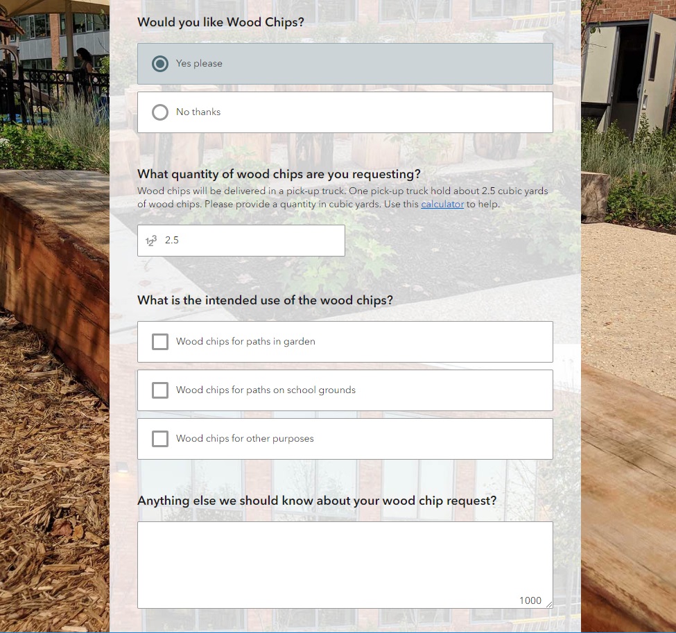
The order form itself is powered by Esri’s Survey 123 for ArcGIS technology and is designed with step-logic where pertinent questions appear based on previous answers.
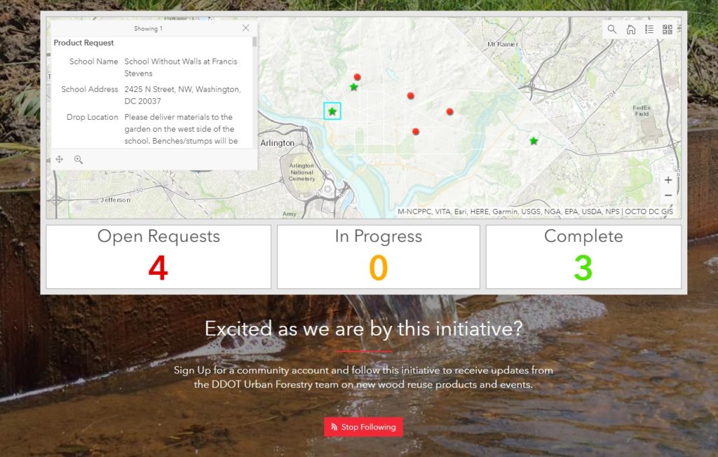
One of the exciting new aspects of an initiative is the ability for an audience member to sign into a community account and “follow” the initiative. This will grant them access to broadcasts about new events, updates, new product launches, and other useful information. Now, being able to show which schools are as excited as we are about this new initiative has never been easier!
Talk to our digital platform experts today if your agency or organization is interested in community engagement with the power of Esri ArcGIS Hub Initiatives – SymGEO is here to help!