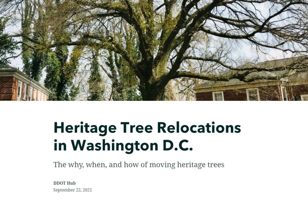
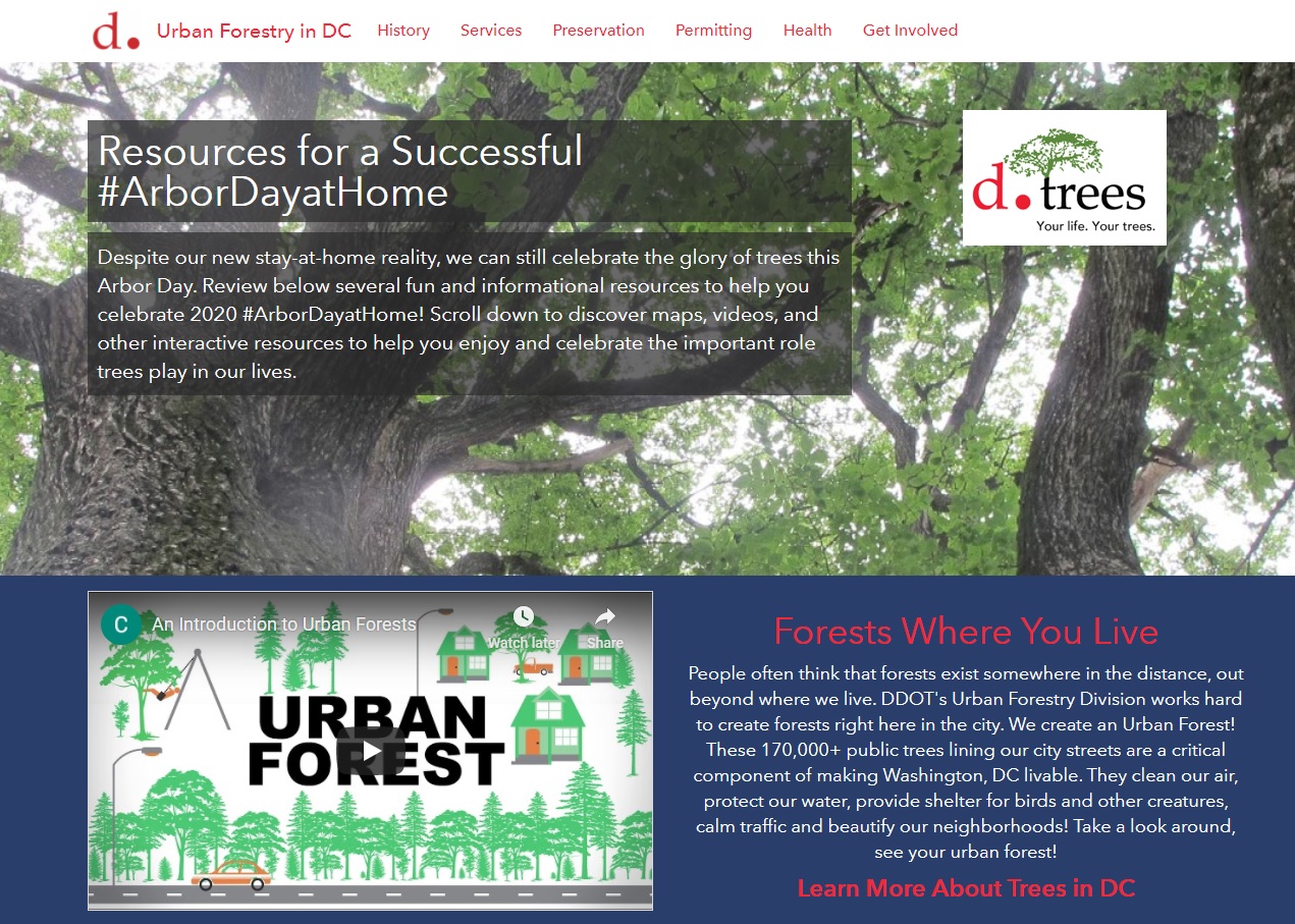
Urban trees in the city are critical to our well-being. Among many other benefits, trees improve our air and water quality, cool our neighborhoods, and provide nurturing habitats for birds, bees, and numerous wildlife. Large trees provide greater environmental benefits than smaller trees and are protected from unnecessary damage or removal by the Urban Forest Preservation Act and the Tree Canopy Protection Act in the District of Columbia.
Learn all about the how, why, and when large “heritage” trees in D.C. have to be moved out of harm’s way during construction projects in a new StoryMap developed in collaboration with the Urban Forestry Division of the District Department of Transportation (DDOT).
Talk to our industry experts today if your agency or organization is interested in community engagement with the power of Esri’s StoryMap technology – SymGEO is a certified Esri business partner and is here to help.
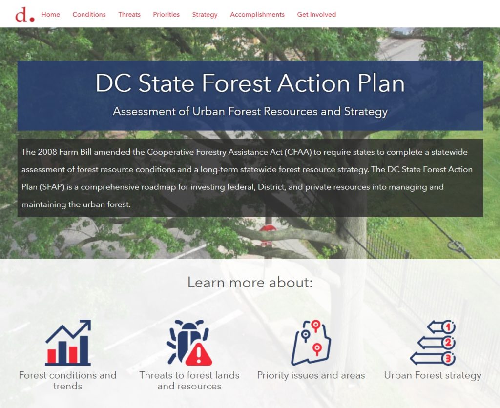
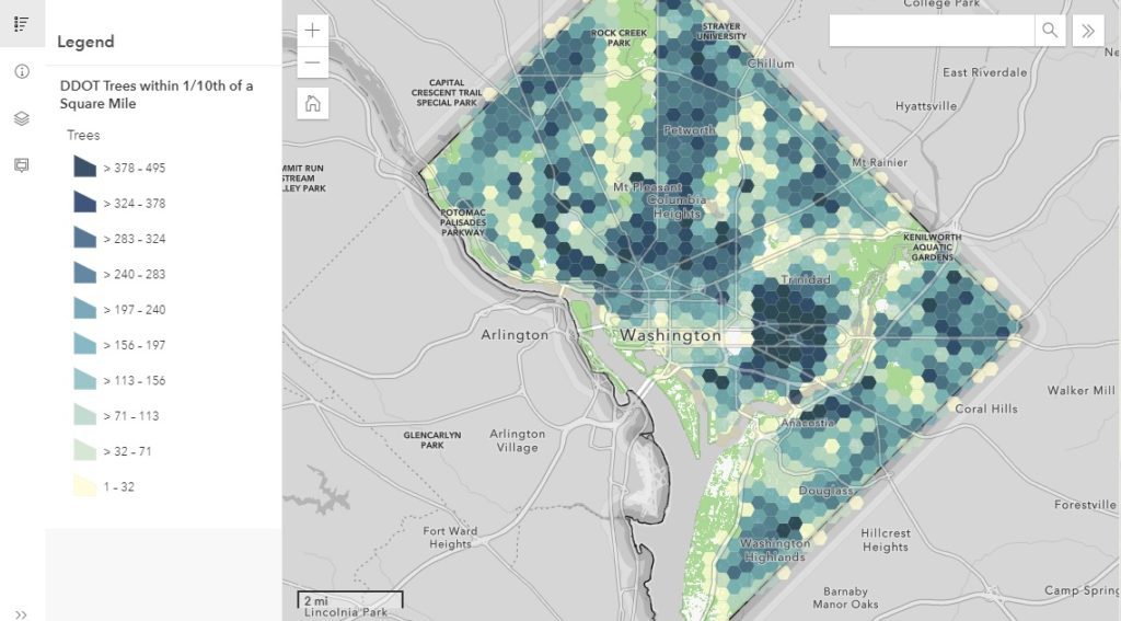
The District Department of Transportation (DDOT)’s Urban Forestry Division (UFD) is the primary steward of Washington DC’s 170,000+ public trees and has a mission of keeping this resource healthy, safe, and growing. Among many other benefits, urban trees improve the air and water quality, cool the neighborhoods, and provide critical habitat for birds, bees, and urban wildlife. As part of their long-term statewide forest resource strategy, the UFD has created the DC State Forest Action Plan (SFAP). This plan is a comprehensive roadmap for investing federal, District, and private resources into managing and maintaining the urban forest.
To help highlight the achievements and findings of the plan, SymGEO created the DC SFAP Hub site, full of condensed information from the full report.
The DC SFAP Hub site integrates numerous data sets, Dashboards, StoryMaps, and other helpful visualizations to support the findings of the report and long-term strategy.
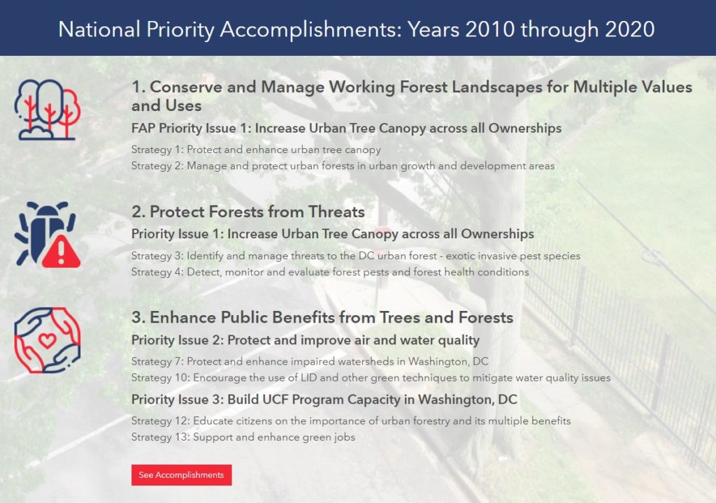
Key accomplishments from the last ten years are presented with links to further information and full documentation.
Explore the DC SFAP Hub site to learn more about D.C.’s forest conditions and trends, threats to forest lands and resources, priority issues and areas, and the long-term urban forest strategy.
Talk to SymGEO industry experts today if your agency or organization is interested in community engagement with the power of Esri’s ArcGIS Hub, Dashboards, or ArcGIS StoryMaps – we are here to help!
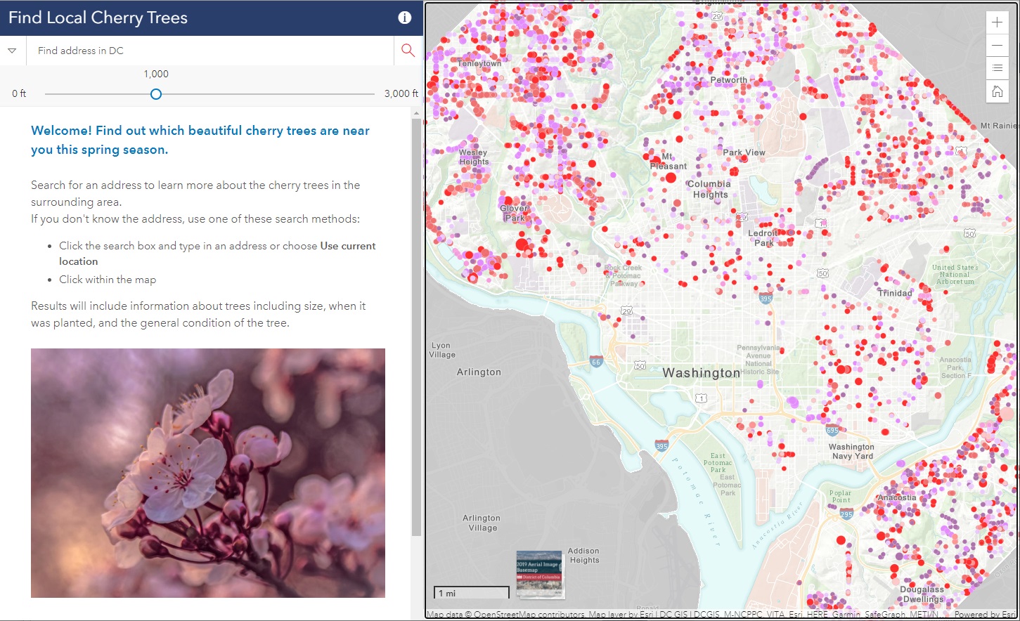
Did you know that there are almost 10,000 cherry trees outside of the tidal basin to see throughout D.C.? SymGEO was honored to help DDOT build the DC Local Cherry Tree Finder leveraging the Urban Forestry Division‘s tree inventory and ArcGIS Online‘s configurable applications to quickly assemble and launch in time for peak blooming.
If you missed it this year, don’t worry, there’s always next spring season!
Talk to our industry experts today if your agency or organization is interested in community engagement with the power of Esri’s ArcGIS mapping solutions – SymGEO is here to help!
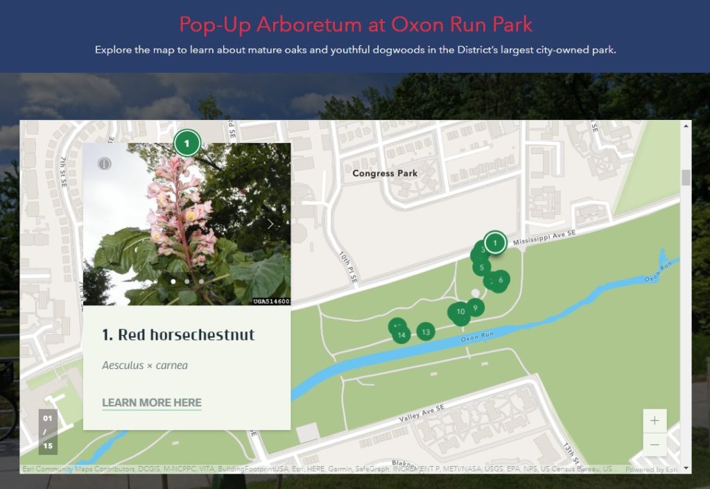
An arboretum is a place where trees, shrubs, and other plants are grown for scientific and educational purposes. A park typically has trees, shrubs, and other plants for the enjoyment of families and friends. Why not have an arboretum in a park? Genius! Check out the first “pop-up arboretum” at Oxon Run Park in Ward 8 by the District Department of Transportation’s (DDOT) Urban Forestry Division. SymGEO is pleased to help launch the Pop-Up Arboretum website with all the specifics of what amazing things can be found at this natural outdoor exhibit.
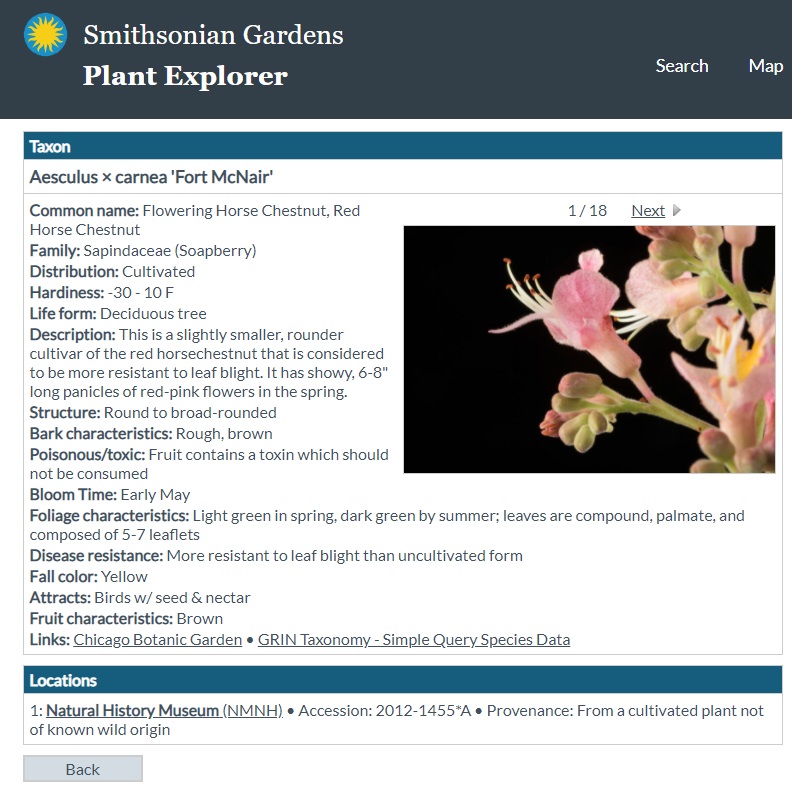
The site is built using ArcGIS Hub technology and features an ArcGIS StoryMap designed to help guide people on their outdoor educational adventure. The site also links to scientific information about each tree species provided by the Smithsonian Institute’s Plant Explorer.
Signs are posted on or near the trees in English and Spanish with QR Codes that link back to the Pop-Up Arboretum website for further information. Be sure to enjoy our natural environment while learning all about the trees at Oxon Run Park!
Talk to our industry experts today if your agency or organization is interested in community engagement with the power of Esri’s ArcGIS Hub or ArcGIS StoryMaps – SymGEO is here to help!
Did you know that any Washington DC resident or contractor who wishes to plant, prune, or remove a tree within the public right of way must first obtain permission from the District Department of Transportation (DDOT) and the Urban Forestry Division? However, knowing when, where, and how to get the right permit for tree work in DC can be a complicated process. Fortunately, DDOT has a new resource available to make it easy! Check out the Tree Permitting Hub site to answer all tree permitting questions.
SymGEO built the Tree Permitting site using ArcGIS Hub technology, which leverages ArcGIS Online mapping and graphic examples to help explain what type of permit is needed based on tree location, property boundaries, and tree size. The site also explains the benefits of the Income Contingent Hazardous Tree Mitigation Program that provides assistance with the removal of a hazardous tree on an owner’s private property.
As an example of “good to know” information, Washington D.C. is unique in that it has dedicated park space along most streets. This “parking” area is generally used for landscaping, retaining walls, trees, and other greenery. Just like on private land, all landscape elements (including trees) in this parking area are the responsibility of the homeowner to maintain. On the other hand, all trees located in the public “sidewalk” area are the responsibility of the city to maintain. However, these trees may be negatively impacted by development or construction projects and need to be considered before projects begin.
Talk to our industry experts today if your agency or organization is interested in community engagement with the power of Esri’s ArcGIS Hub or mapping with ArcGIS Online – SymGEO is here to help!
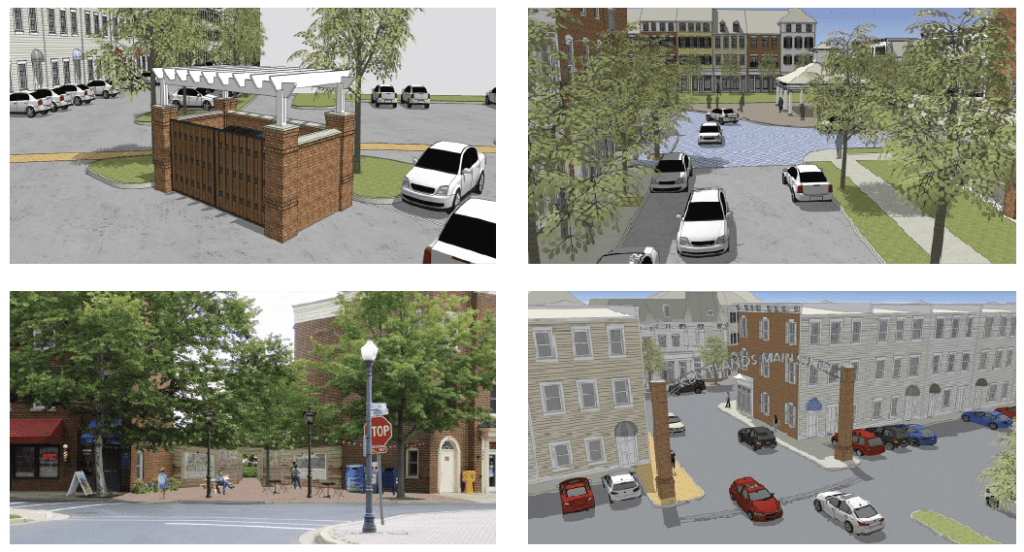
SymGEO is pleased to launch the One Main Street Initiative website produced in collaboration with our local commercial development volunteer committee. This website is powered by ArcGIS Hub technology and is designed to engage business owners and residents in the transformation of the Main Street of Kentlands into a vibrant, family-friendly, retail destination. This was accomplished by summarizing the key findings of a detailed local study conducted by Live Work Learn Play that charted a path forward to energize the Main street through a combination of events, physical improvements, dedicated leadership, and community involvement.
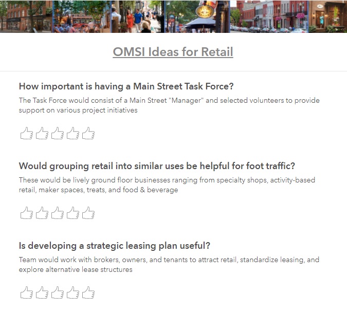
Each key component of the study was summarized and shared using a combination of text and graphics to facilitate community understanding, discussion, and evaluation.
After presenting the key findings, ArcGIS Survey123 was used to gauge public reaction to the importance of each component.
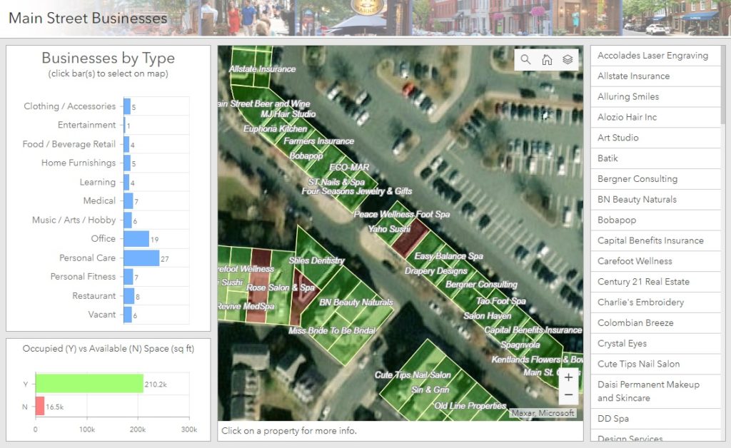
Finally, ArcGIS Dashboards was leveraged to create and share a helpful Main Street Explorer tool (desktop or mobile) for residents to see which businesses are already on Main street and where opportunities for new businesses are located.
Talk to our industry experts today if your community is interested in harnessing the power of Esri’s ArcGIS Hub to share and amplify your development plans – SymGEO is here to help!
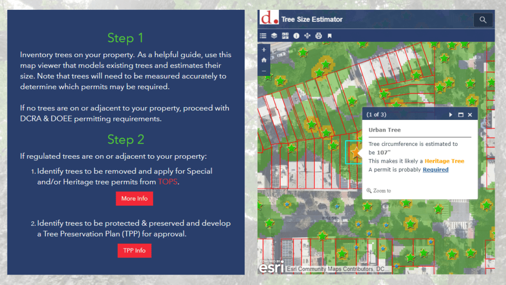
Did you know that trees are so important to Washington DC that they are protected by the Urban Forest Preservation Act and the Tree Canopy Protection Act? This means that before performing any excavation or construction activity on private property, it is important to consider any potential impacts to the trees on site. To facilitate this process, SymGEO is proud to help DDOT launch a new resource, the Tree Preservation Hub site, for property owners and construction companies to identify which trees need to be protected and how to best take care of them during home renovations or new construction projects.
Built using ArcGIS Hub technology, this site leverages ArcGIS Online mapping and graphic examples to help explain what type of permit or protection plan is needed based on estimated tree size. Tree sizes were estimated using LiDAR processing, which in turn is used to estimate the critical root zone and structural root zones that need to be protected during construction. Modeling several hundred thousand trees at the same time has its challenges; however, ArcGIS Pro, ArcGIS Enterprise, Arcade expressions, and hosted image services were used to efficiently capture and share the modeling results.
Talk to our industry experts today if your agency or organization is interested in community engagement with the power of Esri’s ArcGIS Hub or data processing with ArcGIS Pro – SymGEO is here to help!
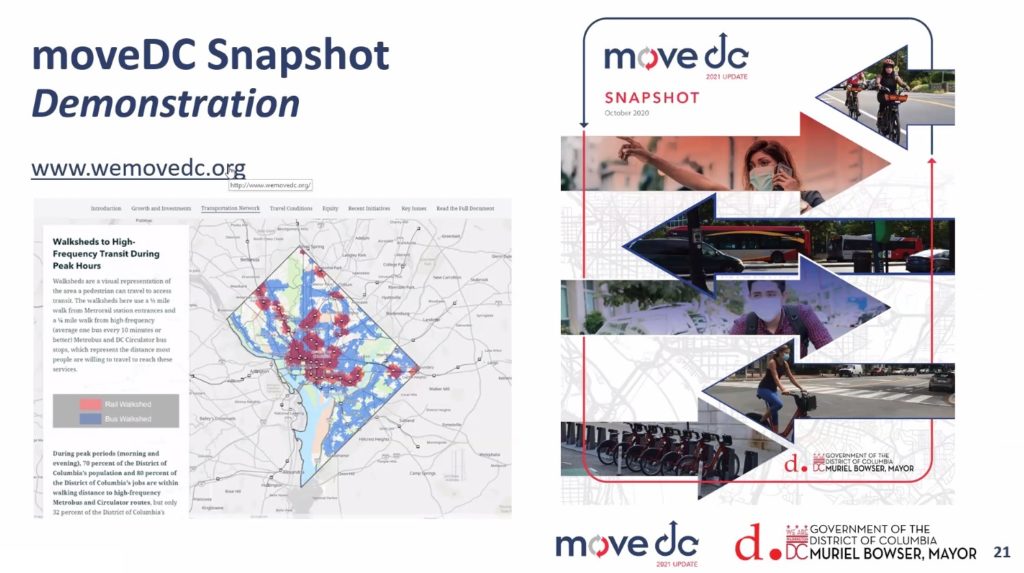
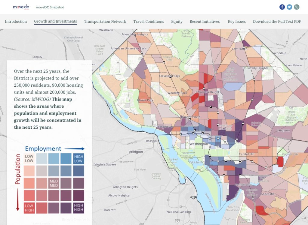
The District Department of Transportation (DDOT) has launched moveDC 2021, the long-range multi-modal transportation plan for Washington DC. As part of this launch, DDOT held Virtual Townhall meetings to discuss the transportation network’s existing conditions within the District and solicit resident input on DDOT’s goals and policies.
We were very excited to see our moveDC Snapshot StoryMap featured prominently during the Townhall meetings! Produced in partnership between SymGEO, Kimley-Horn, Foursquare ITP, and DDOT, this dynamic, interactive, and engaging method of presentation was perfect to capture the energy and data that has gone into moveDC 2021.
“Wow, this looks so good in StoryMap form! I love it!”
– DDOT Project Manager
We used the sidecar functionality of the latest ArcGIS StoryMap framework as a key component to deliver both guided, instructional narrative and interactive mapping at the same time. Mapping symbology was set in the ArcGIS Online web maps while complex legends were imported as images to facilitate visual interpretation of the data.
Talk to our industry experts today if your agency or organization is interested in community engagement with the power of Esri’s ArcGIS StoryMap technology – SymGEO is here to help!
“Every day is Arbor Day in the City of Trees!” – these wise words from Dr. Kasey Yturralde, the Forest Health and Community Outreach Specialist at DDOT’s Urban Forest Division (UFD), are a great indicator of the passion and excitement possessed by the entire UFD team keeping our city green and beautiful.
With that in mind, SymGEO is pleased to announce a brand new interactive Arbor Day at Home resource for communities and individuals who share the same passion for our neighborhood trees. This dynamic website, built with ArcGIS Hub technology, showcases a number of best-practices when planting or caring for trees, as well as fun activities for the whole family in identifying local tree varieties.
Talk to our industry experts today if your agency or organization is interested in community engagement with the power of Esri’s ArcGIS Hub – SymGEO is here to help!
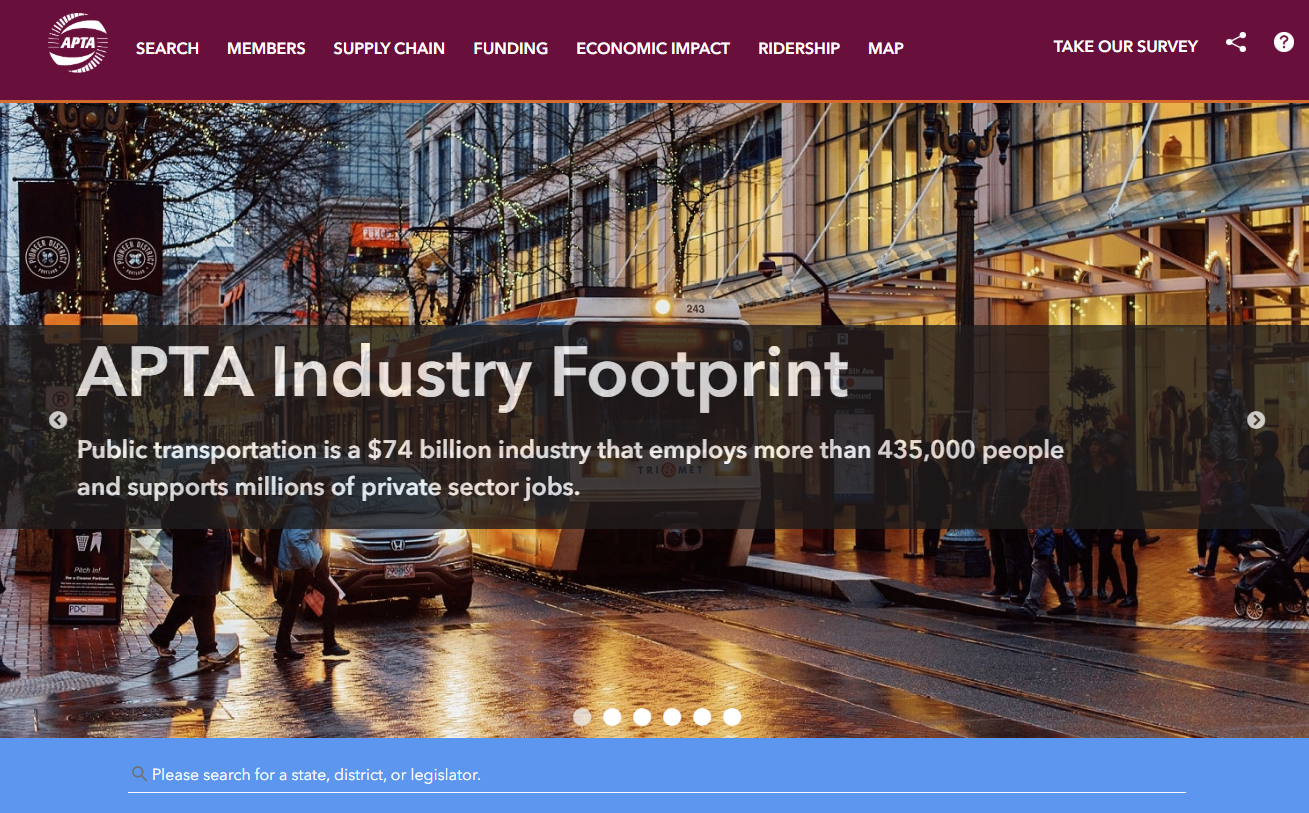
Public transportation is a $74 billion industry that employs 435,000 people and supports millions of private-sector jobs. As the public transportation industry advocacy leader, the American Public Transportation Association (APTA) is dependent on accurate, current data to help inform critical decisions. The all-new Industry Footprint is designed to collect, analyze, and present key statistics at national, state, and local levels. This application, produced in collaboration with our development partners at GeoMarvel, provides insight into APTA membership, public transportation providers, transit service, manufacturing and supply chain, and congressional/legislative contact information.
“We are happy with the results of our partnership with SymGEO. They produced a website that equals our ambition and stature as an association.”
– APTA Director of Policy Research and Development
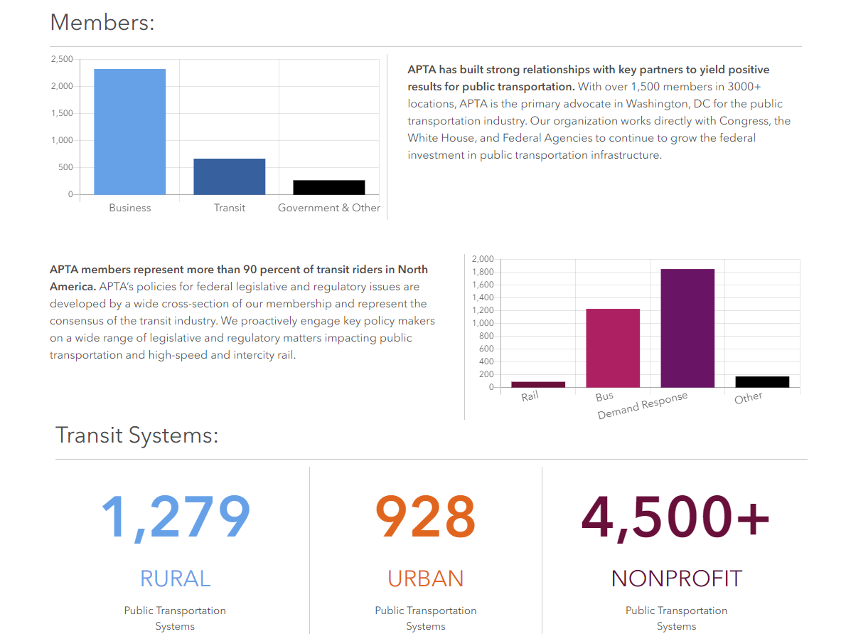
National-level statistics and APTA membership overview are provided on the homepage of the Footprint platform. Navigation links in the header help direct the audience to the section of interest. The top-level summary narrative for each section explains the importance of that component. Search functionality enables the audience to find a person, state, or legislative district of interest. Upon search, the local infographic “map” section is opened to explore in greater detail.
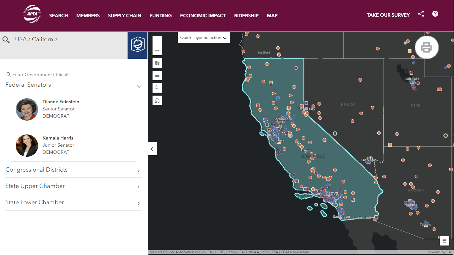
Search functional is enabled for legislators, states, APTA members, and committees in the upper-left corner. Selecting a search result will update the map with the associated geographic area and associated statistics. Map controls include the ability to turn on or off layers of interest, search for a location, switch the basemap, and zoom controls. Quick layer selection is provided to switch between state, congressional, or legislative geographies.
If a state is selected or the map is clicked upon, legislative information opens in the left-hand panel. This searchable section provides easy access to contact information for policymakers throughout the nation.
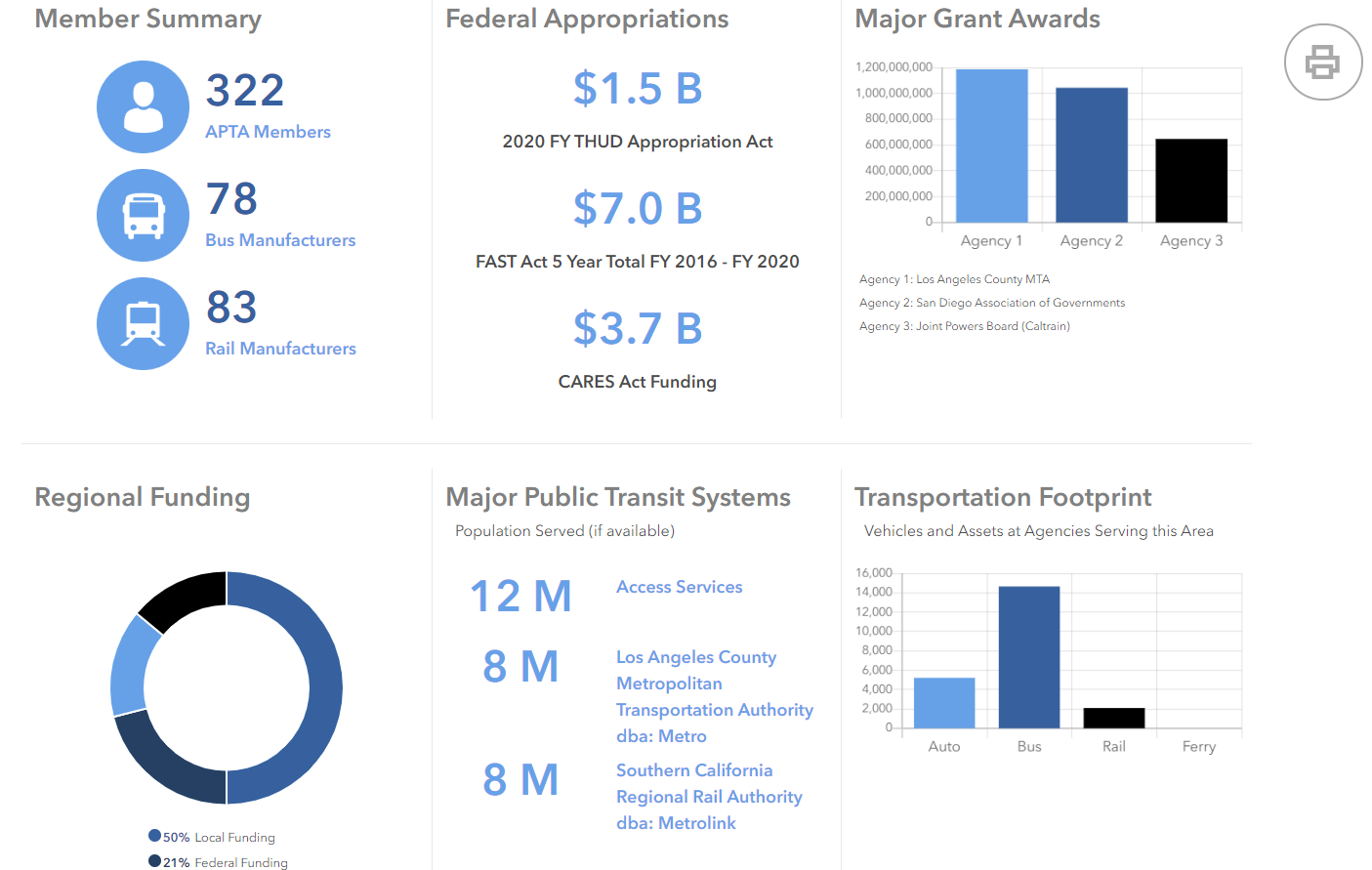
Upon selection of a search result or clicking on a map area, statistics and summary infographics are generated to help characterize the geographic selection. This information is compiled in a print-ready format, designed to help inform and energize a policy discussion for that geographic area.
Would a custom mapping application like this be useful to your organization? Talk to our solution experts today about your unique GIS needs, the SymGEO team is here to help!