APTA Industry Footprint

The SymGEO team was honored to redesign the flagship custom mapping application for the American Public Transportation Association (APTA) called the Industry Footprint. This application is designed to explore APTA membership, public transportation providers, transit service, manufacturing and supply chain, and congressional / legislative information. There is a wealth of information packed into one application!

The newly modernized Industry Footprint first begins with a look at APTA membership and transportation provider data at the national scale. It’s not easy making intuitive sense of thousands of data points, but fortunately, there are visualization tools designed to help. SymGEO uses a novel cartographic predominance approach that shows the relative number of members and dominant industry category in each congressional district with a firefly symbology effect to give it a pleasing glow.
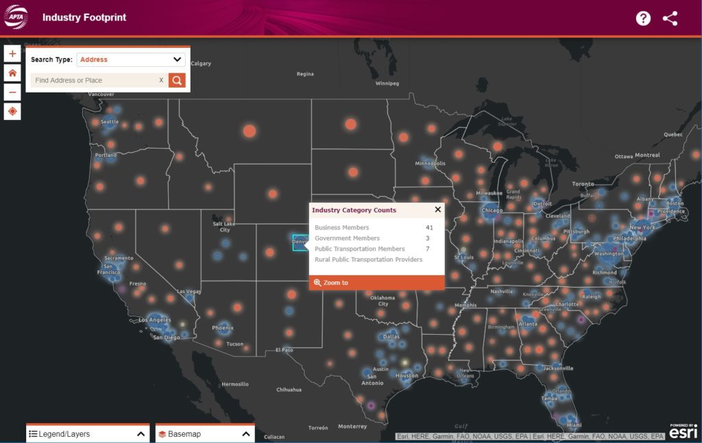
industry categories

“The SymGEO team worked on a tight schedule to deliver a series of impressive updates and fixes to our existing application, including a whole visual re-imagining. We are excited to work on even more innovations to the tool going forward together.”

–  APTA Senior Director, Policy Development and Research

State-wide information is provided upon zoom-in and includes details about the many APTA members, providers, bus and rail service areas, manufacturing supply chain, and legislative representative information. Most of these data sets required updates as part of this project, and several had broken over time as congressional data APIs had changed since the first version of this tool. This required extensive code logic updates and re-writes by our fantastic development partner, GeoMarvel, and included many stylistic and responsive updates to match the new modern design comps from our design partner.
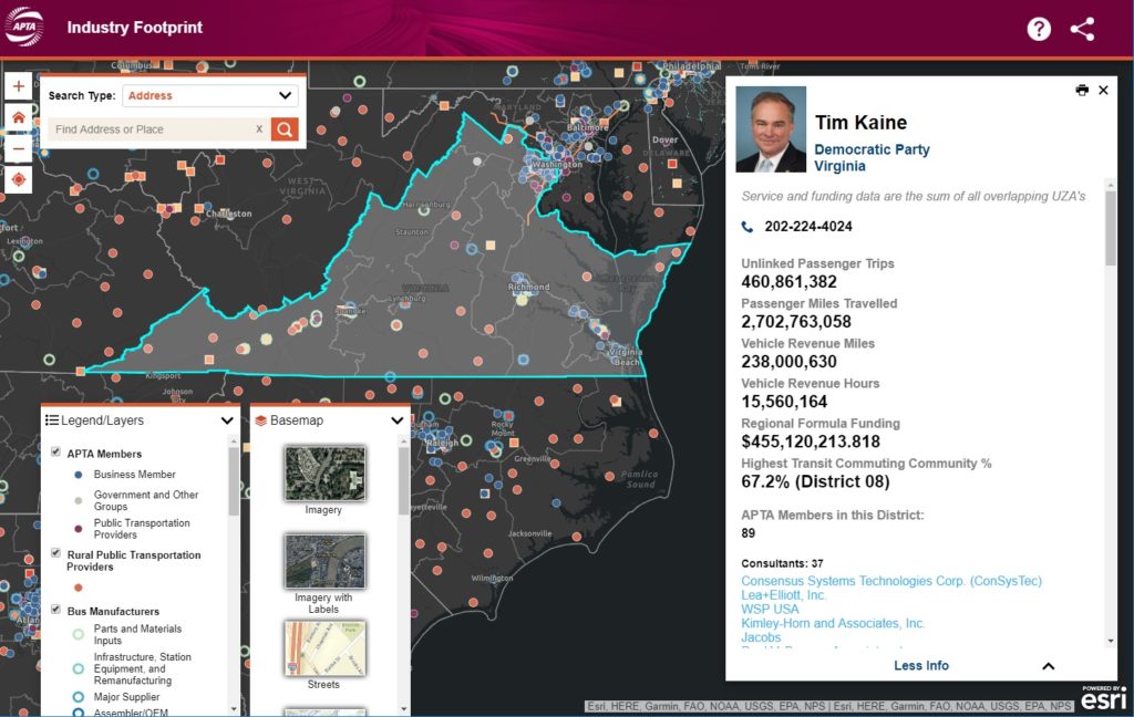
statewide data

There are several search options available to help users find the information they are looking for and create the perfect map for their report or policy advocacy for their nonprofit work. For the detailed legislative information, users can locate their area of interest and select a congressional district or an upper / lower house state legislative district. Contact information is provided for the appropriate representative as well as a snap-shot of transit facts and membership data pertinent to that area.
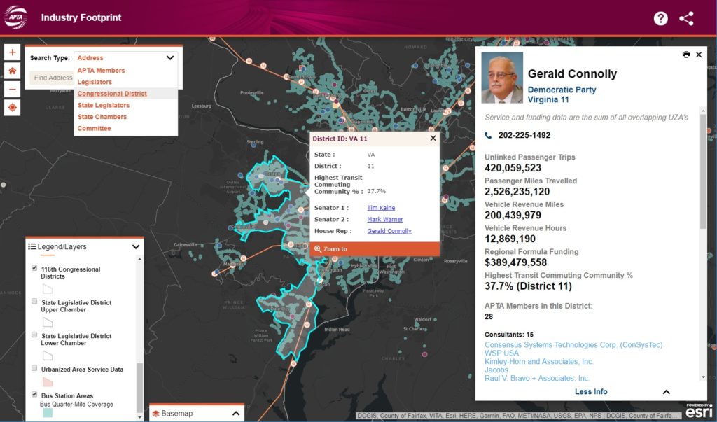
congressional data

Print-ready interactive reports are also offered for the convenience of researchers who need to share their findings with others, either as digital pdfs or hard-copy prints.
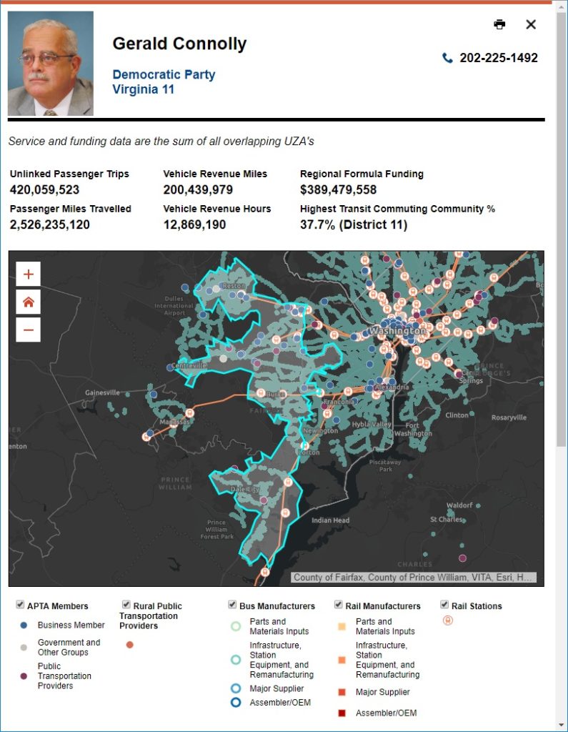
printed report

Finally, the application was redesigned for a fluid and responsive mobile experience. This allows data access on the go, in a meeting, or wherever needed.
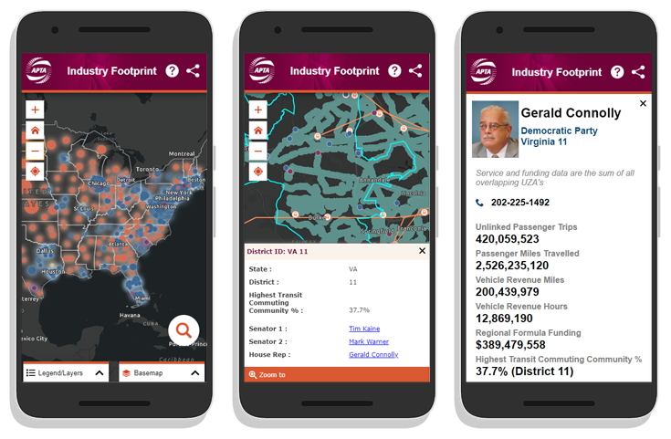
APTA mobile

Talk to our mapping application experts today if you have an aging custom application that needs some modern TLC – the SymGEO team is here to help!

Downtown: Energize! in ArcNews

SymGEO was honored to have our community engagement pilot project Downtown: Energize! Kentlands featured in the 2019 ArcNews Spring edition!  This premier hard-copy and digital publication by Esri has a circulation of 900,000 industry professionals and is a go-to source for all that is new and innovative in the Esri GIS community.

This wonderfully in-depth article examines the purpose and need of the site, the benefits brought to residents and businesses, and of course, the amazing Esri technology that makes it all possible.

Check it out, and let us know if your community would like to experience the positive power of Downtown: Energize!

DDOT Urban Forestry Division Hub

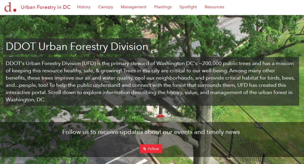
SymGEO is pleased to announce the launch of the DDOT Urban Forestry Division Hub! This new digital platform is designed to engage and interact with the DC community and provide information about the many services and resources offered by the Urban Forestry Division (UFD) of the District Department of Transportation (DDOT). This digital platform was built using Esri’s ArcGIS Hub technology, in coordination with OCTO and Open Data DC.

With a long history of caring for the extensive forest canopy in DC, the Urban Forestry Division has meticulously assembled data sets and applications to help in their forest management mission and to communicate with a variety of audiences. With the introduction of Esri’s ArcGIS Hub technology, there is finally a digital platform perfectly designed to tie all the pieces together into a cohesive story. SymGEO was honored to be approached by the Urban Forestry group to help them design, configure, and deploy this comprehensive digital solution.

“SymGEO is a remarkably flexible and responsive company. They listen carefully to requirements and deftly blend customer vision with technological capabilities.”

– DDOT Associate Director / State Forester, Urban Forestry Division

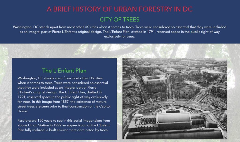
The urban forest story begins with a look to the past and introduces the audience to the long history and important role of trees in DC.

history

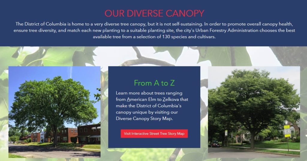
The story then turns to the impressive variety of trees available for public enjoyment and leverages several applications and digital stories that the urban forestry group has already developed.

canopy

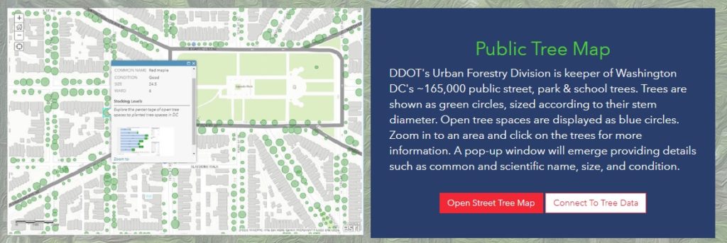
The flagship data set of the Urban Forest group is the Public Tree Map which elegantly displays a tremendous amount of current information about the urban tree canopy. Links are provided to both the map and the underlying data for the community to use and explore.

public tree map

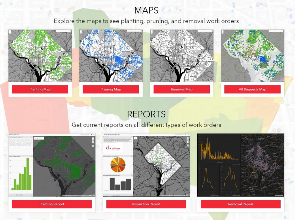
Work orders, permits, inspections, plantings, removals… there’s a lot going on in Urban Forestry! Fortunately, many data sets and reporting mechanisms have been developed to keep track of it all. These have now been shared with the public under one digital roof for a better understanding of agency scope and status.

urban forestry maps

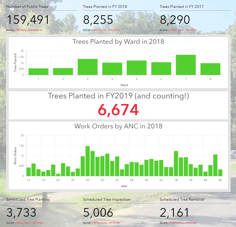
Of course, what fun are statistics if they can’t be updated on the fly as new information is entered into databases behind the scenes?

stats

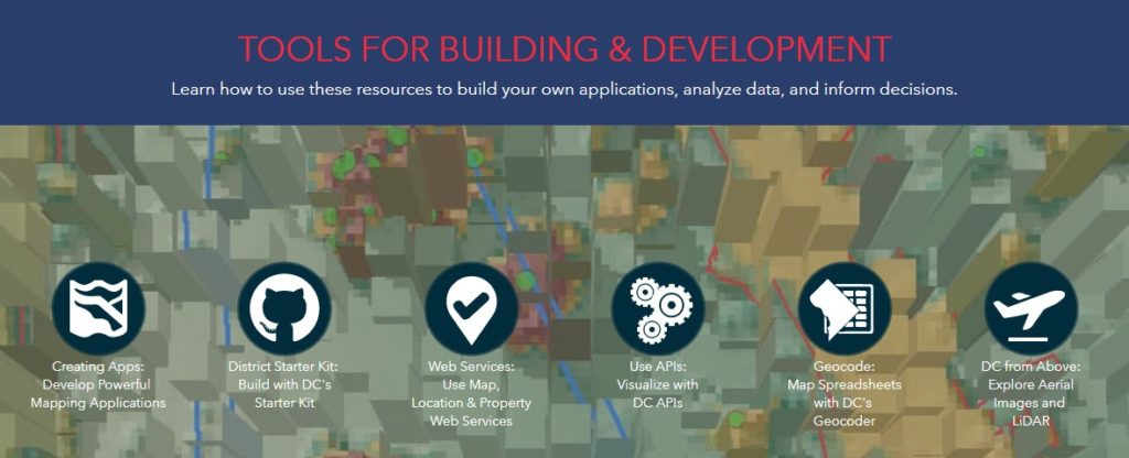
Finally, links to tools and resources are provided for partners and stakeholders to begin making their own applications and discoveries with DC government data.

tools

Talk to our industry experts if your agency or organization is interested in leveraging the power of Esri’s ArcGIS Hub – SymGEO is here to help!
Local Government Solution: Citizen Problem Reporter

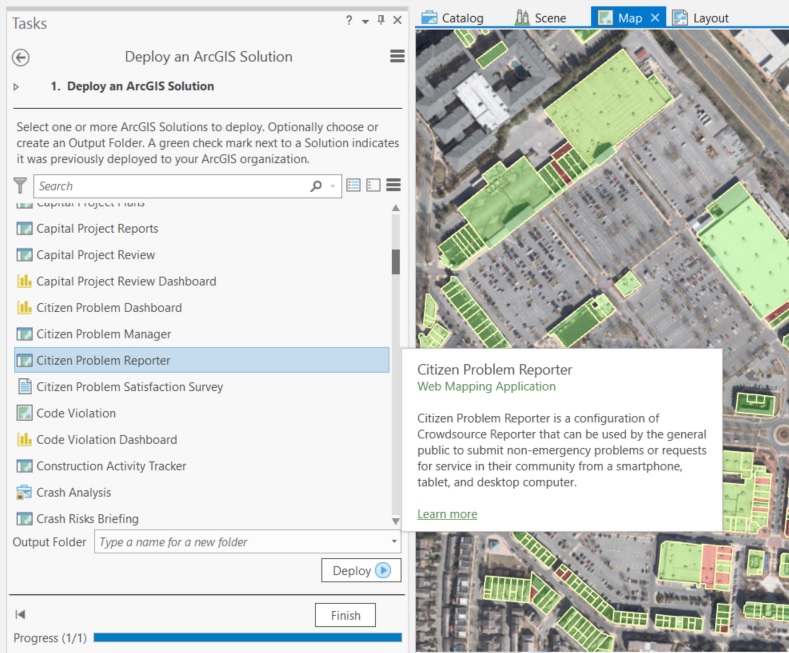
How great would it be to have a solution already developed for you and only some configuration is needed to roll it out? Today we look at the “Citizen Problem Reporter” solution developed by Esri to address a reoccurring need in local government.

Every local government has access to real-time, mobile sensors that travel throughout their jurisdiction on a daily basis. You guessed it, their citizens are their sensors! People notice issues left, right, and center. When armed with the right tools, people can be the eyes and ears of the community, giving near-instant notification of any concerns. These may range from dangers such as downed power-lines, or trash that wasn’t collected, or graffiti, or… the list goes on!

To help get the solution jump-started, Esri has developed a set of data and applications that fit together into a government’s ArcGIS online account.

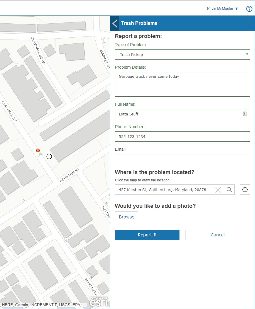
The solution includes an application that a citizen uses to report a problem through a fully mobile-responsive web interface. Great for easy access on the go!

citizen reporter application

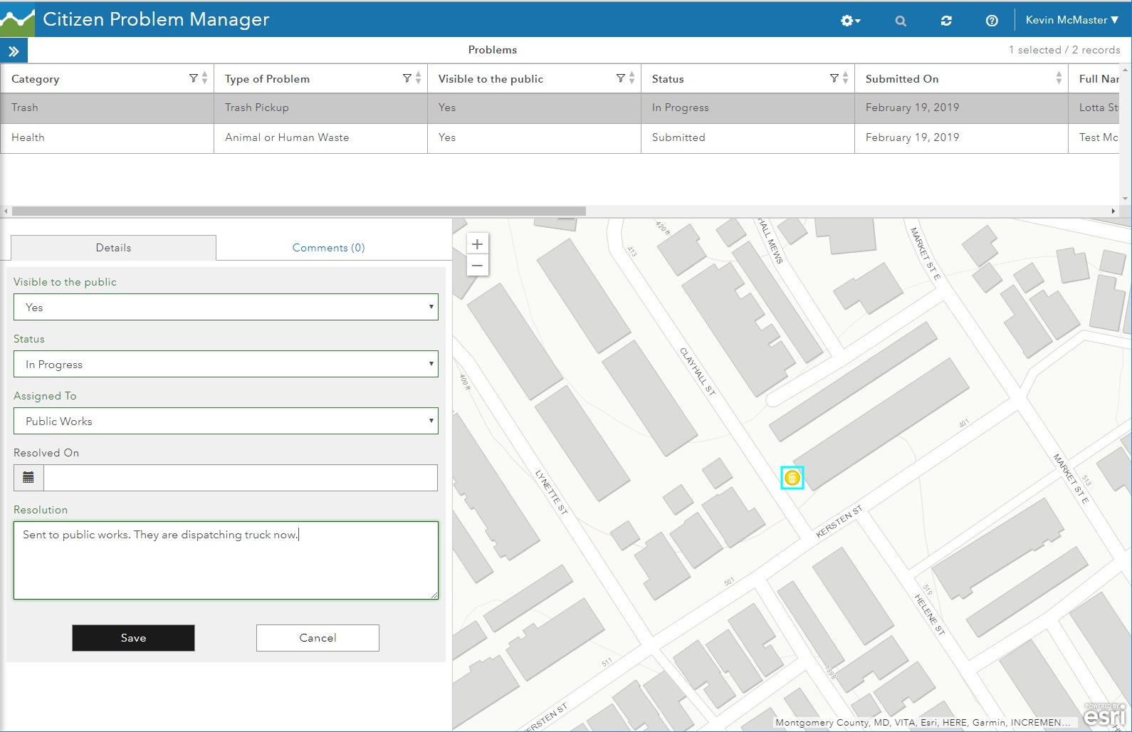
Once reported, the citizen problem manager sees all the issues using a separate application. They will route the issue to the appropriate department, add notes, and update the resolution status.

citizen problem manager

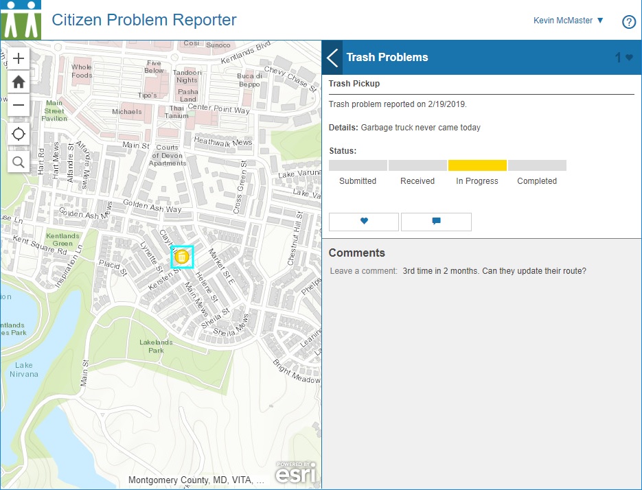
Citizens see the status of all issues through their application and know that they are being addressed. People can add notes, “up-vote” an issue, and make it into a social media platform if desired.

citizen problem reporter social

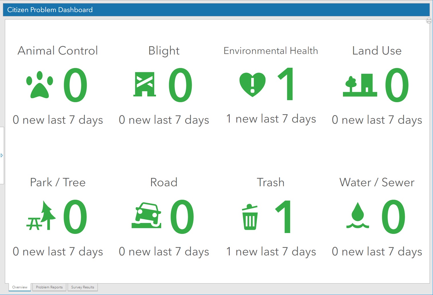
On the manager side, a dashboard keeps track of all issues that have been recently submitted. This helps to spot trends and identify departments that may need extra resources to address the needs.

issue dashboard

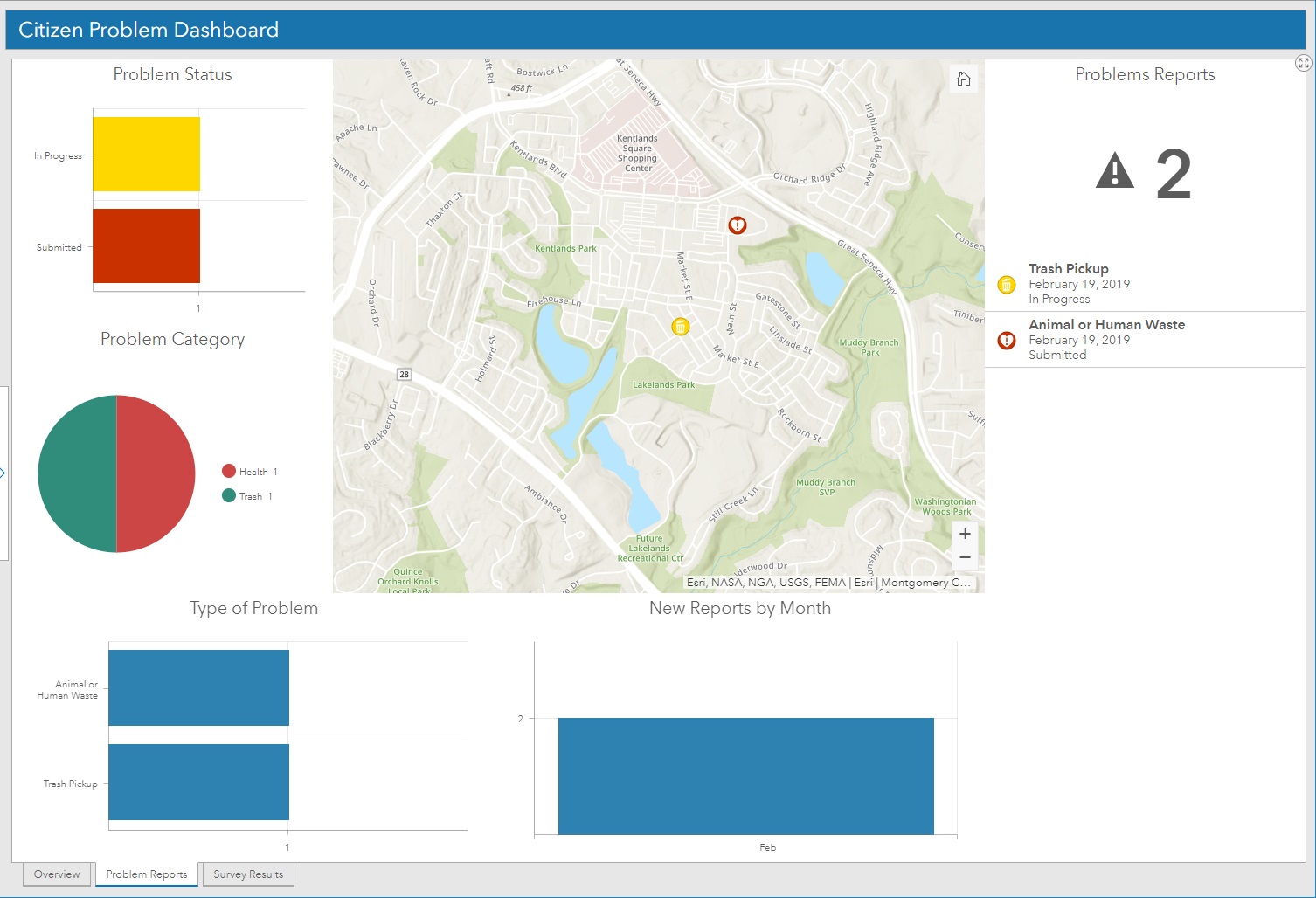
A statistical component of the dashboard keeps track of the requests over time and displays the status of all requests.

issue dashboard status

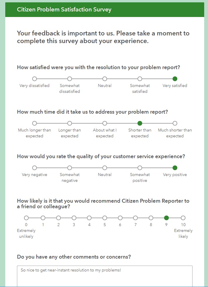
Optionally, a survey can be sent to the citizen who reported the issue to help close the loop and keep them engaged with the process.

reporter survey

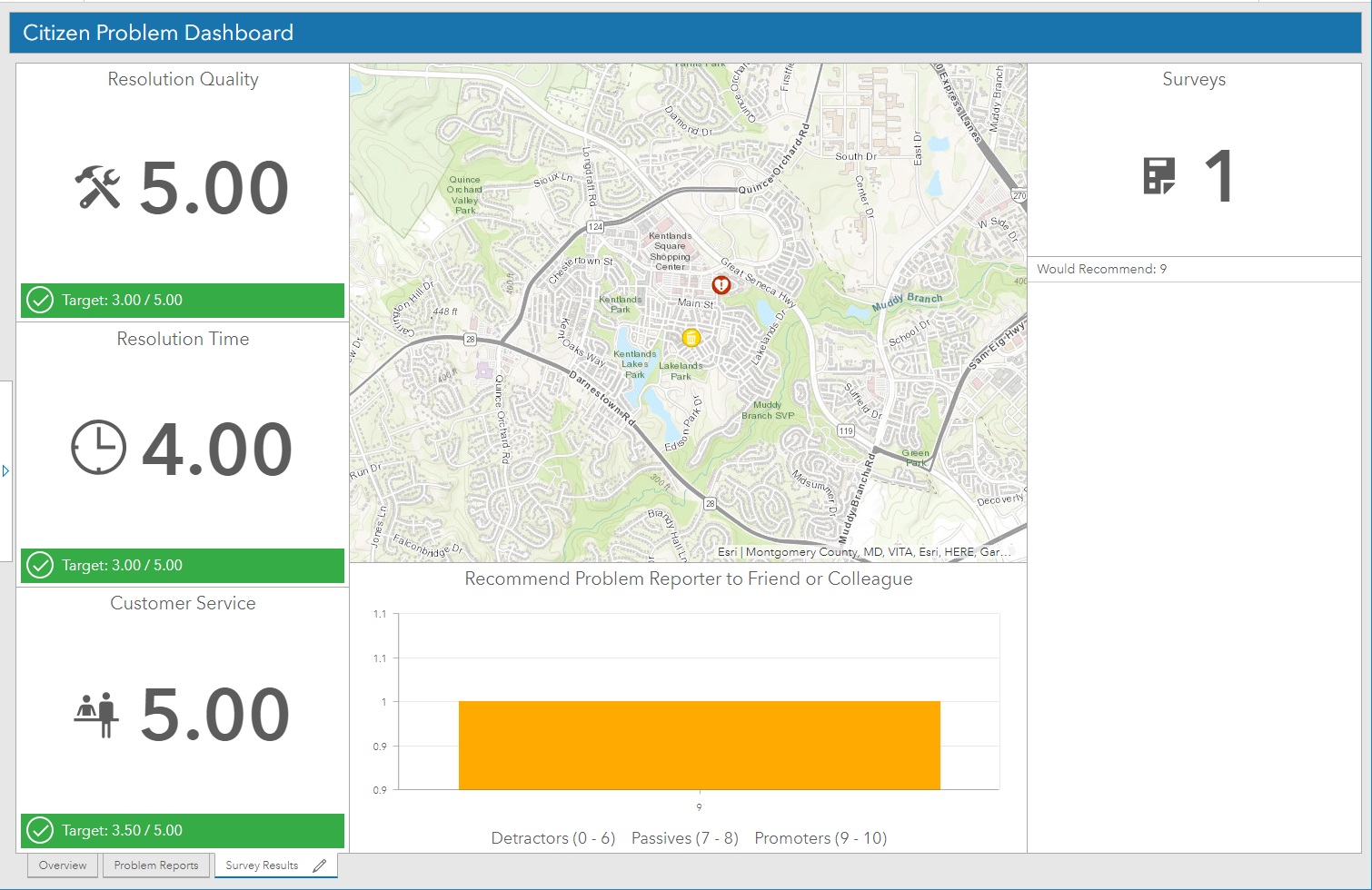
Finally, the manager dashboard also keeps track of survey responses. This is helpful to view perceived responsiveness of the department and show where improvement may be needed.

reporter survey dashboard

This local government solution is just one of many that have been pre-assembled and tested by Esri professional staff.

If you’d like help deploying this or other Esri Local Government Solutions, let SymGEO know, as we’re here to help!


November News 2018

At SymGEO, we love our dashboards! What better way to present interactive and actionable data, styled to perfection and updated in near real-time? This month we thought we’d take a look at some of the dashboards that we’ve configured over the past year, as the technology has been improving rapidly!

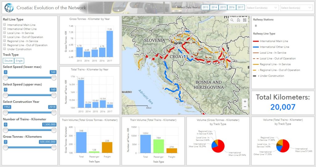
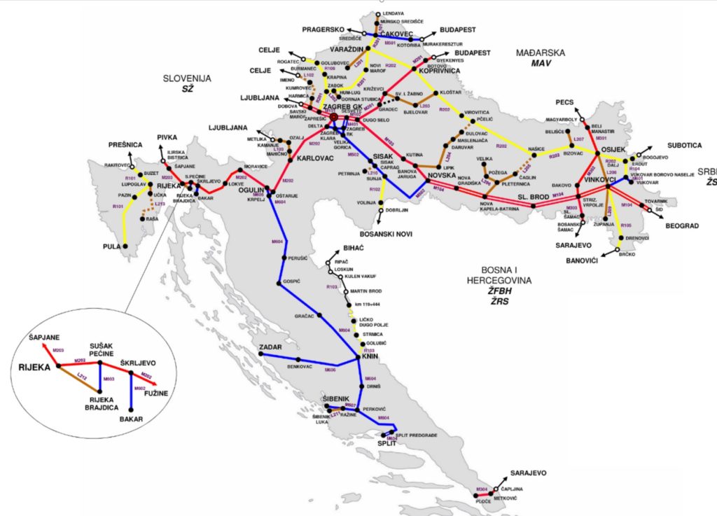
The newest member of our dashboard family was created for the World Bank to help analyze the rail network in Croatia. What started as a number of spreadsheets and a dream, turned into a fully interactive site that will help Croatia identify risk and prioritize upgrades to their network.

Read more


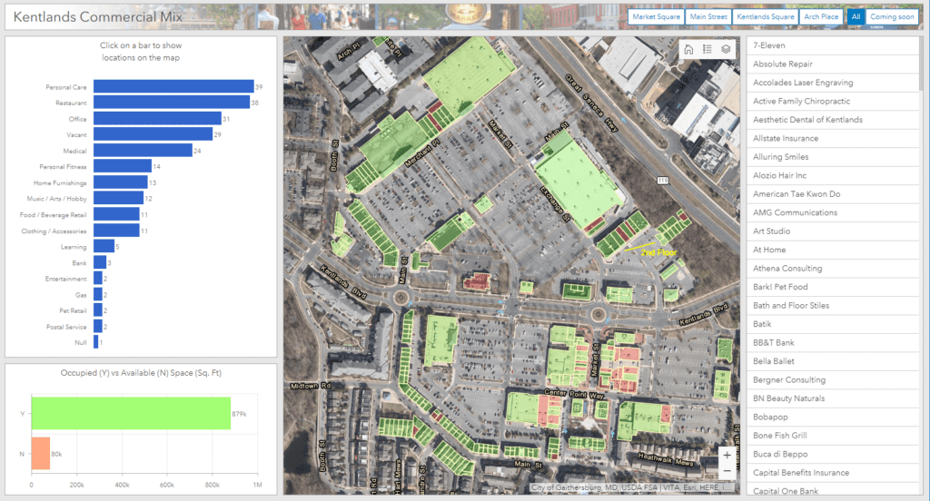
Keeping track of hundreds of commercial properties and identifying retail opportunities through gap analysis is fun and easy with configurable dashboards.

Read more


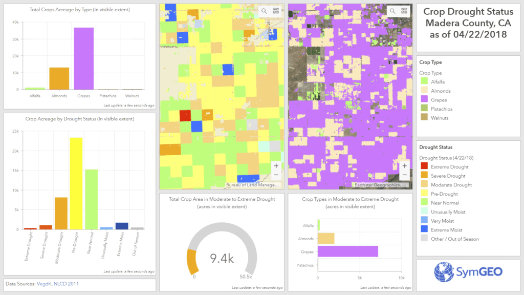
Incorporating remotely-sensed drought information is key to informed water use and allocation decisions in arid areas of the country. Help your district save time, money, and natural resources!

Read more


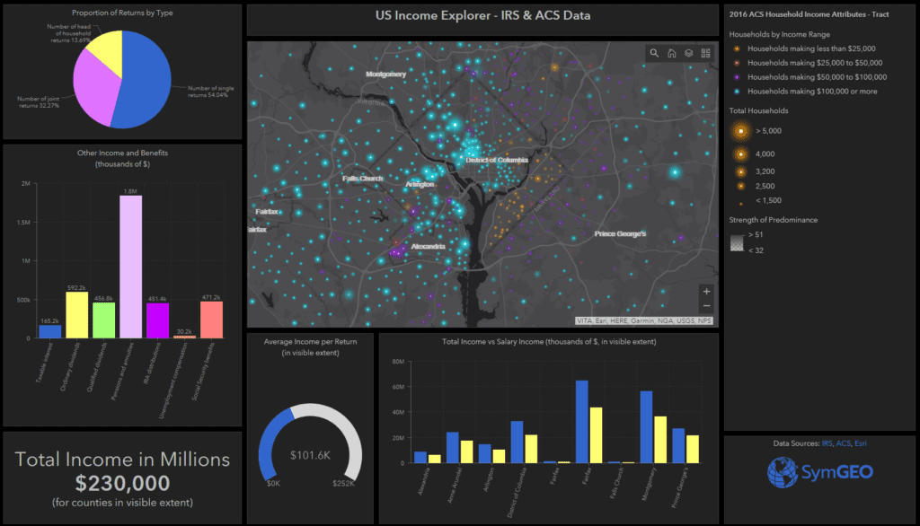
Integrating data from a number of sources such as IRS, Census, Esri, and others allows beautiful visualizations of neighborhood demographics and statistics.

Read more


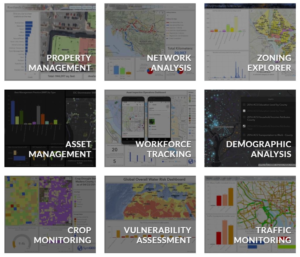
Check out a selection of our dashboards here, or contact SymGEO with project ideas.

From all of us at SymGEO, enjoy the holiday season!

Croatian Rail Network

SymGEO is pleased to announce the completion of a project with The World Bank Group that enables valuable interactive insight into the rail transportation system in Croatia. This project has since been featured by Esri as a Case Study for dashboard best practices, and then featured in ArcNews as a success story entitled “World Bank Deploys GIS Dashboard to Improve Railway Safety in Croatia“.

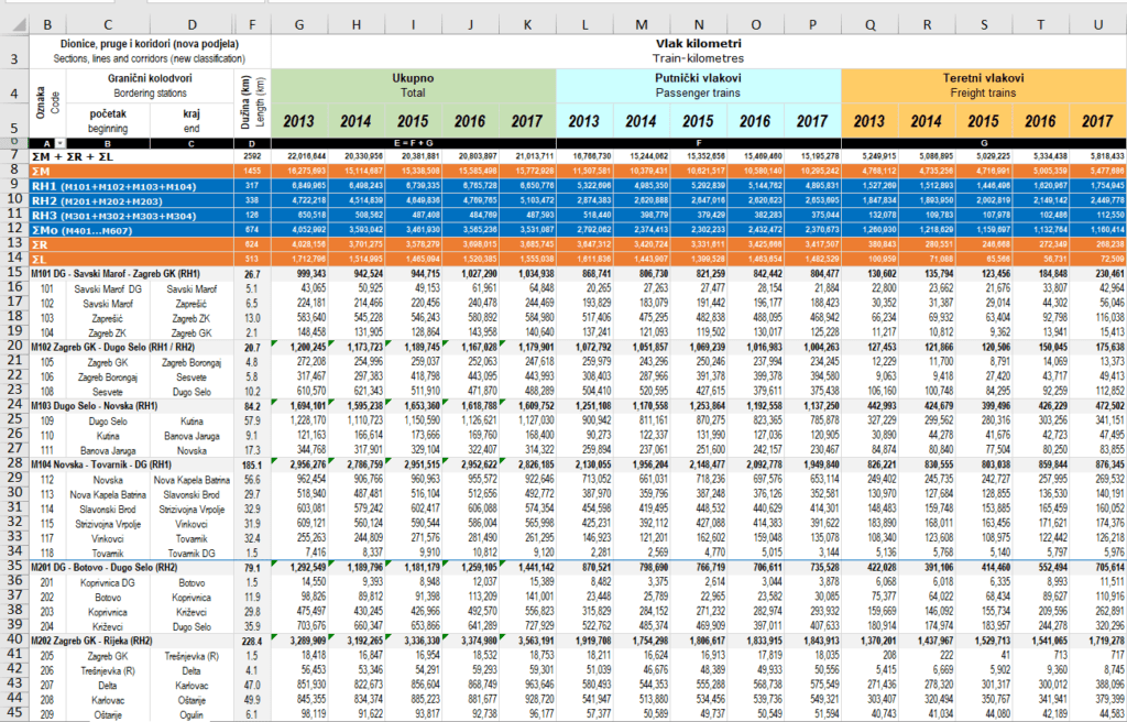
This project started from humble beginnings, with a series of excel files that detailed rail segment speed, passenger numbers, freight volumes, age of the track, and other characteristics.

croatia excel file

SymGEO then used a schematic diagram of the network to build and calibrate a spatially accurate network based on OpenStreetMap rail data and linear referencing of station locations.

croatia network diagram

This newly created spatial data was then hosted in ArcGIS Online and used to configure an ArcGIS Dashboard application. This application was specifically designed to filter and query the data interactively on demand and present summary statistics based on complex queries. This combination of attribute queries, summary statistics, and visual representation now enables report graphics and key decision data to be created on-the-fly by the client.

“This is superb and exactly what the client needed and what I was imagining.”

– World Bank client

If you have complex transportation network data that you’d like to leverage with an intuitive, user-friendly, configurable application, then SymGEO would love to hear from you!

SymGEO Hub in the News

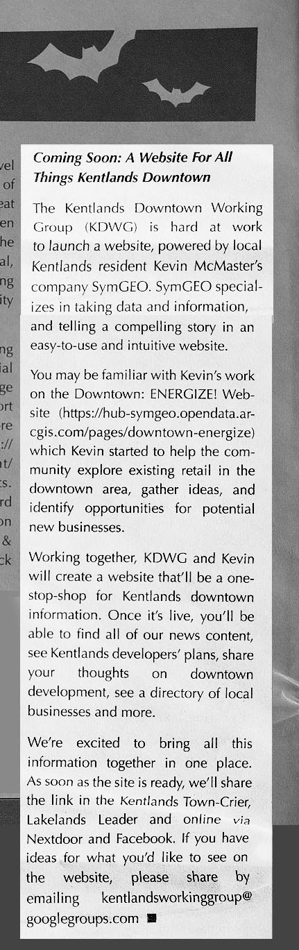
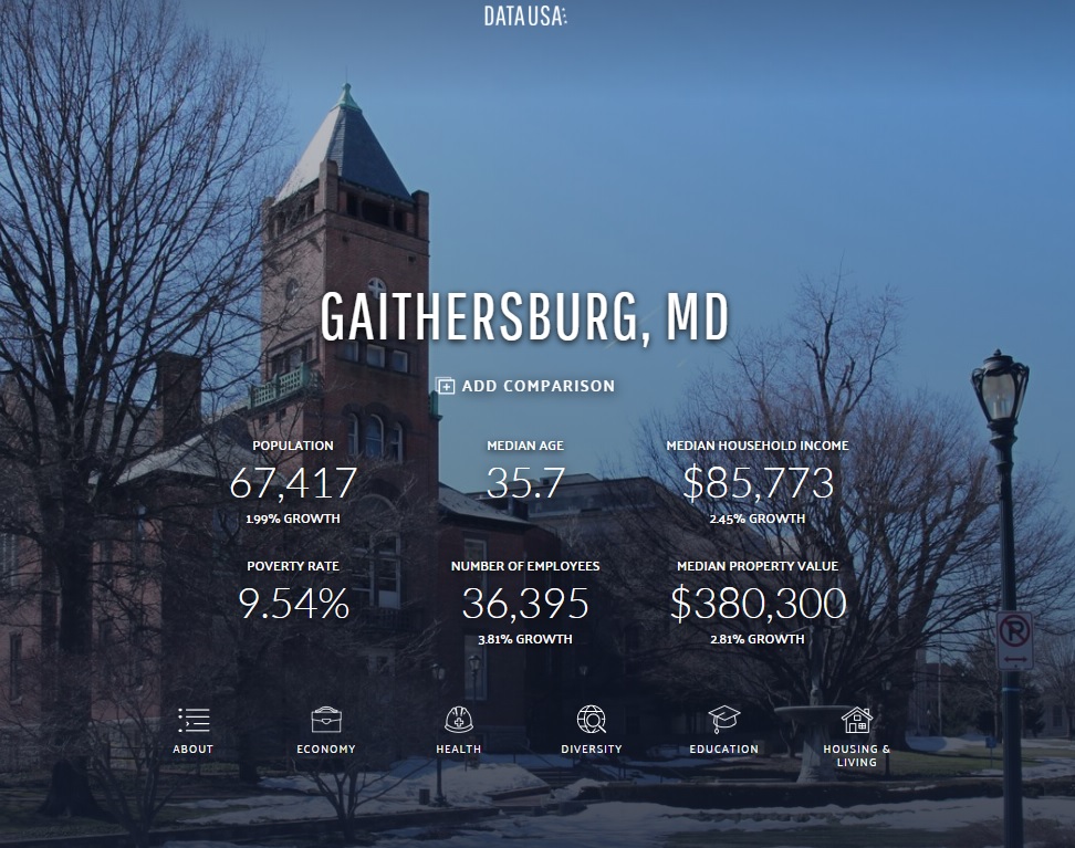
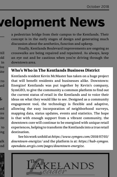
This month we were honored to have Downtown: Energize! featured in two local papers. There has been tremendous energy and enthusiasm swirling around this flagship project from SymGEO, and the technology continues to improve with every update.

lakelands newspaper

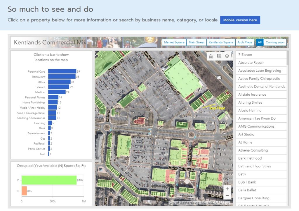
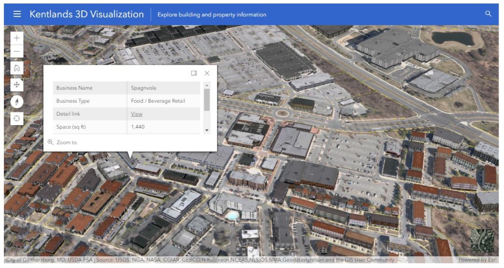
Downtown: Energize! features many different components of the ArcGIS technology suite, including Survey123, GeoForm / Collector, ArcGIS Dashboard, Web AppBuilder for the retail locator, and a web scene that uses CityEngine textured models derived from building footprints and Lidar information processed in ArcGIS Pro. These components are then hosted in ArcGIS Online and leveraged using ArcGIS Hub technology.

downtown energize banner

Two local development boards, the Kentlands Downtown Working Group (KDWG) and the One Main Street Initiative (OMSI), took an excited interest in Downtown: Energize! and have commissioned complimentary sites to be built using Hub technology. The commercial real-estate management of the site is especially useful in a fast-paced environment!

kentlands newspaper

“The KDWG was commissioned by the Kentlands board to provide accurate and timely information on the various development efforts going on with our downtown so residents can be better informed and take a more active role in improving our community. We chose the Downtown: Energize! platform developed by SymGEO with its innovative digital mapping because it helps do exactly that.”

– John Ingrassia, Chair, Kentlands Downtown Working Group

“A great commercial district is a huge amenity for our community. Downtown: Energize! is a great digital tool for helping the community achieve the vision for our commercial district. Not only will it help us engage the community to provide flexible two-way dialogue, but it will help us by mapping opportunities where businesses can expand and thrive. This innovative platform will allow us to easily update data, access data and provide data well beyond our community, which provides outreach to businesses looking to expand. Additionally, it is a fun way to empower consumers looking for a place to spend their precious free time to engage with this easy to use tool whether at home or mobile. Working with Kevin at SymGEO has been an amazing experience. He and his team are bringing tremendous innovations and ideas to our team at The One Mainstreet Initiative.”

– Neil Burka, Chair, One Main Street Initiative

“I was so excited when SymGEO came to us with this idea. As a local real estate agent and resident who is deeply engaged in the community, I understand on a personal level how important this spatial data is to get the community engaged and onboard with what’s happening. This platform will make it easy to access the data – especially for folks who, like me, are more visual.”

– Sheena Saydam, Realtor, Keller Williams Capital Properties, Member, Kentlands Downtown Working Group

“Downtown: Energize! as created by Kevin McMaster using the SymGEO platform, is an innovative digital tool that provides mapping of business locations to potential and existing customers in a format that is fun, easy to use, and flexible enough to accept updates and even track current events. It’s a win-win for our community by empowering residents to engage with our local businesses and to energize our downtown!”

– Ingrid L. Fraley, Local Business Owner – Design Services, Inc.

kentlands 3d

If you’d like to join the party with a Downtown: Energize! initiative, let us know as SymGEO is here to help!
September News 2018

September seemed to be the month of the hurricane with Florence churning its way towards the Carolina coast. Fortunately the GIS community is always prepared and ready to help on the digital front!
esri hurricane gallery

The hurricane program at Esri is an impressive collection of data, sample applications, community-based efforts, and ideas for future development.

Read more


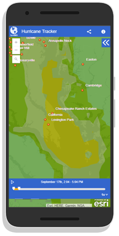
SymGEO used Esri Living Atlas content to produce a mobile-responsive Hurricane Tracker application showing the forecast path of the hurricane.

Read more


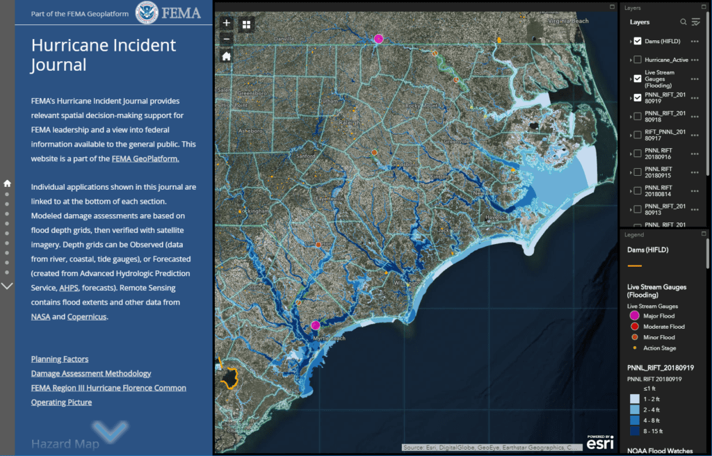
FEMA’s Hurricane Incident Journal provides relevant spatial decision-making support for FEMA leadership and a view into federal information available to the general public.

Read more


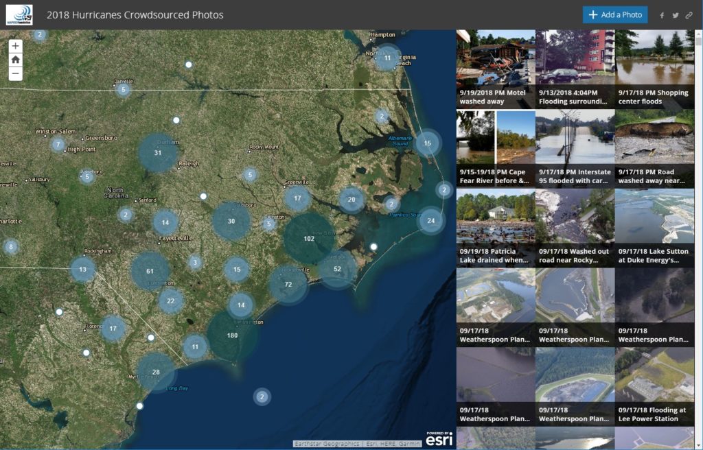
The National Alliance for Public Safety (NAPSG) and GISCorps sprang into action to produce an insightful crowd-sourced photo application to document damage and help direct relief efforts.

Read more


Have an idea for a project? Shoot us an email with project ideas or requirements as we’re here to help, and enjoy the fall season!

Hurricane Tracker

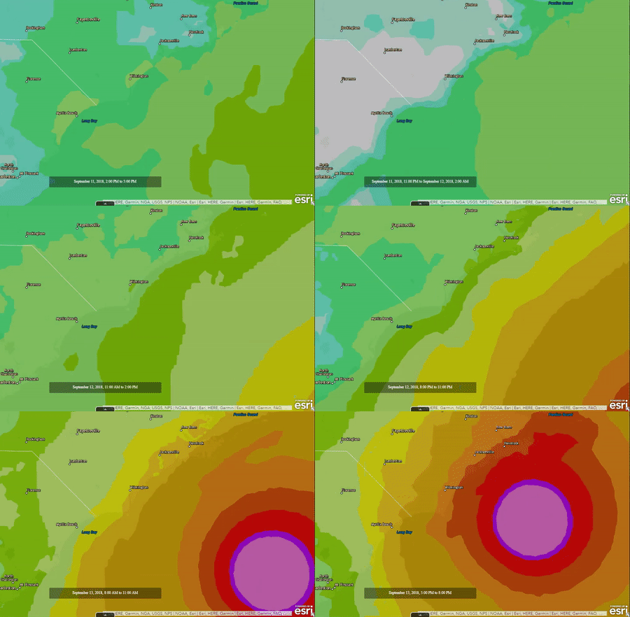
With Hurricane Florence rapidly approaching the Carolinas, the scale and power of the storm was truly terrifying. From eye of the hurricane video, provided by the NOAA Hurricane Hunter (9 second mark below), to overhead imagery from NOAA showing the churning vortex, it was only a matter of time before the devastating effects of the hurricane would be felt.


Armed with Esri technology and the thirst for knowledge, SymGEO explored the Living Atlas of the World data sets until we found The National Digital Forecast Database (NDFD).

“The NDFD was designed to provide access to weather forecasts in digital form from a central location. The NDFD produces gridded forecasts of sensible weather elements. NDFD contains a seamless mosaic of digital forecasts from National Weather Service (NWS) field offices working in collaboration with the National Centers for Environmental Prediction (NCEP). All of these organizations are under the administration of the National Oceanic and Atmospheric Administration (NOAA). Wind Gust is the maximum 3-second wind speed (in knots) forecast to occur within a 2-minute interval at a height of 10 meters. Wind gust forecasts are valid at the top of the indicated hour. This feed consumes NDFD’s files and calculates the amount of forecast wind gust for the next 72 hours.”

– from NDFD metadata

This information was explored in ArcGIS Online and showed the scale and timing of the expected hurricane landfall.

animated hurricane data

Finally, this data was wrapped in a time-aware, mobile responsive template in ArcGIS Online and tested to make sure it was pulling current data.

hurricane tracker phone

Check out the Hurricane Tracker today and let us know if you have an idea that SymGEO can help you with!

August News 2018

August was an exciting month at SymGEO, including commercial real estate management, Enterprise Server configuration, and even a little data processing thrown in. Read on for details!

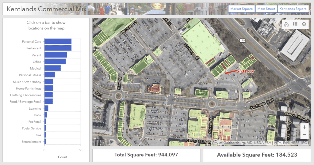
commercial property management

Keeping track of who is where, what’s coming soon, and when leases are ending can be quite a challenge when hundreds (or thousands!) of properties are involved. Fortunately, GIS is perfectly suited to this task.

Read more


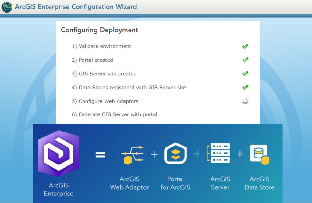
Publishing, organizing, and making data accessible on the web can be tricky business in an ever-changing technical landscape. If you’re ready to set up Enterprise, Server, or Portal, let us know as our highly trained technical staff is here to help.

Read more


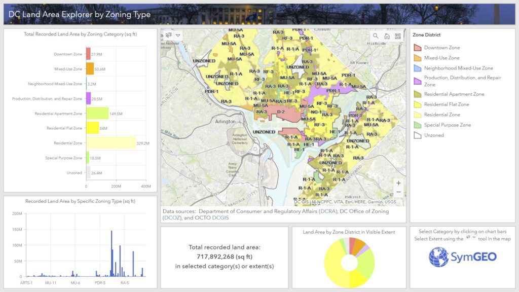
Ever wonder how much land area there is in DC by zoning type? Well, wonder no more, as we sliced and diced the data, and created the DC Land Area Explorer by Zoning Type.

Read more


Have an idea for a project? Contact SymGEO with project requirements as we’re here to help, and enjoy back-to-school season!