Federal Small Business Specialty

SymGEO is honored to join Esri’s Federal Small Business Specialty program, focused on developing opportunities to provide consulting, implementation, and solutions for the ArcGIS platform to the Federal Government user community.

“Esri’s Federal Small Business Specialty program is designed for qualified, registered small businesses who have expertise in GIS and want to develop services offerings and pursue opportunities around the Esri ArcGIS platform to grow their business.” – Esri

As a reminder, SymGEO is the spatial arm of Symago LLC, a small, minority, woman-owned technology company based in Maryland near Washington D.C. We are a GSA IT Schedule 70 holder (47QTCA19D00AL), and we offer competitive rates and flexible staffing arrangements. To start a conversation about teaming on Federal work, contact us  – SymGEO is a certified Esri business partner and we’re here to help.

SymGEO EPC Award Winner

Esri, the global leader in location intelligence, honored select partners for their outstanding application of GIS software at the Closing Session of the virtual Esri Partner Conference (EPC). The award-winning companies are members of the Esri Partner Network (comprised of 2800+ members) and use Esri’s tools to solve complex business problems that impact users worldwide. This year, SymGEO was fortunate to win the High Potential Award for demonstrating substantial growth opportunities with Esri!

SymGEO is honored to be among the 26 award-winning companies and we enjoyed learning more about our esteemed colleagues at the Esri Partner Conference.

“During this annual gathering, organizations in the Esri partner community collaborate and network, hear about Esri’s vision and new opportunities, build business relationships, learn from Esri experts, exchange ideas, discover the latest technology releases, and make plans for growing their businesses.”

– Esri EPC 2021

SymGEO’s work was also shown during the conference plenary as select partner examples for Land Information Management, Cartography, and Preparing for and Responding to Disasters.

To learn more about our specialized work with Esri technology, contact us to start a conversation – SymGEO is here to help.

SymGEO State and Local Government Specialty

SymGEO is pleased to announce we have been awarded Esri’s State and Local Government Specialty designation. This award recognizes SymGEO’s expertise in state and local government, implementation, and delivery of services that help customers succeed. This specialty is one of Esri’s newest specialties, and SymGEO is pleased to join four other prestigious partners who have obtained this designation.

SymGEO has been fortunate to work with great government clients on projects that have now appeared at Esri plenary presentations around the country, with the most recent being at the Esri Federal GIS Conference 2021. Our web GIS work with the District Department of Transportation and our 3D flood visualization work both made an appearance on the main stage. We are really thankful for the opportunity and trust that Esri has placed in our skills and services with the State and Local Government Specialty designation, and we look forward to helping our client partners implement Esri technology for years to come.

DDOT Tree Permitting ArcGIS Hub page development

3D Flood Visualization technology for Laurel, MD.

To learn more about these projects or any of our services, contact us to start a conversation – SymGEO is a certified Esri specialist and is here to help.

3d Buildings in the Marketplace

SymGEO is pleased to announce that our newest 3d building model solution is now listed in the ArcGIS Marketplace, the top destination for users to search, discover, and acquire apps, content, solutions, and professional services from Esri’s ecosystem of providers.

This solution leverages ArcGIS Pro for 3d model production, ArcGIS CityEngine for model texturing, analysis, and landscape refinement, and Unreal Engine by Epic Games for rendering and visualizations. Whether the goal is a digital twin or proposed development scenarios, the end result is a virtual environment that can’t wait to be explored!

To learn more about our 3d building environments, contact us to set up a time to talk – SymGEO is excited to help build your virtual world!

Now in the ArcGIS Marketplace

SymGEO is thrilled to have our services and solutions listed in the ArcGIS Marketplace, the top destination for users to search, discover, and acquire apps, content, solutions, and professional services from Esri’s ecosystem of providers for use within their organization.

ArcGIS Marketplace makes it easy to connect with users, provide free trials, generate leads, and sell your products and services with e-commerce.” – Esri

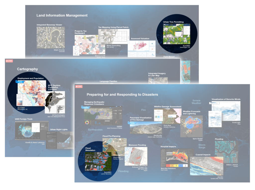
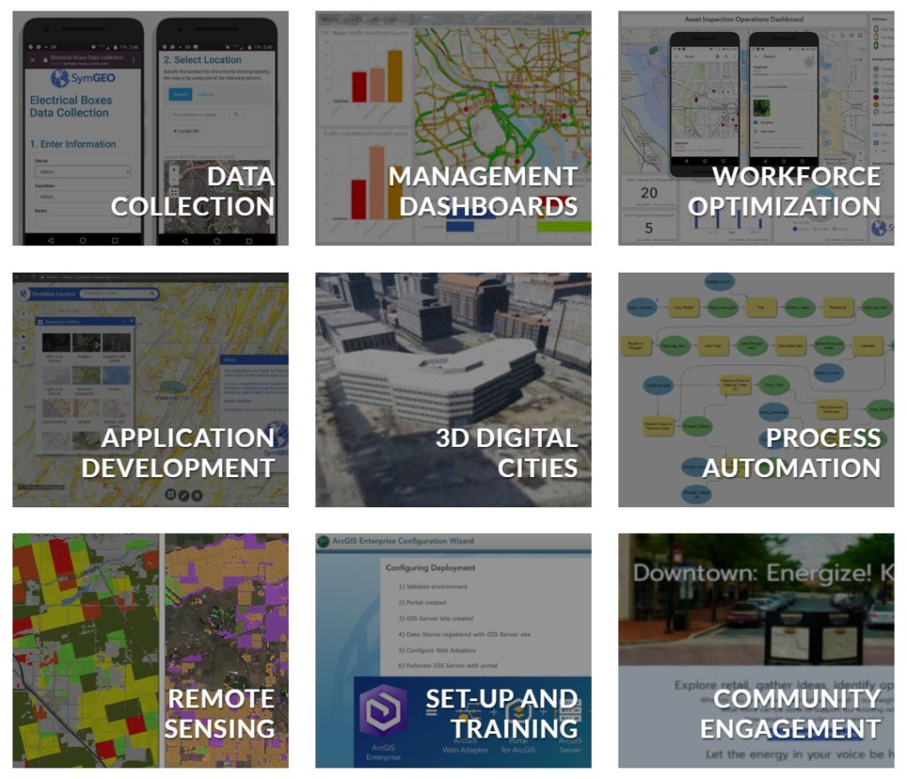
We were fortunate to have three of our listings accepted into the marketplace. The first is our ArcGIS Online and ArcGIS Hub solutions configuration and implementation services. These services focus on our expertise with the ArcGIS Online environment, data analytics and visualization, application configuration and deployment, and community engagement using ArcGIS Hub.

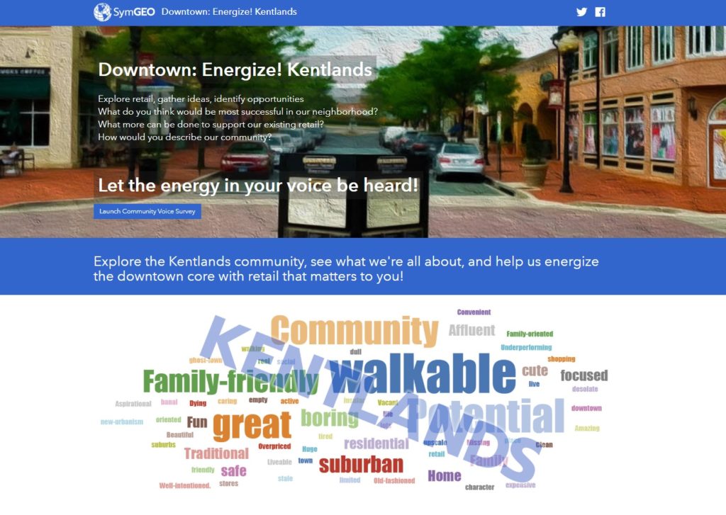
Our second listing is a partner solution focused on an ArcGIS Hub configuration called Downtown: Energize!. This solution is configurable for cities or communities looking to energize their downtown core with retail that fits the needs of the local population. This solution empowers the local community to explore retail in their area and to voice their opinions on what types of new commercial development they feel would do well.

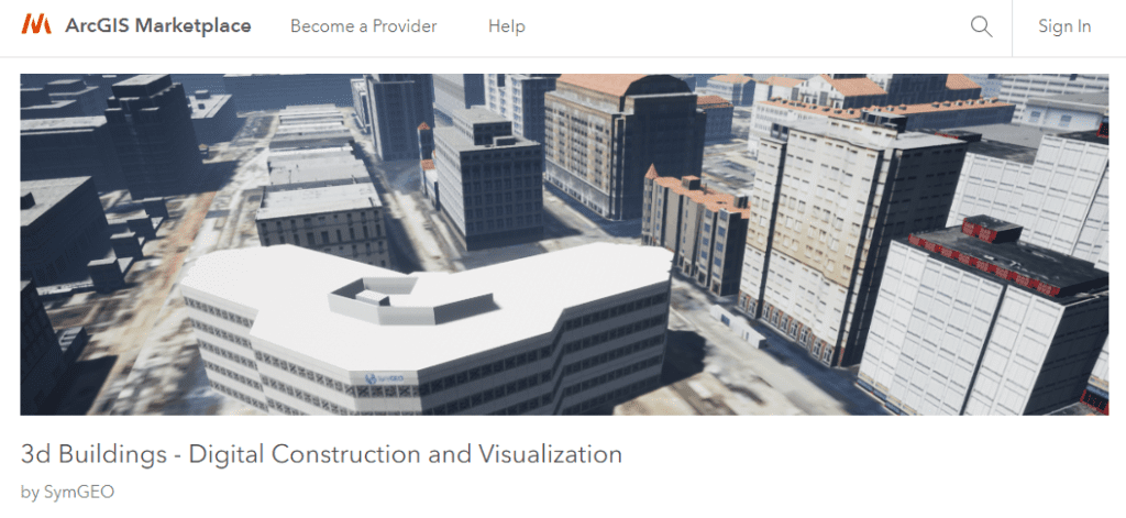
Our third listing provides information about our 3d building modeling capabilities. This solution leverages ArcGIS Pro for 3d model production, ArcGIS CityEngine for model texturing, analysis, and landscape refinement, and Unreal Engine by Epic Games for rendering and visualizations. Whether the goal is a digital twin or proposed development scenarios, the end result is a virtual environment that can’t wait to be explored!

To learn more about our marketplace listings or any of our services, contact us to set up a time to talk – SymGEO is a certified Esri specialist and is here to help!

SymGEO Awarded Esri System Specialty Partner Status

SymGEO is pleased to announce we have been awarded Esri’s ArcGIS System Ready Specialty designation! This honor is for partners that are highly focused on delivering services, content or solutions leveraging the latest versions of ArcGIS technology.


“ArcGIS is a platform for organizations to create, manage, share, and analyze spatial data. It consists of server components, mobile and desktop applications, and developer tools. This platform can be deployed on-premises or in the cloud (Amazon, Azure) with ArcGIS Enterprise, or used via ArcGIS Online which is hosted and managed by Esri.” – Esri

Only a few hundred Esri Partners have been awarded this specialty (out of almost 3500 partners), so we are grateful to be among the top 10 percent! SymGEO has been fortunate to work with great clients on projects that have now appeared at Esri plenary presentations around the country. We are really thankful for the opportunity and trust that Esri has placed in our skills and services with the Release Ready Specialty designation, and we look forward to continuing to develop as GIS professionals over the coming years!

DDOT ArcGIS Hub projects and website development

American Public Transportation Association (APTA) application development and data processing.

World Bank Croatia Rail Dashboard development and data processing

To learn more about these projects or any of our services, contact us to set up a time to talk – SymGEO is a certified Esri specialist and is here to help!